
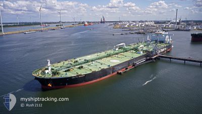
DELTA AMAZON
Tanker
Current Trip
| Time Travelled | 26 days |
|---|---|
| Remaining Time | 1 day |
| Distance Travelled | 6391.75 nm |
| Remaining Distance | 393.19 nm |
| AVG Speed | 11.6 Noeuds |
| MAX Speed | 22.5 Noeuds |
| AVG Wind | 8 knots |
| MAX Wind | 27 knots |
| MIN Temp | 19.9°C / 67.82°F |
| MAX Temp | 30.7°C / 87.26°F |
| Tirant d eau | 19.6 m |
| Position reçue | 1 d depuis |
Current Position
| Longitude | 119.23825° |
|---|---|
| Latitude | 23.17444° |
| Etat | Under way using engine |
| Vitesse | 12.2 Noeuds |
| Parcours | 137.2° |
| Zone | South China Sea |
| Station | T-AIS |
| Position reçue | 1 d depuis |
Info
Information
The current position of DELTA AMAZON is in South China Sea with coordinates 23.17444° / 119.23825° as reported on 2024-05-19 16:02 by AIS to our vessel tracker app. The vessel's current speed is 12.2 Noeuds and is heading at the port of QUANZHOU. The estimated time of arrival as calculated by MyShipTracking vessel tracking app is 2024-05-22 05:43 LT
The vessel DELTA AMAZON (IMO: 9748916, MMSI: 636019059) is a Tanker It's sailing under the flag of [LR] Liberia.
In this page you can find informations about the vessels current position, last detected port calls, and current voyage information. If the vessels is not in coverage by AIS you will find the latest position.
The current position of DELTA AMAZON is detected by our AIS receivers and we are not responsible for the reliability of the data. The last position was recorded while the vessel was in Coverage by the Ais receivers of our vessel tracking app.
The current draught of DELTA AMAZON as reported by AIS is 19.6 meters
Weather
| Temperature | 28.9°C / 84.02°F |
|---|---|
| Wind Speed | 5 knots |
| Direction | 139° SE |
| Pressure | 1007.1 hPa |
| Humidity | 77.6 % |
| Cloud Coverage | 100 % |
Featured Company
Last Port Calls
| Port | Arrival | Departure | Time In Port |
|---|---|---|---|
| 2024-04-22 12:11 | 2024-04-24 02:23 | 1 d | |
| 2024-03-14 14:59 | 2024-03-18 11:00 | 3 d |
Most Visited Ports (Last year)
| Port | Arrivals | |
|---|---|---|
| 1 | ||
| 1 | ||
| 1 | ||
| 1 |
Last Trips
| Origin | Departure | Destination | Arrival | Distance | |
|---|---|---|---|---|---|
| 2024-03-18 11:00 | 2024-04-22 12:11 | 6231.10 nm |
Events
| Heure | Evenement | Détails | Position/ Destination | Info |
|---|---|---|---|---|
| 2024-05-19 16:08 | Etat Changé | Default Under way using engine |
23.16151 / 119.25111
CN QZJ
|
Vitesse: 12.2 kn Parcours: 137.2° |
| 2024-05-19 16:02 | Etat Changé | Under way using engine Default |
23.17444 / 119.23825
CN QZJ
|
Vitesse: 12.3 kn Parcours: 138° |
| 2024-05-19 16:02 | Hors de la zone couverte |
23.17444 / 119.23825
South China Sea
|
Vitesse: 12.2 kn Parcours: 137.2° |
|
| 2024-05-19 15:45 | Etat Changé | Default Under way using engine |
23.22002 / 119.19410
CN QZJ
|
Vitesse: 11.9 kn Parcours: 139.6° |
| 2024-05-19 15:26 | Etat Changé | Under way using engine Default |
23.26674 / 119.15023
CN QZJ
|
Vitesse: 11.5 kn Parcours: 139° |
| 2024-05-19 15:22 | Etat Changé | Default Under way using engine |
23.27690 / 119.14066
CN QZJ
|
Vitesse: 11.3 kn Parcours: 138° |
| 2024-05-19 15:17 | Etat Changé | Under way using engine Default |
23.28852 / 119.12948
CN QZJ
|
Vitesse: 11.2 kn Parcours: 138° |
| 2024-05-19 15:12 | Etat Changé | Default Under way using engine |
23.29905 / 119.11910
CN QZJ
|
Vitesse: 11.1 kn Parcours: 138.7° |
| 2024-05-19 15:08 | Changement de zone | Taiwanese part of the South China Sea Chinese part of the South China Sea |
23.31037 / 119.10809
South China Sea
|
Vitesse: 11.1 kn Parcours: 138.5° |
| 2024-05-19 15:08 | Etat Changé | Under way using engine Default |
23.31037 / 119.10809
CN QZJ
|
Vitesse: 11 kn Parcours: 138° |