
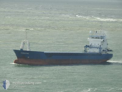
DAY BLUE
General Cargo
Current Trip
| Time Travelled | 22 days |
|---|---|
| Remaining Time | 1 day |
| Distance Travelled | 1774.28 nm |
| Remaining Distance | 424.42 nm |
| AVG Speed | 9.2 Noeuds |
| MAX Speed | 14.7 Noeuds |
| AVG Wind | 6.8 knots |
| MAX Wind | 21 knots |
| MIN Temp | 11.1°C / 51.98°F |
| MAX Temp | 32.6°C / 90.68°F |
| Tirant d eau | 5.2 m |
| Position reçue | 1 m depuis |
Current Position
| Longitude | 17.01736° |
|---|---|
| Latitude | 36.54923° |
| Etat | Under way using engine |
| Vitesse | 10.7 Noeuds |
| Parcours | 272.3° |
| Zone | Mediterranean Sea - Eastern Basin |
| Station | T-AIS |
| Position reçue | 1 m depuis |
Info
Information
The current position of DAY BLUE is in Mediterranean Sea - Eastern Basin with coordinates 36.54923° / 17.01736° as reported on 2024-06-08 14:35 by AIS to our vessel tracker app. The vessel's current speed is 10.7 Noeuds and is heading at the port of CAGLIARI. The estimated time of arrival as calculated by MyShipTracking vessel tracking app is 2024-06-10 08:49 LT
The vessel DAY BLUE (IMO: 9184811, MMSI: 312012000) is a General Cargo that was built in 1998 ( 26 Age ). It's sailing under the flag of [BZ] Belize.
In this page you can find informations about the vessels current position, last detected port calls, and current voyage information. If the vessels is not in coverage by AIS you will find the latest position.
The current position of DAY BLUE is detected by our AIS receivers and we are not responsible for the reliability of the data. The last position was recorded while the vessel was in Coverage by the Ais receivers of our vessel tracking app.
The current draught of DAY BLUE as reported by AIS is 5.2 meters
Weather
| Temperature | 24.1°C / 75.38°F |
|---|---|
| Wind Speed | 6 knots |
| Direction | 273° W |
| Pressure | 1014.2 hPa |
| Humidity | 69.9 % |
| Cloud Coverage | 3 % |
Featured Company
Last Port Calls
| Port | Arrival | Departure | Time In Port |
|---|---|---|---|
| 2024-05-14 03:13 | 2024-05-17 03:15 | 3 d | |
| 2024-04-29 08:28 | 2024-05-02 01:49 | 2 d | |
| 2024-04-22 16:38 | 2024-04-25 17:38 | 3 d | |
| 2024-04-14 06:54 | 2024-04-15 10:28 | 1 d | |
| 2024-04-09 04:12 | 2024-04-09 18:43 | 14 h | |
| 2024-04-05 08:31 | 2024-04-06 18:06 | 1 d | |
| 2024-04-04 18:03 |
Most Visited Ports (Last year)
| Port | Arrivals | |
|---|---|---|
| 2 | ||
| 1 | ||
| 1 | ||
| 1 | ||
| 1 | ||
| 1 |
Last Trips
| Origin | Departure | Destination | Arrival | Distance | |
|---|---|---|---|---|---|
| 2024-05-02 02:49 | 2024-05-14 06:13 | 3019.00 nm | |||
| 2024-04-25 19:38 | 2024-04-29 09:28 | 342.04 nm | |||
| 2024-04-15 11:28 | 2024-04-22 18:38 | 1758.42 nm | |||
| 2024-04-09 20:43 | 2024-04-14 07:54 | 454.47 nm | |||
| 2024-04-06 20:06 | 2024-04-09 06:12 | 558.19 nm | |||
| 2024-04-04 20:03 | 2024-04-05 10:31 | 45.53 nm |
Events
| Heure | Evenement | Détails | Position/ Destination | Info |
|---|---|---|---|---|
| 2024-06-08 08:31 | Changement de zone | Italian part of the Mediterranean Sea - Eastern Basin Greek part of the Mediterranean Sea - Eastern Basin |
36.50787 / 18.29316
Mediterranean Sea - Eastern Basin
ITCAG
|
Vitesse: 10.9 kn Parcours: 271.4° |
| 2024-06-08 06:32 | Etat Changé | Under way using engine Default |
36.49473 / 18.74740
ITCAG
|
Vitesse: 11 kn Parcours: 272° |
| 2024-06-08 06:32 | Dans la zone couverte |
36.49473 / 18.74740
Mediterranean Sea - Eastern Basin
ITCAG
|
Vitesse: 11.2 kn Parcours: 273.2° |
|
| 2024-06-08 01:04 | Etat Changé | Default Under way using engine |
36.45342 / 19.97257
ITCAG
|
Vitesse: 9.9 kn Parcours: 272.4° |
| 2024-06-08 00:54 | Etat Changé | Under way using engine Default |
36.45264 / 20.00811
ITCAG
|
Vitesse: 10.3 kn Parcours: 272° |
| 2024-06-08 00:54 | Hors de la zone couverte |
36.45264 / 20.00811
Mediterranean Sea - Eastern Basin
ITCAG
|
Vitesse: 9.9 kn Parcours: 272.4° |
|
| 2024-06-08 00:21 | Etat Changé | Default Under way using engine |
36.44980 / 20.12552
ITCAG
|
Vitesse: 10.2 kn Parcours: 272.2° |
| 2024-06-08 00:15 | Etat Changé | Under way using engine Default |
36.44924 / 20.14922
ITCAG
|
Vitesse: 10.2 kn Parcours: 273° |
| 2024-06-08 00:03 | Etat Changé | Default Under way using engine |
36.44803 / 20.19198
ITCAG
|
Vitesse: 10.3 kn Parcours: 273.9° |
| 2024-06-07 23:53 | Etat Changé | Under way using engine Default |
36.44637 / 20.22517
ITCAG
|
Vitesse: 10.7 kn Parcours: 273° |