
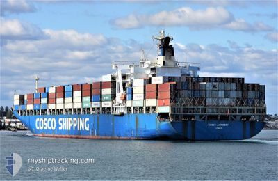
COSCO ANTWERP
Container Ship
Current Trip
| Time Travelled | 2 days |
|---|---|
| Remaining Time | --- |
| Distance Travelled | 503.47 nm |
| Remaining Distance | --- |
| AVG Speed | 12.2 Noeuds |
| MAX Speed | 14.1 Noeuds |
| AVG Wind | 13 knots |
| MAX Wind | 18.8 knots |
| MIN Temp | 12.4°C / 54.32°F |
| MAX Temp | 19.2°C / 66.56°F |
| Tirant d eau | 11.3 m |
| Position reçue | 1 d depuis |
Current Position
| Longitude | --- |
|---|---|
| Latitude | --- |
| Etat | Under way using engine |
| Vitesse | 14.1 Noeuds |
| Parcours | 238° |
| Zone | Mediterranean Sea - Eastern Basin |
| Station | T-AIS |
| Position reçue | 1 d depuis |
Info
Information
The current position of COSCO ANTWERP is in Mediterranean Sea - Eastern Basin with coordinates 33.93296° / 32.35225° as reported on 2025-12-09 15:57 by AIS to our vessel tracker app. The vessel's current speed is 14.1 Noeuds
The vessel COSCO ANTWERP (IMO: 9246396, MMSI: 235068025) is a Container Ship that was built in 2001 ( 24 Age ). It's sailing under the flag of [GB] United Kingdom.
In this page you can find informations about the vessels current position, last detected port calls, and current voyage information. If the vessels is not in coverage by AIS you will find the latest position.
The current position of COSCO ANTWERP is detected by our AIS receivers and we are not responsible for the reliability of the data. The last position was recorded while the vessel was in Coverage by the Ais receivers of our vessel tracking app.
The current draught of COSCO ANTWERP as reported by AIS is 11.3 meters
Weather
| Temperature | 18.9°C / 66.02°F |
|---|---|
| Wind Speed | 17 knots |
| Direction | 306° NW |
| Pressure | 1018.5 hPa |
| Humidity | 63.3 % |
| Cloud Coverage | 58 % |
Featured Company
Last Port Calls
| Port | Arrival | Departure | Time In Port |
|---|---|---|---|
| 2025-12-08 07:24 | 2025-12-08 22:53 | 15 h | |
| 2025-12-06 13:45 | 2025-12-07 16:45 | 1 d | |
| 2025-12-02 14:49 | 2025-12-03 07:57 | 17 h | |
| 2025-11-21 20:16 | 2025-11-22 09:04 | 12 h | |
| 2025-11-19 07:29 | 2025-11-20 09:37 | 1 d | |
| 2025-11-16 16:42 | 2025-11-17 05:49 | 13 h | |
| 2025-11-03 08:20 | 2025-11-04 14:57 | 1 d | |
| 2025-11-01 08:01 | 2025-11-02 15:26 | 1 d | |
| 2025-10-20 22:33 | 2025-10-21 23:30 | 1 d | |
| 2025-10-14 04:15 | 2025-10-15 14:17 | 1 d |
Most Visited Ports (Last year)
| Port | Arrivals | |
|---|---|---|
| 10 | ||
| 10 | ||
| 10 | ||
| 8 | ||
| 6 | ||
| 5 |
Last Trips
| Origin | Departure | Destination | Arrival | Distance | |
|---|---|---|---|---|---|
| 2025-12-07 16:45 | 2025-12-08 07:24 | 95.08 nm | |||
| 2025-12-03 07:57 | 2025-12-06 13:45 | 662.62 nm | |||
| 2025-11-22 09:04 | 2025-12-02 14:49 | 2974.09 nm | |||
| 2025-11-20 09:37 | 2025-11-21 20:16 | 404.37 nm | |||
| 2025-11-17 05:49 | 2025-11-19 07:29 | 420.76 nm | |||
| 2025-11-04 14:57 | 2025-11-16 16:42 | 3117.56 nm | |||
| 2025-11-02 15:26 | 2025-11-03 08:20 | 200.12 nm | |||
| 2025-10-21 23:30 | 2025-11-01 08:01 | 2813.37 nm | |||
| 2025-10-15 14:17 | 2025-10-20 22:33 | 729.72 nm | |||
| 2025-10-13 16:41 | 2025-10-14 04:15 | 134.63 nm |
Events
| Heure | Evenement | Détails | Position/ Destination | Info |
|---|---|---|---|---|
| 2025-12-10 11:45 | Arret | 6.1 nm, North West of EL DEKHEILA |
31.23793 / 29.75388
EGALY
|
Vitesse: 0.1 kn Parcours: 331° |
| 2025-12-09 15:57 | Hors de la zone couverte |
33.93296 / 32.35225
Mediterranean Sea - Eastern Basin
EGALY
|
Vitesse: 14.1 kn Parcours: 238° |
|
| 2025-12-09 15:57 | Etat Changé | Under way using engine Default |
33.93296 / 32.35225
EGALY
|
Vitesse: 14 kn Parcours: 236° |
| 2025-12-09 15:43 | Etat Changé | Default Under way using engine |
33.96080 / 32.40637
EGALY
|
Vitesse: 14 kn Parcours: 239.6° |
| 2025-12-09 15:40 | Etat Changé | Under way using engine Default |
33.96715 / 32.41882
EGALY
|
Vitesse: 13.8 kn Parcours: 240° |
| 2025-12-09 15:37 | Dans la zone couverte |
33.96715 / 32.41882
Mediterranean Sea - Eastern Basin
EGALY
|
Vitesse: 14 kn Parcours: 239.6° |
|
| 2025-12-09 14:21 | Etat Changé | Default Under way using engine |
34.12756 / 32.73395
EGALY
|
Vitesse: 14 kn Parcours: 235.7° |
| 2025-12-09 14:14 | Hors de la zone couverte |
34.14227 / 32.76008
Mediterranean Sea - Eastern Basin
EGALY
|
Vitesse: 14 kn Parcours: 235.7° |
|
| 2025-12-09 14:01 | Etat Changé | Under way using engine Default |
34.17187 / 32.81265
EGALY
|
Vitesse: 14 kn Parcours: 236° |
| 2025-12-09 13:57 | Etat Changé | Default Under way using engine |
34.17995 / 32.82711
EGALY
|
Vitesse: 13.7 kn Parcours: 235.1° |