
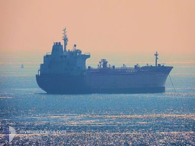
CONTI BENGUELA
Oil/Chemical Tanker
Current Trip
| Time Travelled | 13 h, 52 mins |
|---|---|
| Remaining Time | 17 h, 50 mins |
| Distance Travelled | 167.35 nm |
| Remaining Distance | 213.81 nm |
| AVG Speed | 12 Noeuds |
| MAX Speed | 13.3 Noeuds |
| AVG Wind | 14 knots |
| MAX Wind | 17.8 knots |
| MIN Temp | 7°C / 44.6°F |
| MAX Temp | 9.9°C / 49.82°F |
| Tirant d eau | 7.8 m |
| Position reçue | 12 h, 15 m depuis |
Current Position
| Longitude | --- |
|---|---|
| Latitude | --- |
| Etat | Under way using engine |
| Vitesse | 11.9 Noeuds |
| Parcours | 305.2° |
| Zone | North Sea |
| Station | T-AIS |
| Position reçue | 12 h, 15 m depuis |
Info
Information
The current position of CONTI BENGUELA is in North Sea with coordinates 53.83489° / 7.88198° as reported on 2025-12-13 04:50 by AIS to our vessel tracker app. The vessel's current speed is 11.9 Noeuds and is heading at the port of ANTWERP. The estimated time of arrival as calculated by MyShipTracking vessel tracking app is 2025-12-14 11:55 LT
The vessel CONTI BENGUELA (IMO: 9391373, MMSI: 636091569) is a Oil/Chemical Tanker that was built in 2008 ( 17 Age ). It's sailing under the flag of [LR] Liberia.
In this page you can find informations about the vessels current position, last detected port calls, and current voyage information. If the vessels is not in coverage by AIS you will find the latest position.
The current position of CONTI BENGUELA is detected by our AIS receivers and we are not responsible for the reliability of the data. The last position was recorded while the vessel was in Coverage by the Ais receivers of our vessel tracking app.
The current draught of CONTI BENGUELA as reported by AIS is 7.8 meters
Weather
| Temperature | 9.2°C / 48.56°F |
|---|---|
| Wind Speed | 18 knots |
| Direction | 229° SW |
| Pressure | 1024.2 hPa |
| Humidity | 80.5 % |
| Cloud Coverage | 44 % |
Featured Company
Last Port Calls
| Port | Arrival | Departure | Time In Port |
|---|---|---|---|
| 2025-12-12 00:18 | 2025-12-13 04:13 | 1 d | |
| 2025-12-08 08:07 | 2025-12-10 22:19 | 2 d | |
| 2025-11-28 12:01 | 2025-12-01 01:44 | 2 d | |
| 2025-11-19 18:13 | 2025-11-19 19:47 | 1 h | |
| 2025-11-18 08:40 | 2025-11-19 17:05 | 1 d | |
| 2025-11-18 06:52 | 2025-11-18 07:34 | 42 m | |
| 2025-11-07 17:06 | 2025-11-09 07:59 | 1 d | |
| 2025-10-22 07:37 | 2025-10-24 18:33 | 2 d | |
| 2025-10-13 20:15 | 2025-10-15 15:20 | 1 d | |
| 2025-10-04 17:13 | 2025-10-07 00:07 | 2 d |
Most Visited Ports (Last year)
| Port | Arrivals | |
|---|---|---|
| 4 | ||
| 3 | ||
| 3 | ||
| 2 | ||
| 2 | ||
| 2 |
Last Trips
| Origin | Departure | Destination | Arrival | Distance | |
|---|---|---|---|---|---|
| 2025-12-10 22:19 | 2025-12-12 00:18 | 324.95 nm | |||
| 2025-12-01 01:44 | 2025-12-08 08:07 | 572.53 nm | |||
| 2025-11-19 19:47 | 2025-11-28 12:01 | 571.30 nm | |||
| 2025-11-19 17:05 | 2025-11-19 18:13 | 4.54 nm | |||
| 2025-11-18 07:34 | 2025-11-18 08:40 | 6.91 nm | |||
| 2025-11-09 07:59 | 2025-11-18 06:52 | 120.85 nm | |||
| 2025-10-24 18:33 | 2025-11-07 17:06 | 517.34 nm | |||
| 2025-10-15 15:20 | 2025-10-22 07:37 | 1531.21 nm | |||
| 2025-10-07 00:07 | 2025-10-13 20:15 | 1008.16 nm | |||
| 2025-09-23 16:19 | 2025-10-04 17:13 | 2249.04 nm |
Events
| Heure | Evenement | Détails | Position/ Destination | Info |
|---|---|---|---|---|
| 2025-12-13 04:57 | Etat Changé | Default Under way using engine |
53.85091 / 7.85312
DE WVN>BE ANR
|
Vitesse: 11.9 kn Parcours: 305.2° |
| 2025-12-13 04:50 | Hors de la zone couverte |
53.83489 / 7.88198
North Sea
DE WVN>BE ANR
|
Vitesse: 11.9 kn Parcours: 305.2° |
|
| 2025-12-13 04:45 | Etat Changé | Under way using engine Default |
53.82752 / 7.90493
DE WVN>BE ANR
|
Vitesse: 11.7 kn Parcours: 297° |
| 2025-12-13 04:41 | Etat Changé | Default Under way using engine |
53.82167 / 7.92481
DE WVN>BE ANR
|
Vitesse: 11.4 kn Parcours: 293.4° |
| 2025-12-13 04:33 | Etat Changé | Under way using engine Default |
53.81012 / 7.96361
DE WVN>BE ANR
|
Vitesse: 11 kn Parcours: 287° |
| 2025-12-13 03:57 | Etat Changé | Default Under way using engine |
53.72888 / 8.06200
DE WVN>BE ANR
|
Vitesse: 10.8 kn Parcours: 342.9° |
| 2025-12-13 03:13 | PORT DE DEPART |
|
53.62524 / 8.13779
DE WVN>BE ANR
|
Vitesse: 4.3 kn Parcours: 352° |
| 2025-12-13 03:12 | Démarrage |
53.62344 / 8.13841
[DE] WILHELMSHAVEN
|
Vitesse: 3.2 kn Parcours: 341° |
|
| 2025-12-13 02:50 | Dans la zone couverte |
53.62217 / 8.14044
North Sea
[DE] WILHELMSHAVEN
|
Vitesse: Parcours: 318.2° |
|
| 2025-12-13 02:49 | Tirant d'eau modifié | 7.8 7.2 |
53.62217 / 8.14045
[DE] WILHELMSHAVEN
|
Vitesse: Parcours: 334° |