
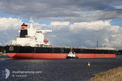
CONSTANTIA
Cargo
Current Trip
| Time Travelled | 13 days |
|---|---|
| Remaining Time | --- |
| Distance Travelled | 3905.22 nm |
| Remaining Distance | 1372.30 nm |
| AVG Speed | 12.5 Noeuds |
| MAX Speed | 15.2 Noeuds |
| AVG Wind | 15.5 knots |
| MAX Wind | 30 knots |
| MIN Temp | 21.2°C / 70.16°F |
| MAX Temp | 33.8°C / 92.84°F |
| Tirant d eau | 10.9 m |
| Position reçue | 3 d depuis |
Current Position
| Longitude | 57.38121° |
|---|---|
| Latitude | -20.15004° |
| Etat | Under way using engine |
| Vitesse | 11.4 Noeuds |
| Parcours | 263.5° |
| Zone | Indian Ocean |
| Station | T-AIS |
| Position reçue | 3 d depuis |
Info
Information
The current position of CONSTANTIA is in Indian Ocean with coordinates -20.15004° / 57.38121° as reported on 2024-05-31 04:50 by AIS to our vessel tracker app. The vessel's current speed is 11.4 Noeuds and is heading at the port of SALDANHA. The estimated time of arrival as calculated by MyShipTracking vessel tracking app is 2024-06-07 11:00 LT
The vessel CONSTANTIA (IMO: 9492347, MMSI: 232027093) is a Cargo It's sailing under the flag of [GB] United Kingdom.
In this page you can find informations about the vessels current position, last detected port calls, and current voyage information. If the vessels is not in coverage by AIS you will find the latest position.
The current position of CONSTANTIA is detected by our AIS receivers and we are not responsible for the reliability of the data. The last position was recorded while the vessel was in Coverage by the Ais receivers of our vessel tracking app.
The current draught of CONSTANTIA as reported by AIS is 10.9 meters
Weather
| Temperature | 21.7°C / 71.06°F |
|---|---|
| Wind Speed | 26 knots |
| Direction | 91° E |
| Pressure | 1020.7 hPa |
| Humidity | 77.6 % |
| Cloud Coverage | 51 % |
Featured Company
Last Port Calls
| Port | Arrival | Departure | Time In Port |
|---|---|---|---|
| 2024-05-16 05:16 | 2024-05-21 07:32 | 5 d |
Most Visited Ports (Last year)
| Port | Arrivals | |
|---|---|---|
| 2 | ||
| 1 | ||
| 1 | ||
| 1 | ||
| 1 |
Last Trips
| Origin | Departure | Destination | Arrival | Distance | |
|---|---|---|---|---|---|
| 2024-02-25 21:07 | 2024-05-16 10:46 | 9824.49 nm |
Events
| Heure | Evenement | Détails | Position/ Destination | Info |
|---|---|---|---|---|
| 2024-05-31 04:57 | Etat Changé | Default Under way using engine |
-20.15682 / 57.35912
ZA SDB
|
Vitesse: 11.4 kn Parcours: 263.5° |
| 2024-05-31 04:50 | Hors de la zone couverte |
-20.15004 / 57.38121
Indian Ocean
ZA SDB
|
Vitesse: 11.4 kn Parcours: 263.5° |
|
| 2024-05-31 04:50 | Etat Changé | Under way using engine Default |
-20.14995 / 57.38238
ZA SDB
|
Vitesse: 11.6 kn Parcours: 269° |
| 2024-05-31 04:49 | Etat Changé | Default Under way using engine |
-20.14995 / 57.38525
ZA SDB
|
Vitesse: 11 kn Parcours: 270.3° |
| 2024-05-31 04:28 | Démarrage | 2.51 nm, West of PORT LOUIS |
-20.15061 / 57.43922
ZA SDB
|
Vitesse: 3.8 kn Parcours: 265° |
| 2024-05-31 04:19 | Etat Changé | Under way using engine At anchor |
-20.14930 / 57.44093
ZA SDB
|
Vitesse: 1.3 kn Parcours: 137° |
| 2024-05-31 03:58 | Etat Changé | At anchor Default |
-20.15018 / 57.43988
ZA SDB
|
Vitesse: 0.1 kn Parcours: 139° |
| 2024-05-31 03:54 | Etat Changé | Default At anchor |
-20.14999 / 57.43983
ZA SDB
|
Vitesse: 0.1 kn Parcours: 140° |
| 2024-05-31 02:49 | Tirant d'eau modifié | 10.9 10.4 |
-20.15083 / 57.43921
ZA SDB
|
Vitesse: Parcours: 110° |
| 2024-05-31 02:49 | Changement d'ETA | 2024/06/07 11:00 2024/05/30 12:00 |
-20.15083 / 57.43921
ZA SDB
|
Vitesse: Parcours: 110° |