
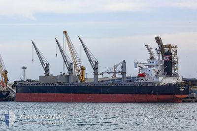
COLUMBIA
Bulk Carrier
Current Trip
DZ BJA
| Time Travelled | 1 day |
|---|---|
| Remaining Time | --- |
| Distance Travelled | 149.72 nm |
| Remaining Distance | --- |
| AVG Speed | 10 Noeuds |
| MAX Speed | 13.9 Noeuds |
| AVG Wind | 4.2 knots |
| MAX Wind | 9 knots |
| MIN Temp | 13.9°C / 57.02°F |
| MAX Temp | 19.2°C / 66.56°F |
| Tirant d eau | 11.3 m |
| Position reçue | 15 h, 41 m depuis |
Current Position
| Longitude | --- |
|---|---|
| Latitude | --- |
| Etat | Under way using engine |
| Vitesse | 1.3 Noeuds |
| Parcours | 274° |
| Zone | Mediterranean Sea - Western Basin |
| Station | T-AIS |
| Position reçue | 15 h, 41 m depuis |
Info
Information
The current position of COLUMBIA is in Mediterranean Sea - Western Basin with coordinates 37.02509° / 3.19673° as reported on 2025-12-08 11:14 by AIS to our vessel tracker app. The vessel's current speed is 1.3 Noeuds
The vessel COLUMBIA (IMO: 9423530, MMSI: 636091202) is a Bulk Carrier that was built in 2009 ( 16 Age ). It's sailing under the flag of [LR] Liberia.
In this page you can find informations about the vessels current position, last detected port calls, and current voyage information. If the vessels is not in coverage by AIS you will find the latest position.
The current position of COLUMBIA is detected by our AIS receivers and we are not responsible for the reliability of the data. The last position was recorded while the vessel was in Coverage by the Ais receivers of our vessel tracking app.
The current draught of COLUMBIA as reported by AIS is 11.3 meters
Weather
| Temperature | 15.7°C / 60.26°F |
|---|---|
| Wind Speed | 3 knots |
| Direction | 131° SE |
| Pressure | 1022.4 hPa |
| Humidity | 65.2 % |
| Cloud Coverage | 100 % |
Featured Company
Most Visited Ports (Last year)
| Port | Arrivals | |
|---|---|---|
| 2 | ||
| 2 | ||
| 1 | ||
| 1 | ||
| 1 | ||
| 1 |
Events
| Heure | Evenement | Détails | Position/ Destination | Info |
|---|---|---|---|---|
| 2025-12-09 02:01 | Démarrage | 1.51 nm, North of ALGER |
36.79403 / 3.08194
DZ BJA
|
Vitesse: 7.2 kn Parcours: 3° |
| 2025-12-08 13:29 | Arret | 1.12 nm, North East of ALGER |
36.78643 / 3.08323
DZ BJA
|
Vitesse: 0.3 kn Parcours: 184° |
| 2025-12-08 11:21 | Etat Changé | Default Under way using engine |
37.02478 / 3.19593
DZ BJA
|
Vitesse: 1.3 kn Parcours: 274° |
| 2025-12-08 11:14 | Hors de la zone couverte |
37.02509 / 3.19673
Mediterranean Sea - Western Basin
|
Vitesse: 1.3 kn Parcours: 63.8° |
|
| 2025-12-08 11:07 | Etat Changé | Under way using engine Default |
37.02402 / 3.19369
DZ BJA
|
Vitesse: 1.2 kn Parcours: 265° |
| 2025-12-08 10:53 | Dans la zone couverte |
37.02402 / 3.19369
Mediterranean Sea - Western Basin
|
Vitesse: 1.2 kn Parcours: 68.1° |
|
| 2025-12-08 08:25 | Démarrage | 12.54 nm, North of EL MARSA TAMANFOUSST |
37.01507 / 3.23398
DZ BJA
|
Vitesse: 3.3 kn Parcours: 265° |
| 2025-12-08 05:13 | Arret | 11.63 nm, North of EL MARSA TAMANFOUSST |
36.99580 / 3.18076
DZ BJA
|
Vitesse: 0.2 kn Parcours: 252° |
| 2025-12-08 00:21 | Etat Changé | Default Under way using engine |
37.13525 / 4.20557
DZ BJA
|
Vitesse: 12.4 kn Parcours: 267.8° |
| 2025-12-08 00:13 | Hors de la zone couverte |
37.13415 / 4.23954
Mediterranean Sea - Western Basin
|
Vitesse: 12.4 kn Parcours: 267.8° |