
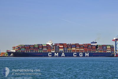
CMA CGM T.ROOSEVELT
Cargo A
Current Trip
| Trip Time | 35 days |
|---|---|
| Trip Distance | 12520.88 nm |
| AVG Speed | 15.2 Noeuds |
| MAX Speed | 20 Noeuds |
| Tirant d eau | 12.6 m |
| AVG Wind | 13.2 knots |
| MAX Wind | 26.5 knots |
| MIN Temp | 17.2°C / 62.96°F |
| MAX Temp | 28.2°C / 82.76°F |
| Position reçue | 1 d depuis |
Current Position
| Longitude | --- |
|---|---|
| Latitude | --- |
| Etat | Under way using engine |
| Vitesse | 12.3 Noeuds |
| Parcours | 104.2° |
| Zone | Malacca Strait |
| Station | T-AIS |
| Position reçue | 1 d depuis |
Info
Information
The current position of CMA CGM T.ROOSEVELT is in Malacca Strait with coordinates 5.49241° / 97.51910° as reported on 2025-12-10 07:08 by AIS to our vessel tracker app. The vessel's current speed is 12.3 Noeuds and is currently inside the port of PORT KLANG.
The vessel CMA CGM T.ROOSEVELT (IMO: 9780873, MMSI: 215251000) is a Cargo A It's sailing under the flag of [MT] Malta.
In this page you can find informations about the vessels current position, last detected port calls, and current voyage information. If the vessels is not in coverage by AIS you will find the latest position.
The current position of CMA CGM T.ROOSEVELT is detected by our AIS receivers and we are not responsible for the reliability of the data. The last position was recorded while the vessel was in Coverage by the Ais receivers of our vessel tracking app.
The current draught of CMA CGM T.ROOSEVELT as reported by AIS is 12.6 meters
Weather
| Temperature | 27.7°C / 81.86°F |
|---|---|
| Wind Speed | 5 knots |
| Direction | 344° NNW |
| Pressure | 1006.9 hPa |
| Humidity | 74 % |
| Cloud Coverage | 100 % |
Featured Company
Last Port Calls
| Port | Arrival | Departure | Time In Port |
|---|---|---|---|
| 2025-12-11 16:33 | |||
| 2025-11-05 03:03 | 2025-11-06 02:44 | 23 h | |
| 2025-11-03 00:33 | 2025-11-04 14:51 | 1 d | |
| 2025-10-30 21:08 | 2025-11-01 15:50 | 1 d | |
| 2025-10-27 13:00 | 2025-10-29 11:09 | 1 d | |
| 2025-10-24 11:28 | 2025-10-25 15:17 | 1 d |
Most Visited Ports (Last year)
| Port | Arrivals | |
|---|---|---|
| 5 | ||
| 4 | ||
| 3 | ||
| 3 | ||
| 3 | ||
| 3 |
Last Trips
| Origin | Departure | Destination | Arrival | Distance | |
|---|---|---|---|---|---|
| 2025-11-06 02:44 | 2025-12-11 16:33 | 12520.88 nm | |||
| 2025-11-04 14:51 | 2025-11-05 03:03 | 125.20 nm | |||
| 2025-11-01 15:50 | 2025-11-03 00:33 | 536.76 nm | |||
| 2025-10-29 11:09 | 2025-10-30 21:08 | 319.92 nm | |||
| 2025-10-25 15:17 | 2025-10-27 13:00 | 599.21 nm | |||
| 2025-09-25 18:02 | 2025-10-24 11:28 | 12193.33 nm |
Events
| Heure | Evenement | Détails | Position/ Destination | Info |
|---|---|---|---|---|
| 2025-12-11 09:09 | Arret |
2.91570 / 101.28324
[MY] PORT KLANG
|
Vitesse: Parcours: 210° |
|
| 2025-12-11 08:33 | Port d'arrivée |
|
2.91470 / 101.27739
[MY] PORT KLANG
|
Vitesse: 6.5 kn Parcours: 41° |
| 2025-12-10 07:10 | Etat Changé | Default Under way using engine |
5.49087 / 97.52525
MYPKG
|
Vitesse: 12.3 kn Parcours: 104.2° |
| 2025-12-10 07:08 | Etat Changé | Under way using engine Default |
5.49241 / 97.51910
MYPKG
|
Vitesse: 13 kn Parcours: 106° |
| 2025-12-10 07:08 | Hors de la zone couverte |
5.49241 / 97.51910
Malacca Strait
MYPKG
|
Vitesse: 12.3 kn Parcours: 104.2° |
|
| 2025-12-10 07:08 | Changement de zone | Indonesian part of the Malacca Strait South African part of the Indian Ocean |
5.49241 / 97.51910
Malacca Strait
MYPKG
|
Vitesse: 12.3 kn Parcours: 104.2° |
| 2025-12-10 06:53 | Dans la zone couverte |
5.49241 / 97.51910
Malacca Strait
MYPKG
|
Vitesse: 12.3 kn Parcours: 104.2° |
|
| 2025-12-09 21:33 | Démarrage | 21.23 nm, East of SABANG |
6.00833 / 95.65166
MYPKG
|
Vitesse: 4 kn Parcours: -1° |
| 2025-12-09 03:52 | Arret |
5.79833 / 96.25500
MYPKG
|
Vitesse: Parcours: -1° |