
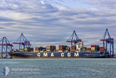
CMA CGM PEGASUS
Container Ship
Current Trip
| Time Travelled | 22 days |
|---|---|
| Remaining Time | 2 days |
| Distance Travelled | 8953.60 nm |
| Remaining Distance | 826.84 nm |
| AVG Speed | 16.8 Noeuds |
| MAX Speed | 22 Noeuds |
| AVG Wind | 11.6 knots |
| MAX Wind | 28.9 knots |
| MIN Temp | 15.4°C / 59.72°F |
| MAX Temp | 30.3°C / 86.54°F |
| Tirant d eau | 15.3 m |
| Position reçue | 6 d depuis |
Current Position
| Longitude | -0.58055° |
|---|---|
| Latitude | -13.17943° |
| Etat | Under way using engine |
| Vitesse | 18.2 Noeuds |
| Parcours | 329.2° |
| Zone | South Atlantic Ocean |
| Station | T-AIS |
| Position reçue | 6 d depuis |
Info
Information
The current position of CMA CGM PEGASUS is in South Atlantic Ocean with coordinates -13.17943° / -0.58055° as reported on 2024-04-21 11:11 by AIS to our vessel tracker app. The vessel's current speed is 18.2 Noeuds and is heading at the port of TANGER MED. The estimated time of arrival as calculated by MyShipTracking vessel tracking app is 2024-04-30 03:04 LT
The vessel CMA CGM PEGASUS (IMO: 9399210, MMSI: 248013000) is a Container Ship that was built in 2010 ( 14 Age ). It's sailing under the flag of [MT] Malta.
In this page you can find informations about the vessels current position, last detected port calls, and current voyage information. If the vessels is not in coverage by AIS you will find the latest position.
The current position of CMA CGM PEGASUS is detected by our AIS receivers and we are not responsible for the reliability of the data. The last position was recorded while the vessel was in Coverage by the Ais receivers of our vessel tracking app.
The current draught of CMA CGM PEGASUS as reported by AIS is 15.3 meters
Weather
| Temperature | 19.1°C / 66.38°F |
|---|---|
| Wind Speed | 8 knots |
| Direction | 8° N |
| Pressure | 1014.1 hPa |
| Humidity | 78.4 % |
| Cloud Coverage | --- |
Featured Company
Last Port Calls
| Port | Arrival | Departure | Time In Port |
|---|---|---|---|
| 2024-04-04 22:25 | 2024-04-05 22:35 | 1 d | |
| 2024-04-02 16:45 | 2024-04-03 19:57 | 1 d | |
| 2024-03-28 10:54 | 2024-03-29 03:34 | 16 h | |
| 2024-03-26 07:00 | 2024-03-28 05:11 | 1 d | |
| 2024-02-20 23:29 | 2024-02-21 18:45 | 19 h | |
| 2024-02-15 18:22 | 2024-02-17 19:54 | 2 d | |
| 2024-02-13 01:59 | 2024-02-14 14:54 | 1 d | |
| 2024-02-11 09:59 | 2024-02-12 15:27 | 1 d | |
| 2024-02-09 11:04 | 2024-02-10 10:19 | 23 h | |
| 2024-02-07 06:06 | 2024-02-08 17:38 | 1 d |
Most Visited Ports (Last year)
| Port | Arrivals | |
|---|---|---|
| 8 | ||
| 7 | ||
| 6 | ||
| 5 | ||
| 5 | ||
| 5 |
Last Trips
| Origin | Departure | Destination | Arrival | Distance | |
|---|---|---|---|---|---|
| 2024-04-04 01:27 | 2024-04-05 03:55 | 428.86 nm | |||
| 2024-03-29 07:34 | 2024-04-02 22:15 | 1346.55 nm | |||
| 2024-03-28 09:11 | 2024-03-28 14:54 | 47.61 nm | |||
| 2024-02-21 19:45 | 2024-03-26 11:00 | 10005.78 nm | |||
| 2024-02-17 20:54 | 2024-02-21 00:29 | 1251.60 nm | |||
| 2024-02-14 15:54 | 2024-02-15 19:22 | 281.71 nm | |||
| 2024-02-12 16:27 | 2024-02-13 02:59 | 125.26 nm | |||
| 2024-02-10 11:19 | 2024-02-11 10:59 | 355.08 nm | |||
| 2024-02-08 18:38 | 2024-02-09 12:04 | 270.55 nm | |||
| 2024-02-03 19:44 | 2024-02-07 07:06 | 348.70 nm |
Events
| Heure | Evenement | Détails | Position/ Destination | Info |
|---|---|---|---|---|
| 2024-04-21 11:16 | Etat Changé | Default Under way using engine |
-13.15867 / -.59506
MAPTM
|
Vitesse: 18.2 kn Parcours: 329.2° |
| 2024-04-21 11:11 | Hors de la zone couverte |
-13.17943 / -.58055
South Atlantic Ocean
MAPTM
|
Vitesse: 18.2 kn Parcours: 329.2° |
|
| 2024-04-21 11:10 | Etat Changé | Under way using engine Default |
-13.18378 / -.57786
MAPTM
|
Vitesse: 18.2 kn Parcours: 326° |
| 2024-04-21 10:54 | Dans la zone couverte |
-13.18378 / -.57786
South Atlantic Ocean
MAPTM
|
Vitesse: 18.1 kn Parcours: 328.3° |
|
| 2024-04-21 07:47 | Etat Changé | Default Under way using engine |
-14.01596 / .02196
MAPTM
|
Vitesse: 17.8 kn Parcours: 325.5° |
| 2024-04-21 07:42 | Hors de la zone couverte |
-14.03435 / .03539
South Atlantic Ocean
MAPTM
|
Vitesse: 17.8 kn Parcours: 325.5° |
|
| 2024-04-21 07:14 | Etat Changé | Under way using engine Default |
-14.14766 / .11907
MAPTM
|
Vitesse: 18 kn Parcours: 323° |
| 2024-04-21 07:10 | Etat Changé | Default Under way using engine |
-14.16411 / .13166
MAPTM
|
Vitesse: 18 kn Parcours: 322.9° |
| 2024-04-21 06:46 | Etat Changé | Under way using engine Default |
-14.26497 / .20613
MAPTM
|
Vitesse: 18.1 kn Parcours: 325° |
| 2024-04-21 06:39 | Etat Changé | Default Under way using engine |
-14.29500 / .22667
MAPTM
|
Vitesse: 18 kn Parcours: 325.1° |