
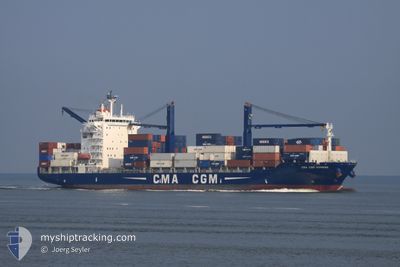
CMA CGM HOMERE
Container Ship
Current Trip
| Time Travelled | 4 days |
|---|---|
| Remaining Time | 1 day |
| Distance Travelled | 1240.25 nm |
| Remaining Distance | 394.21 nm |
| AVG Speed | 11.1 Noeuds |
| MAX Speed | 18 Noeuds |
| AVG Wind | 12.1 knots |
| MAX Wind | 26 knots |
| MIN Temp | 11.9°C / 53.42°F |
| MAX Temp | 29°C / 84.2°F |
| Tirant d eau | 6.8 m |
| Position reçue | 3 d depuis |
Current Position
| Longitude | --- |
|---|---|
| Latitude | --- |
| Etat | Under way using engine |
| Vitesse | 12.7 Noeuds |
| Parcours | 356.9° |
| Zone | North Atlantic Ocean |
| Station | T-AIS |
| Position reçue | 3 d depuis |
Info
Information
The current position of CMA CGM HOMERE is in North Atlantic Ocean with coordinates 20.79053° / -68.67526° as reported on 2025-12-08 11:42 by AIS to our vessel tracker app. The vessel's current speed is 12.7 Noeuds and is heading at the port of NEW YORK. The estimated time of arrival as calculated by MyShipTracking vessel tracking app is 2025-12-13 04:20 LT
The vessel CMA CGM HOMERE (IMO: 9362322, MMSI: 525119170) is a Container Ship that was built in 2007 ( 18 Age ). It's sailing under the flag of [ID] Indonesia.
In this page you can find informations about the vessels current position, last detected port calls, and current voyage information. If the vessels is not in coverage by AIS you will find the latest position.
The current position of CMA CGM HOMERE is detected by our AIS receivers and we are not responsible for the reliability of the data. The last position was recorded while the vessel was in Coverage by the Ais receivers of our vessel tracking app.
The current draught of CMA CGM HOMERE as reported by AIS is 6.8 meters
Weather
| Temperature | 12°C / 53.6°F |
|---|---|
| Wind Speed | 19 knots |
| Direction | 322° NW |
| Pressure | 1017.5 hPa |
| Humidity | 59.7 % |
| Cloud Coverage | 46 % |
Featured Company
Last Port Calls
| Port | Arrival | Departure | Time In Port |
|---|---|---|---|
| 2025-12-06 23:42 | 2025-12-07 13:54 | 14 h | |
| 2025-12-04 09:24 | 2025-12-04 23:57 | 14 h | |
| 2025-11-29 04:55 | 2025-11-29 06:25 | 1 h | |
| 2025-11-21 05:25 | 2025-11-23 17:04 | 2 d | |
| 2025-11-13 06:12 | 2025-11-14 17:23 | 1 d | |
| 2025-11-08 14:54 | 2025-11-10 02:58 | 1 d | |
| 2025-10-30 14:46 | 2025-10-31 07:41 | 16 h | |
| 2025-10-28 17:35 | 2025-10-29 05:58 | 12 h | |
| 2025-10-22 15:16 | 2025-10-22 16:25 | 1 h | |
| 2025-10-19 16:58 | 2025-10-20 18:22 | 1 d |
Most Visited Ports (Last year)
| Port | Arrivals | |
|---|---|---|
| 16 | ||
| 16 | ||
| 15 | ||
| 15 | ||
| 15 | ||
| 10 |
Last Trips
| Origin | Departure | Destination | Arrival | Distance | |
|---|---|---|---|---|---|
| 2025-12-04 23:57 | 2025-12-06 23:42 | 107.84 nm | |||
| 2025-11-29 06:25 | 2025-12-04 09:24 | 1521.77 nm | |||
| 2025-11-23 17:04 | 2025-11-29 04:55 | 626.61 nm | |||
| 2025-11-14 17:23 | 2025-11-21 05:25 | 1741.72 nm | |||
| 2025-11-10 02:58 | 2025-11-13 06:12 | 679.72 nm | |||
| 2025-10-31 07:41 | 2025-11-08 14:54 | 519.57 nm | |||
| 2025-10-29 05:58 | 2025-10-30 14:46 | 102.32 nm | |||
| 2025-10-22 16:25 | 2025-10-28 17:35 | 1551.96 nm | |||
| 2025-10-20 18:22 | 2025-10-22 15:16 | 580.98 nm | |||
| 2025-10-13 19:37 | 2025-10-19 16:58 | 1927.54 nm |
Events
| Heure | Evenement | Détails | Position/ Destination | Info |
|---|---|---|---|---|
| 2025-12-08 11:44 | Etat Changé | Default Under way using engine |
20.79947 / -68.67763
USNYC
|
Vitesse: 12.7 kn Parcours: 356.9° |
| 2025-12-08 11:42 | Etat Changé | Under way using engine Default |
20.79053 / -68.67526
USNYC
|
Vitesse: 12 kn Parcours: 347° |
| 2025-12-08 11:42 | Dans la zone couverte |
20.79053 / -68.67526
North Atlantic Ocean
USNYC
|
Vitesse: 12.7 kn Parcours: 356.9° |
|
| 2025-12-08 11:42 | Hors de la zone couverte |
20.79053 / -68.67526
North Atlantic Ocean
USNYC
|
Vitesse: 12.7 kn Parcours: 356.9° |
|
| 2025-12-08 11:42 | Changement de zone | Dominican Republic part of the North Atlantic Ocean Domican Republic part of the Caribbean Sea |
20.79053 / -68.67526
North Atlantic Ocean
USNYC
|
Vitesse: 12.7 kn Parcours: 356.9° |
| 2025-12-07 19:50 | Etat Changé | Default Under way using engine |
18.21666 / -69.23834
USNYC
|
Vitesse: 15.1 kn Parcours: 114.7° |
| 2025-12-07 19:46 | Hors de la zone couverte |
18.22485 / -69.25523
Caribbean Sea
USNYC
|
Vitesse: 15.1 kn Parcours: 114.7° |
|
| 2025-12-07 18:25 | Etat Changé | Under way using engine Moored |
18.36877 / -69.54741
USNYC
|
Vitesse: 9.8 kn Parcours: 125.2° |
| 2025-12-07 17:54 | PORT DE DEPART |
|
18.42876 / -69.61686
USNYC
|
Vitesse: 8.5 kn Parcours: 117° |
| 2025-12-07 17:45 | Démarrage |
18.42547 / -69.62941
[DO] BOCA CHIKA
|
Vitesse: 6.1 kn Parcours: 8° |