
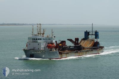
CITY OF LONDON
Suction Dredger
Current Trip
| Time Travelled | 22 days |
|---|---|
| Remaining Time | --- |
| Distance Travelled | 2210.23 nm |
| Remaining Distance | --- |
| AVG Speed | 10.2 Noeuds |
| MAX Speed | 16 Noeuds |
| AVG Wind | 8.3 knots |
| MAX Wind | 27.2 knots |
| MIN Temp | 4.2°C / 39.56°F |
| MAX Temp | 19.3°C / 66.74°F |
| Tirant d eau | 6.2 m |
| Position reçue | 1 m depuis |
Current Position
| Longitude | 0.38918° |
|---|---|
| Latitude | 51.45190° |
| Etat | Moored |
| Vitesse | |
| Parcours | 265° |
| Zone | North Sea |
| Station | T-AIS |
| Position reçue | 1 m depuis |
Info
Information
The current position of CITY OF LONDON is in North Sea with coordinates 51.45190° / 0.38918° as reported on 2024-05-14 16:00 by AIS to our vessel tracker app. The vessel's current speed is 0 Noeuds
The vessel CITY OF LONDON (IMO: 8806058, MMSI: 233322000) is a Suction Dredger that was built in 1989 ( 35 Age ). It's sailing under the flag of [GB] United Kingdom.
In this page you can find informations about the vessels current position, last detected port calls, and current voyage information. If the vessels is not in coverage by AIS you will find the latest position.
The current position of CITY OF LONDON is detected by our AIS receivers and we are not responsible for the reliability of the data. The last position was recorded while the vessel was in Coverage by the Ais receivers of our vessel tracking app.
The current draught of CITY OF LONDON as reported by AIS is 6.2 meters
Weather
| Temperature | 13.2°C / 55.76°F |
|---|---|
| Wind Speed | 9 knots |
| Direction | 152° SSE |
| Pressure | 1002.2 hPa |
| Humidity | 92.8 % |
| Cloud Coverage | 100 % |
Featured Company
Last Port Calls
| Port | Arrival | Departure | Time In Port |
|---|---|---|---|
| 2024-04-21 21:18 | 2024-04-22 11:27 | 14 h | |
| 2024-04-13 12:09 | 2024-04-16 13:24 | 3 d | |
| 2024-04-12 13:05 | 2024-04-13 03:29 | 14 h | |
| 2024-04-05 07:49 | 2024-04-05 18:26 | 10 h | |
| 2024-03-31 08:07 | 2024-03-31 08:35 | 27 m | |
| 2024-03-30 15:18 | 2024-03-30 15:53 | 35 m | |
| 2024-03-29 11:33 | 2024-03-29 12:00 | 26 m | |
| 2024-03-29 02:11 | 2024-03-29 02:43 | 31 m | |
| 2024-03-19 07:56 | 2024-03-27 08:20 | 8 d | |
| 2024-03-08 20:31 | 2024-03-09 12:58 | 16 h |
Most Visited Ports (Last year)
| Port | Arrivals | |
|---|---|---|
| 56 | ||
| 18 | ||
| 3 | ||
| 1 | ||
| 1 |
Last Trips
| Origin | Departure | Destination | Arrival | Distance | |
|---|---|---|---|---|---|
| 2024-04-16 14:24 | 2024-04-21 22:18 | 708.73 nm | |||
| 2024-04-13 04:29 | 2024-04-13 13:09 | 60.26 nm | |||
| 2024-04-05 19:26 | 2024-04-12 14:05 | 681.46 nm | |||
| 2024-03-31 09:35 | 2024-04-05 08:49 | 536.12 nm | |||
| 2024-03-30 15:53 | 2024-03-31 09:07 | 0.96 nm | |||
| 2024-03-29 12:00 | 2024-03-30 15:18 | 213.01 nm | |||
| 2024-03-29 02:43 | 2024-03-29 11:33 | 1.02 nm | |||
| 2024-03-27 08:20 | 2024-03-29 02:11 | 298.10 nm | |||
| 2024-03-09 12:58 | 2024-03-19 07:56 | 884.29 nm | |||
| 2024-03-04 13:36 | 2024-03-08 20:31 | 673.08 nm |
Events
| Heure | Evenement | Détails | Position/ Destination | Info |
|---|---|---|---|---|
| 2024-05-12 03:34 | Etat Changé | Moored Restricted manoeuverability |
51.45188 / .38921
TILBURY 2
|
Vitesse: Parcours: 264° |
| 2024-05-12 03:34 | Etat Changé | Restricted manoeuverability At anchor |
51.45188 / .38921
TILBURY 2
|
Vitesse: Parcours: 264° |
| 2024-05-12 03:33 | Etat Changé | At anchor Under way using engine |
51.45188 / .38920
TILBURY 2
|
Vitesse: Parcours: 264° |
| 2024-05-12 03:03 | Arret | 0.62 nm, North East of GRAVESEND |
51.45169 / .39033
TILBURY 2
|
Vitesse: 0.3 kn Parcours: 268° |
| 2024-05-11 18:28 | Tirant d'eau modifié | 6.2 4 |
51.71922 / 1.64492
TILBURY 2
|
Vitesse: 5.6 kn Parcours: 84° |
| 2024-05-11 18:28 | Changement de destination | TILBURY 2 LONG SAND HEAD DA509 |
51.71922 / 1.64492
TILBURY 2
|
Vitesse: 5.6 kn Parcours: 84° |
| 2024-05-11 18:28 | Changement d'ETA | 2024/05/12 03:00 2024/05/11 15:30 |
51.71922 / 1.64492
TILBURY 2
|
Vitesse: 5.6 kn Parcours: 84° |
| 2024-05-11 18:11 | Etat Changé | Under way using engine Restricted manoeuverability |
51.70854 / 1.59998
LONG SAND HEAD DA509
|
Vitesse: 5 kn Parcours: 63.5° |
| 2024-05-11 18:02 | Démarrage | 14.35 nm, South East of F HALLS COMPANY BOAT |
51.70341 / 1.58644
LONG SAND HEAD DA509
|
Vitesse: 3.1 kn Parcours: 102° |
| 2024-05-11 16:13 | Arret | 14.57 nm, South East of F HALLS COMPANY BOAT |
51.70878 / 1.59971
LONG SAND HEAD DA509
|
Vitesse: 0.2 kn Parcours: 215° |