
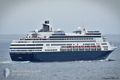
CELESTYAL JOURNEY
Passengers Ship
Current Trip
| Time Travelled | 20 h, 2 mins |
|---|---|
| Remaining Time | --- |
| Distance Travelled | 184.96 nm |
| Remaining Distance | --- |
| AVG Speed | 12 Noeuds |
| MAX Speed | 14.9 Noeuds |
| AVG Wind | 8.1 knots |
| MAX Wind | 10.3 knots |
| MIN Temp | 23.4°C / 74.12°F |
| MAX Temp | 26.4°C / 79.52°F |
| Tirant d eau | 7.7 m |
| Position reçue | 6 m depuis |
Current Position
| Longitude | --- |
|---|---|
| Latitude | --- |
| Etat | Moored |
| Vitesse | |
| Parcours | 326° |
| Zone | Persian Gulf |
| Station | T-AIS |
| Position reçue | 6 m depuis |
Info
Information
The current position of CELESTYAL JOURNEY is in Persian Gulf with coordinates 24.28761° / 52.64042° as reported on 2025-12-10 10:23 by AIS to our vessel tracker app. The vessel's current speed is 0 Noeuds
The vessel CELESTYAL JOURNEY (IMO: 8919269, MMSI: 310811000) is a Passengers Ship that was built in 1994 ( 31 Age ). It's sailing under the flag of [BM] Bermuda.
In this page you can find informations about the vessels current position, last detected port calls, and current voyage information. If the vessels is not in coverage by AIS you will find the latest position.
The current position of CELESTYAL JOURNEY is detected by our AIS receivers and we are not responsible for the reliability of the data. The last position was recorded while the vessel was in Coverage by the Ais receivers of our vessel tracking app.
The current draught of CELESTYAL JOURNEY as reported by AIS is 7.7 meters
Weather
| Temperature | 25.5°C / 77.9°F |
|---|---|
| Wind Speed | 8 knots |
| Direction | 31° NNE |
| Pressure | 1016 hPa |
| Humidity | 52 % |
| Cloud Coverage | 75 % |
Featured Company
Last Port Calls
| Port | Arrival | Departure | Time In Port |
|---|---|---|---|
| 2025-12-08 09:41 | 2025-12-09 18:28 | 1 d | |
| 2025-12-05 14:03 | 2025-12-08 01:26 | 2 d | |
| 2025-11-29 06:38 | 2025-11-29 20:22 | 13 h | |
| 2025-11-27 06:22 | 2025-11-27 20:47 | 14 h | |
| 2025-11-25 08:02 | 2025-11-25 16:27 | 8 h | |
| 2025-11-24 09:21 | 2025-11-25 07:56 | 22 h | |
| 2025-11-22 00:36 | 2025-11-22 14:29 | 13 h | |
| 2025-11-20 07:11 | 2025-11-20 23:00 | 15 h | |
| 2025-11-19 06:47 | 2025-11-19 07:12 | 25 m | |
| 2025-11-18 08:43 | 2025-11-18 20:10 | 11 h |
Last Trips
| Origin | Departure | Destination | Arrival | Distance | |
|---|---|---|---|---|---|
| 2025-12-08 01:26 | 2025-12-08 09:41 | 90.13 nm | |||
| 2025-11-29 20:22 | 2025-12-05 14:03 | 2405.19 nm | |||
| 2025-11-27 20:47 | 2025-11-29 06:38 | 451.16 nm | |||
| 2025-11-25 07:56 | 2025-11-27 06:22 | 368.23 nm | |||
| 2025-11-25 07:56 | 2025-11-25 08:02 | 0.93 nm | |||
| 2025-11-22 14:29 | 2025-11-24 09:21 | 653.91 nm | |||
| 2025-11-20 23:00 | 2025-11-22 00:36 | 156.74 nm | |||
| 2025-11-19 07:12 | 2025-11-20 07:11 | 82.96 nm | |||
| 2025-11-18 20:10 | 2025-11-19 06:47 | 65.77 nm | |||
| 2025-11-17 20:24 | 2025-11-18 08:43 | 187.45 nm |
Events
| Heure | Evenement | Détails | Position/ Destination | Info |
|---|---|---|---|---|
| 2025-12-10 10:02 | Changement de destination | AEMZD AEYAS |
24.28763 / 52.64043
AEMZD
|
Vitesse: Parcours: 326° |
| 2025-12-10 10:02 | Changement d'ETA | 2025/12/11 02:15 2025/12/10 06:00 |
24.28763 / 52.64043
AEMZD
|
Vitesse: Parcours: 326° |
| 2025-12-10 10:02 | Etat Changé | Moored Default |
24.28763 / 52.64043
AEYAS
|
Vitesse: Parcours: 326° |
| 2025-12-10 09:59 | Etat Changé | Default Moored |
24.28763 / 52.64043
AEYAS
|
Vitesse: Parcours: 326° |
| 2025-12-10 09:35 | Etat Changé | Moored Default |
24.28761 / 52.64043
AEYAS
|
Vitesse: Parcours: 326° |
| 2025-12-10 09:35 | Dans la zone couverte |
24.28761 / 52.64043
Persian Gulf
AEYAS
|
Vitesse: Parcours: 325.5° |
|
| 2025-12-10 06:20 | Etat Changé | Default Moored |
24.28758 / 52.64039
AEYAS
|
Vitesse: Parcours: 325° |
| 2025-12-10 06:11 | Hors de la zone couverte |
24.28758 / 52.64039
Persian Gulf
AEYAS
|
Vitesse: Parcours: 324.9° |
|
| 2025-12-10 05:17 | Etat Changé | Moored Under way using engine |
24.28759 / 52.64041
AEYAS
|
Vitesse: Parcours: 326° |
| 2025-12-10 05:14 | Arret | 2.11 nm, North East of SIR BANIYAS |
24.28754 / 52.64063
AEYAS
|
Vitesse: 0.3 kn Parcours: 321° |