
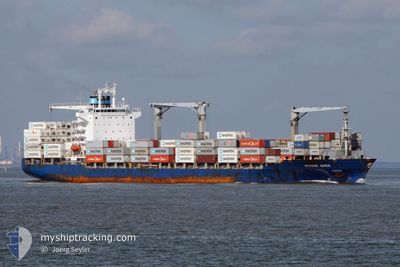
CAUCEDO EXPRESS
Container Ship
Current Trip
DOCAU
| Time Travelled | 9 days |
|---|---|
| Remaining Time | --- |
| Distance Travelled | 3566.03 nm |
| Remaining Distance | --- |
| AVG Speed | 16 Noeuds |
| MAX Speed | 18 Noeuds |
| AVG Wind | 10.4 knots |
| MAX Wind | 18 knots |
| MIN Temp | 12.9°C / 55.22°F |
| MAX Temp | 28.6°C / 83.48°F |
| Tirant d eau | 10.2 m |
| Position reçue | 8 d depuis |
Current Position
| Longitude | -67.10365° |
|---|---|
| Latitude | 19.66623° |
| Etat | Under way using engine |
| Vitesse | 16.1 Noeuds |
| Parcours | 43° |
| Zone | North Atlantic Ocean |
| Station | T-AIS |
| Position reçue | 8 d depuis |
Info
Information
The current position of CAUCEDO EXPRESS is in North Atlantic Ocean with coordinates 19.66623° / -67.10365° as reported on 2024-05-31 13:58 by AIS to our vessel tracker app. The vessel's current speed is 16.1 Noeuds
The vessel CAUCEDO EXPRESS (IMO: 9434931, MMSI: 477893100) is a Container Ship that was built in 2009 ( 15 Age ). It's sailing under the flag of [HK] Hong Kong.
In this page you can find informations about the vessels current position, last detected port calls, and current voyage information. If the vessels is not in coverage by AIS you will find the latest position.
The current position of CAUCEDO EXPRESS is detected by our AIS receivers and we are not responsible for the reliability of the data. The last position was recorded while the vessel was in Coverage by the Ais receivers of our vessel tracking app.
The current draught of CAUCEDO EXPRESS as reported by AIS is 10.2 meters
Weather
| Temperature | 12.8°C / 55.04°F |
|---|---|
| Wind Speed | 14 knots |
| Direction | 347° NNW |
| Pressure | 1018.5 hPa |
| Humidity | 69.3 % |
| Cloud Coverage | --- |
Featured Company
Last Port Calls
| Port | Arrival | Departure | Time In Port |
|---|---|---|---|
| 2024-05-30 03:55 | 2024-05-30 21:35 | 17 h | |
| 2024-05-24 10:06 | 2024-05-24 18:25 | 8 h | |
| 2024-05-21 21:10 | 2024-05-22 11:42 | 14 h | |
| 2024-05-14 10:12 | 2024-05-15 13:07 | 1 d | |
| 2024-05-11 04:04 | 2024-05-12 01:14 | 21 h | |
| 2024-04-29 18:12 | 2024-04-30 12:56 | 18 h | |
| 2024-04-28 14:28 | 2024-04-29 05:46 | 15 h | |
| 2024-04-26 20:24 | 2024-04-27 15:32 | 19 h | |
| 2024-04-24 03:12 | 2024-04-24 14:25 | 11 h | |
| 2024-04-22 06:27 | 2024-04-23 03:47 | 21 h |
Most Visited Ports (Last year)
| Port | Arrivals | |
|---|---|---|
| 12 | ||
| 8 | ||
| 7 | ||
| 7 | ||
| 7 | ||
| 7 |
Last Trips
| Origin | Departure | Destination | Arrival | Distance | |
|---|---|---|---|---|---|
| 2024-05-24 18:25 | 2024-05-30 03:55 | 1481.54 nm | |||
| 2024-05-22 11:42 | 2024-05-24 10:06 | 438.26 nm | |||
| 2024-05-15 13:07 | 2024-05-21 21:10 | 1421.13 nm | |||
| 2024-05-12 01:14 | 2024-05-14 10:12 | 776.33 nm | |||
| 2024-04-30 12:56 | 2024-05-11 04:04 | 3156.49 nm | |||
| 2024-04-29 05:46 | 2024-04-29 18:12 | 130.09 nm | |||
| 2024-04-27 15:32 | 2024-04-28 14:28 | 314.66 nm | |||
| 2024-04-24 14:25 | 2024-04-26 20:24 | 437.10 nm | |||
| 2024-04-23 03:47 | 2024-04-24 03:12 | 186.09 nm | |||
| 2024-04-11 23:28 | 2024-04-22 06:27 | 4038.86 nm |
Events
| Heure | Evenement | Détails | Position/ Destination | Info |
|---|---|---|---|---|
| 2024-05-31 14:07 | Etat Changé | Default Under way using engine |
19.69490 / -67.07522
DOCAU
|
Vitesse: 16.1 kn Parcours: 43° |
| 2024-05-31 13:58 | Etat Changé | Under way using engine Default |
19.66623 / -67.10365
DOCAU
|
Vitesse: 16.1 kn Parcours: 43° |
| 2024-05-31 13:58 | Hors de la zone couverte |
19.66623 / -67.10365
North Atlantic Ocean
|
Vitesse: 16.1 kn Parcours: 43° |
|
| 2024-05-31 13:54 | Etat Changé | Default Under way using engine |
19.65337 / -67.11643
DOCAU
|
Vitesse: 16.2 kn Parcours: 44° |
| 2024-05-31 13:35 | Changement de zone | Puerto Rican part of the North Atlantic Ocean Domican Republic part of the Caribbean Sea |
19.59120 / -67.17950
North Atlantic Ocean
|
Vitesse: 16.2 kn Parcours: 44° |
| 2024-05-31 13:35 | Etat Changé | Under way using engine Default |
19.59120 / -67.17950
DOCAU
|
Vitesse: 16.3 kn Parcours: 43° |
| 2024-05-31 13:22 | Dans la zone couverte |
19.59120 / -67.17950
North Atlantic Ocean
|
Vitesse: 16.2 kn Parcours: 44° |
|
| 2024-05-31 01:35 | Etat Changé | Default Under way using engine |
18.42775 / -69.61708
DOCAU
|
Vitesse: 4.3 kn Parcours: 87° |
| 2024-05-31 01:35 | PORT DE DEPART |
|
18.42775 / -69.61708
DOCAU
|
Vitesse: 4.3 kn Parcours: 87° |
| 2024-05-31 01:29 | Hors de la zone couverte |
18.43062 / -69.62498
Caribbean Sea
|
Vitesse: 4.3 kn Parcours: 74° |