
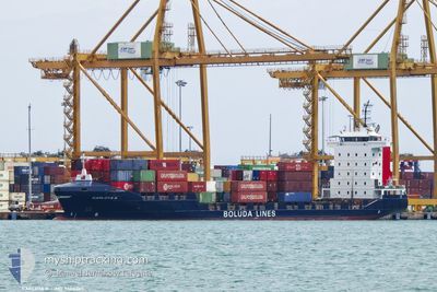
CARLOTA B
Container Ship
Current Trip
| Time Travelled | 1 day |
|---|---|
| Remaining Time | 3 h, 37 mins |
| Distance Travelled | 559.93 nm |
| Remaining Distance | 43.57 nm |
| AVG Speed | 12.4 Noeuds |
| MAX Speed | 14.1 Noeuds |
| AVG Wind | 5.5 knots |
| MAX Wind | 16.9 knots |
| MIN Temp | 17.5°C / 63.5°F |
| MAX Temp | 19.6°C / 67.28°F |
| Tirant d eau | 7.4 m |
| Position reçue | 2 m depuis |
Current Position
| Longitude | -6.20897° |
|---|---|
| Latitude | 36.01952° |
| Etat | Under way using engine |
| Vitesse | 10.9 Noeuds |
| Parcours | 282.3° |
| Zone | North Atlantic Ocean |
| Station | T-AIS |
| Position reçue | 2 m depuis |
Info
Information
The current position of CARLOTA B is in North Atlantic Ocean with coordinates 36.01952° / -6.20897° as reported on 2024-05-12 16:28 by AIS to our vessel tracker app. The vessel's current speed is 10.9 Noeuds and is heading at the port of CADIZ. The estimated time of arrival as calculated by MyShipTracking vessel tracking app is 2024-05-12 22:07 LT
The vessel CARLOTA B (IMO: 9404065, MMSI: 255805878) is a Container Ship that was built in 2007 ( 17 Age ). It's sailing under the flag of [PT] Portugal.
In this page you can find informations about the vessels current position, last detected port calls, and current voyage information. If the vessels is not in coverage by AIS you will find the latest position.
The current position of CARLOTA B is detected by our AIS receivers and we are not responsible for the reliability of the data. The last position was recorded while the vessel was in Coverage by the Ais receivers of our vessel tracking app.
The current draught of CARLOTA B as reported by AIS is 7.4 meters
Weather
| Temperature | 19.6°C / 67.28°F |
|---|---|
| Wind Speed | 4 knots |
| Direction | 304° NW |
| Pressure | 1014.7 hPa |
| Humidity | 71 % |
| Cloud Coverage | 54 % |
Featured Company
Last Port Calls
| Port | Arrival | Departure | Time In Port |
|---|---|---|---|
| 2024-05-09 12:45 | 2024-05-10 21:45 | 1 d | |
| 2024-05-08 05:43 | 2024-05-08 12:19 | 6 h | |
| 2024-05-06 07:22 | 2024-05-06 10:09 | 2 h | |
| 2024-05-03 12:06 | 2024-05-03 20:05 | 7 h | |
| 2024-05-02 18:18 | 2024-05-03 02:30 | 8 h | |
| 2024-05-01 09:03 | 2024-05-02 13:36 | 1 d | |
| 2024-05-01 00:25 | 2024-05-01 05:19 | 4 h | |
| 2024-04-28 22:32 | 2024-04-29 06:08 | 7 h | |
| 2024-04-25 12:21 | 2024-04-26 22:37 | 1 d | |
| 2024-04-24 07:03 | 2024-04-24 13:02 | 5 h |
Last Trips
| Origin | Departure | Destination | Arrival | Distance | |
|---|---|---|---|---|---|
| 2024-05-08 12:19 | 2024-05-09 12:45 | 235.26 nm | |||
| 2024-05-06 10:09 | 2024-05-08 05:43 | 408.82 nm | |||
| 2024-05-03 20:05 | 2024-05-06 07:22 | 752.78 nm | |||
| 2024-05-03 02:30 | 2024-05-03 12:06 | 108.64 nm | |||
| 2024-05-02 13:36 | 2024-05-02 18:18 | 62.29 nm | |||
| 2024-05-01 05:19 | 2024-05-01 09:03 | 54.06 nm | |||
| 2024-04-29 06:08 | 2024-05-01 00:25 | 703.18 nm | |||
| 2024-04-26 22:37 | 2024-04-28 22:32 | 603.74 nm | |||
| 2024-04-24 13:02 | 2024-04-25 12:21 | 238.41 nm | |||
| 2024-04-22 11:25 | 2024-04-24 07:03 | 406.41 nm |
Events
| Heure | Evenement | Détails | Position/ Destination | Info |
|---|---|---|---|---|
| 2024-05-12 15:24 | Changement de zone | Spanish part of the North Atlantic Ocean Spanish part of the Strait of Gibraltar |
35.97739 / -5.97961
North Atlantic Ocean
ESCAD
|
Vitesse: 10.5 kn Parcours: 280.6° |
| 2024-05-12 15:18 | Etat Changé | Under way using engine Default |
35.97387 / -5.95723
ESCAD
|
Vitesse: 10.5 kn Parcours: 283° |
| 2024-05-12 15:06 | Etat Changé | Default Under way using engine |
35.96822 / -5.91608
ESCAD
|
Vitesse: 11 kn Parcours: 276.7° |
| 2024-05-12 14:54 | Etat Changé | Under way using engine Default |
35.96383 / -5.86764
ESCAD
|
Vitesse: 11.4 kn Parcours: 267° |
| 2024-05-12 14:50 | Etat Changé | Default Under way using engine |
35.96352 / -5.85539
ESCAD
|
Vitesse: 11.4 kn Parcours: 268.2° |
| 2024-05-12 14:29 | Etat Changé | Under way using engine Default |
35.96561 / -5.77127
ESCAD
|
Vitesse: 12.1 kn Parcours: 268° |
| 2024-05-12 14:26 | Etat Changé | Default Under way using engine |
35.96582 / -5.75889
ESCAD
|
Vitesse: 12.2 kn Parcours: 273.5° |
| 2024-05-12 12:38 | Detecté en mer | Spanish part of the Strait of Gibraltar |
36.01439 / -5.33773
Strait of Gibraltar
ESCAD
|
Vitesse: 11.2 kn Parcours: 251.2° |
| 2024-05-12 12:35 | Changement de zone | Gibraltarian part of the Strait of Gibraltar Gibraltarian part of the Alboran Sea |
36.01743 / -5.32597
Strait of Gibraltar
ESCAD
|
Vitesse: 12.1 kn Parcours: 251.5° |
| 2024-05-12 10:50 | Changement de zone | Gibraltarian part of the Alboran Sea Spanish part of the Alboran Sea |
36.08830 / -4.92772
Alboran Sea
ESCAD
|
Vitesse: 11.2 kn Parcours: 256.5° |