
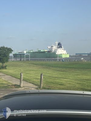
BW LIBRA
Tanker
Current Trip
| Time Travelled | 17 days |
|---|---|
| Remaining Time | 3 days |
| Distance Travelled | 4805.81 nm |
| Remaining Distance | 1201.89 nm |
| AVG Speed | 14.4 Noeuds |
| MAX Speed | 19.2 Noeuds |
| AVG Wind | 10.9 knots |
| MAX Wind | 31.7 knots |
| MIN Temp | 18.8°C / 65.84°F |
| MAX Temp | 28.3°C / 82.94°F |
| Tirant d eau | 8.3 m |
| Position reçue | 3 d depuis |
Current Position
| Longitude | --- |
|---|---|
| Latitude | --- |
| Etat | Under way using engine |
| Vitesse | 2 Noeuds |
| Parcours | 14° |
| Zone | Indian Ocean |
| Station | T-AIS |
| Position reçue | 3 d depuis |
Info
Information
The current position of BW LIBRA is in Indian Ocean with coordinates -20.14305° / 57.46044° as reported on 2025-12-03 02:25 by AIS to our vessel tracker app. The vessel's current speed is 2 Noeuds and is heading at the port of PORT LOUIS. The estimated time of arrival as calculated by MyShipTracking vessel tracking app is 2025-12-10 00:13 LT
The vessel BW LIBRA (IMO: 9719496, MMSI: 235111639) is a Tanker It's sailing under the flag of [GB] United Kingdom.
In this page you can find informations about the vessels current position, last detected port calls, and current voyage information. If the vessels is not in coverage by AIS you will find the latest position.
The current position of BW LIBRA is detected by our AIS receivers and we are not responsible for the reliability of the data. The last position was recorded while the vessel was in Coverage by the Ais receivers of our vessel tracking app.
The current draught of BW LIBRA as reported by AIS is 8.3 meters
Weather
| Temperature | 23°C / 73.4°F |
|---|---|
| Wind Speed | 10 knots |
| Direction | 2° N |
| Pressure | 1017.2 hPa |
| Humidity | 75.3 % |
| Cloud Coverage | 79 % |
Featured Company
Last Port Calls
| Port | Arrival | Departure | Time In Port |
|---|---|---|---|
| 2025-11-16 12:50 | 2025-11-18 17:15 | 2 d | |
| 2025-11-02 02:25 | 2025-11-03 14:56 | 1 d | |
| 2025-10-14 13:29 | 2025-10-15 16:44 | 1 d | |
| 2025-10-05 16:23 | 2025-10-07 03:44 | 1 d |
Most Visited Ports (Last year)
| Port | Arrivals | |
|---|---|---|
| 2 | ||
| 1 | ||
| 1 | ||
| 1 | ||
| 1 | ||
| 1 |
Last Trips
| Origin | Departure | Destination | Arrival | Distance | |
|---|---|---|---|---|---|
| 2025-11-03 14:56 | 2025-11-16 12:50 | 3317.38 nm | |||
| 2025-10-15 16:44 | 2025-11-02 02:25 | 5437.77 nm | |||
| 2025-10-07 03:44 | 2025-10-14 13:29 | 1381.93 nm | |||
| 2025-09-19 08:53 | 2025-10-05 16:23 | 5795.23 nm |
Events
| Heure | Evenement | Détails | Position/ Destination | Info |
|---|---|---|---|---|
| 2025-12-03 02:32 | Etat Changé | Default Under way using engine |
-20.13928 / 57.45893
MU PLU
|
Vitesse: 2 kn Parcours: 14° |
| 2025-12-03 02:32 | Démarrage | 1.33 nm, West of PORT LOUIS |
-20.13928 / 57.45893
MU PLU
|
Vitesse: 4.2 kn Parcours: 267° |
| 2025-12-03 02:25 | Hors de la zone couverte |
-20.14305 / 57.46044
Indian Ocean
|
Vitesse: 2 kn Parcours: 49.5° |
|
| 2025-12-03 02:24 | Etat Changé | Under way using engine Default |
-20.14340 / 57.45989
MU PLU
|
Vitesse: 0.6 kn Parcours: 49° |
| 2025-12-03 02:20 | Dans la zone couverte |
-20.14305 / 57.46044
Indian Ocean
|
Vitesse: 2 kn Parcours: 49.5° |
|
| 2025-12-02 20:02 | Etat Changé | Default At anchor |
-20.14500 / 57.45667
MU PLU
|
Vitesse: 0.1 kn Parcours: 63° |
| 2025-12-02 19:56 | Etat Changé | At anchor Default |
-20.14498 / 57.45797
MU PLU
|
Vitesse: Parcours: -1° |
| 2025-12-02 19:56 | Hors de la zone couverte |
-20.14498 / 57.45797
Indian Ocean
|
Vitesse: 0.1 kn Parcours: 318.5° |
|
| 2025-12-02 19:50 | Etat Changé | Default At anchor |
-20.14500 / 57.45667
MU PLU
|
Vitesse: Parcours: 46° |
| 2025-12-02 19:41 | Etat Changé | At anchor Default |
-20.14534 / 57.45822
MU PLU
|
Vitesse: Parcours: -1° |