
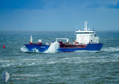
BRO ANNA
Oil/Chemical Tanker
Current Trip
| Time Travelled | 17 h, 4 mins |
|---|---|
| Remaining Time | 2 days |
| Distance Travelled | 153.86 nm |
| Remaining Distance | 539.37 nm |
| AVG Speed | 8.5 Noeuds |
| MAX Speed | 12.8 Noeuds |
| AVG Wind | 24.9 knots |
| MAX Wind | 37.5 knots |
| MIN Temp | 6.2°C / 43.16°F |
| MAX Temp | 12.2°C / 53.96°F |
| Tirant d eau | 7.8 m |
| Position reçue | 54 m depuis |
Current Position
| Longitude | --- |
|---|---|
| Latitude | --- |
| Etat | Under way using engine |
| Vitesse | 9.5 Noeuds |
| Parcours | 227.4° |
| Zone | English Channel |
| Station | T-AIS |
| Position reçue | 54 m depuis |
Info
Information
The current position of BRO ANNA is in English Channel with coordinates 50.93081° / 1.21470° as reported on 2025-12-06 06:48 by AIS to our vessel tracker app. The vessel's current speed is 9.5 Noeuds and is heading at the port of LIVERPOOL ANCH. The estimated time of arrival as calculated by MyShipTracking vessel tracking app is 2025-12-08 21:00 LT
The vessel BRO ANNA (IMO: 9344435, MMSI: 564066000) is a Oil/Chemical Tanker that was built in 2008 ( 17 Age ). It's sailing under the flag of [SG] Singapore.
In this page you can find informations about the vessels current position, last detected port calls, and current voyage information. If the vessels is not in coverage by AIS you will find the latest position.
The current position of BRO ANNA is detected by our AIS receivers and we are not responsible for the reliability of the data. The last position was recorded while the vessel was in Coverage by the Ais receivers of our vessel tracking app.
The current draught of BRO ANNA as reported by AIS is 7.8 meters
Weather
| Temperature | 12.1°C / 53.78°F |
|---|---|
| Wind Speed | 30 knots |
| Direction | 237° WSW |
| Pressure | 997 hPa |
| Humidity | 82.6 % |
| Cloud Coverage | 100 % |
Featured Company
Last Port Calls
| Port | Arrival | Departure | Time In Port |
|---|---|---|---|
| 2025-12-04 08:09 | 2025-12-05 15:39 | 1 d | |
| 2025-12-03 09:05 | 2025-12-04 06:21 | 21 h | |
| 2025-12-01 19:18 | 2025-12-03 08:50 | 1 d | |
| 2025-11-28 15:57 | 2025-11-28 16:48 | 50 m | |
| 2025-11-26 16:11 | 2025-11-28 15:17 | 1 d | |
| 2025-11-26 14:58 | 2025-11-26 15:45 | 46 m | |
| 2025-11-21 09:57 | 2025-11-24 06:13 | 2 d | |
| 2025-11-17 20:10 | 2025-11-17 21:03 | 52 m | |
| 2025-11-15 21:25 | 2025-11-17 19:22 | 1 d | |
| 2025-11-15 20:11 | 2025-11-15 20:55 | 44 m |
Most Visited Ports (Last year)
| Port | Arrivals | |
|---|---|---|
| 16 | ||
| 9 | ||
| 9 | ||
| 8 | ||
| 8 | ||
| 7 |
Last Trips
| Origin | Departure | Destination | Arrival | Distance | |
|---|---|---|---|---|---|
| 2025-12-04 06:21 | 2025-12-04 08:09 | 14.62 nm | |||
| 2025-12-03 08:50 | 2025-12-03 09:05 | 2.53 nm | |||
| 2025-11-28 16:48 | 2025-12-01 19:18 | 795.81 nm | |||
| 2025-11-28 15:17 | 2025-11-28 15:57 | 1.99 nm | |||
| 2025-11-26 15:45 | 2025-11-26 16:11 | 1.55 nm | |||
| 2025-11-24 06:13 | 2025-11-26 14:58 | 725.35 nm | |||
| 2025-11-17 21:03 | 2025-11-21 09:57 | 790.68 nm | |||
| 2025-11-17 19:22 | 2025-11-17 20:10 | 1.50 nm | |||
| 2025-11-15 20:55 | 2025-11-15 21:25 | 1.54 nm | |||
| 2025-11-11 10:42 | 2025-11-15 20:11 | 764.70 nm |
Events
| Heure | Evenement | Détails | Position/ Destination | Info |
|---|---|---|---|---|
| 2025-12-06 06:49 | Etat Changé | Default Under way using engine |
50.92965 / 1.21278
NLRTM>GBSOW
|
Vitesse: 9.5 kn Parcours: 227.4° |
| 2025-12-06 05:29 | Detecté en mer | United Kingdom part of the English Channel |
51.07268 / 1.46317
English Channel
NLRTM>GBSOW
|
Vitesse: 8.8 kn Parcours: 230.3° |
| 2025-12-05 23:07 | Changement de zone | United Kingdom part of the North Sea Belgian part of the North Sea |
51.62759 / 2.22664
North Sea
NLRTM>GBSOW
|
Vitesse: 7.6 kn Parcours: 220° |
| 2025-12-05 23:07 | Etat Changé | Under way using engine Default |
51.62759 / 2.22664
NLRTM>GBSOW
|
Vitesse: 7.8 kn Parcours: 219° |
| 2025-12-05 23:07 | Dans la zone couverte |
51.62759 / 2.22664
North Sea
NLRTM>GBSOW
|
Vitesse: 7.6 kn Parcours: 220° |
|
| 2025-12-05 22:09 | Etat Changé | Default Under way using engine |
51.72975 / 2.39098
NLRTM>GBSOW
|
Vitesse: 9.4 kn Parcours: 225.3° |
| 2025-12-05 22:03 | Hors de la zone couverte |
51.74066 / 2.40848
North Sea
NLRTM>GBSOW
|
Vitesse: 9.4 kn Parcours: 225.3° |
|
| 2025-12-05 21:10 | Detecté en mer | Belgian part of the North Sea |
51.84918 / 2.57347
North Sea
NLRTM>GBSOW
|
Vitesse: 10.7 kn Parcours: 223.2° |
| 2025-12-05 20:18 | Etat Changé | Under way using engine Default |
51.97424 / 2.75511
NLRTM>GBSOW
|
Vitesse: 11.7 kn Parcours: 222° |
| 2025-12-05 20:17 | Etat Changé | Default Under way using engine |
51.97836 / 2.76093
NLRTM>GBSOW
|
Vitesse: 11.7 kn Parcours: 222.5° |