
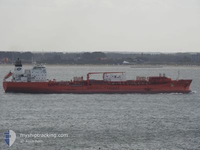
BOW CECIL
Oil/Chemical Tanker
Current Trip
| Trip Time | 2 h, 48 mins |
|---|---|
| Trip Distance | 9.31 nm |
| AVG Speed | 6.2 Noeuds |
| MAX Speed | 11.1 Noeuds |
| Tirant d eau | 6.6 m |
| AVG Wind | 7.7 knots |
| MAX Wind | 8.2 knots |
| MIN Temp | 27.6°C / 81.68°F |
| MAX Temp | 28.6°C / 83.48°F |
| Position reçue | 3 d depuis |
Current Position
| Longitude | 49.87933° |
|---|---|
| Latitude | 27.23162° |
| Etat | Under way using engine |
| Vitesse | 3.4 Noeuds |
| Parcours | 164° |
| Zone | Persian Gulf |
| Station | T-AIS |
| Position reçue | 3 d depuis |
Info
Information
The current position of BOW CECIL is in Persian Gulf with coordinates 27.23162° / 49.87933° as reported on 2024-05-09 21:07 by AIS to our vessel tracker app. The vessel's current speed is 3.4 Noeuds and is currently inside the port of AL JUBAIL.
The vessel BOW CECIL (IMO: 9143219, MMSI: 259928000) is a Oil/Chemical Tanker that was built in 1998 ( 26 Age ). It's sailing under the flag of [NO] Norway.
In this page you can find informations about the vessels current position, last detected port calls, and current voyage information. If the vessels is not in coverage by AIS you will find the latest position.
The current position of BOW CECIL is detected by our AIS receivers and we are not responsible for the reliability of the data. The last position was recorded while the vessel was in Coverage by the Ais receivers of our vessel tracking app.
The current draught of BOW CECIL as reported by AIS is 6.6 meters
Weather
| Temperature | 29.4°C / 84.92°F |
|---|---|
| Wind Speed | 12 knots |
| Direction | 162° SSE |
| Pressure | 1003.5 hPa |
| Humidity | 60.8 % |
| Cloud Coverage | 98 % |
Featured Company
Last Port Calls
| Port | Arrival | Departure | Time In Port |
|---|---|---|---|
| 2024-05-12 10:04 | |||
| 2024-05-09 22:47 | 2024-05-12 07:16 | 2 d | |
| 2024-05-05 05:08 | 2024-05-06 02:48 | 21 h | |
| 2024-04-20 15:36 | 2024-04-21 00:03 | 8 h | |
| 2024-04-19 11:41 | 2024-04-20 14:18 | 1 d | |
| 2024-04-19 10:28 | 2024-04-19 10:39 | 10 m | |
| 2024-04-18 00:38 | 2024-04-19 09:28 | 1 d | |
| 2024-04-16 15:21 | 2024-04-17 12:20 | 20 h | |
| 2024-04-15 09:33 | 2024-04-16 13:54 | 1 d | |
| 2024-03-25 11:44 | 2024-03-29 02:28 | 3 d |
Most Visited Ports (Last year)
| Port | Arrivals | |
|---|---|---|
| 14 | ||
| 11 | ||
| 6 | ||
| 3 | ||
| 3 | ||
| 3 |
Last Trips
| Origin | Departure | Destination | Arrival | Distance | |
|---|---|---|---|---|---|
| 2024-05-12 10:16 | 2024-05-12 13:04 | 9.31 nm | |||
| 2024-05-06 06:48 | 2024-05-10 01:47 | 418.77 nm | |||
| 2024-04-21 08:03 | 2024-05-05 09:08 | 3833.24 nm | |||
| 2024-04-20 22:18 | 2024-04-20 23:36 | 10.67 nm | |||
| 2024-04-19 18:39 | 2024-04-19 19:41 | 1.69 nm | |||
| 2024-04-19 17:28 | 2024-04-19 18:28 | 11.24 nm | |||
| 2024-04-17 20:20 | 2024-04-18 08:38 | 22.13 nm | |||
| 2024-04-16 21:54 | 2024-04-16 23:21 | 10.55 nm | |||
| 2024-03-29 04:28 | 2024-04-15 17:33 | 4862.64 nm | |||
| 2024-03-22 07:35 | 2024-03-25 13:44 | 247.29 nm |
Events
| Heure | Evenement | Détails | Position/ Destination | Info |
|---|---|---|---|---|
| 2024-05-12 10:25 | Arret |
27.08483 / 49.69633
[SA] AL JUBAIL
|
Vitesse: Parcours: 179° |
|
| 2024-05-12 10:04 | Port d'arrivée |
|
27.08453 / 49.69650
[SA] AL JUBAIL
|
Vitesse: 1.1 kn Parcours: 176° |
| 2024-05-12 08:34 | Démarrage | 3.59 nm, East of AL JUBAIL |
27.09181 / 49.75571
SA JUB
|
Vitesse: 3.9 kn Parcours: 354° |
| 2024-05-12 07:56 | Arret | 3.8 nm, East of AL JUBAIL |
27.09950 / 49.76200
SA JUB
|
Vitesse: 0.2 kn Parcours: 208° |
| 2024-05-12 07:16 | PORT DE DEPART |
|
27.06794 / 49.75167
SA JUB
|
Vitesse: 6.6 kn Parcours: 31° |
| 2024-05-12 06:58 | Démarrage |
27.02253 / 49.68762
[SA] AL JUBAIL
|
Vitesse: 4.7 kn Parcours: 43° |
|
| 2024-05-09 23:55 | Arret |
27.02050 / 49.68350
[SA] AL JUBAIL
|
Vitesse: 0.1 kn Parcours: 44° |
|
| 2024-05-09 22:47 | Port d'arrivée |
|
27.06710 / 49.74029
[SA] AL JUBAIL
|
Vitesse: 5.8 kn Parcours: 228° |
| 2024-05-09 21:09 | Etat Changé | Default Under way using engine |
27.22885 / 49.88008
SA JUB
|
Vitesse: 3.4 kn Parcours: 164° |
| 2024-05-09 21:07 | Hors de la zone couverte |
27.23162 / 49.87933
Persian Gulf
|
Vitesse: 3.4 kn Parcours: 143.5° |