
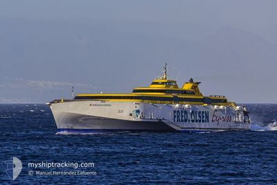
BENCHIJIGUA EXPRESS
Ro-Ro/Passenger Ship
Current Trip
CRT_GMR_SPC
| Time Travelled | 1 day |
|---|---|
| Remaining Time | --- |
| Distance Travelled | 1070.76 nm |
| Remaining Distance | --- |
| AVG Speed | 16.5 Noeuds |
| MAX Speed | 16.5 Noeuds |
| AVG Wind | 8.8 knots |
| MAX Wind | 22 knots |
| MIN Temp | 14.2°C / 57.56°F |
| MAX Temp | 21.7°C / 71.06°F |
| Tirant d eau | 4.1 m |
| Position reçue | 1 m depuis |
Current Position
| Longitude | -8.79031° |
|---|---|
| Latitude | 43.50796° |
| Etat | Under way using engine |
| Vitesse | 9.1 Noeuds |
| Parcours | 237.9° |
| Zone | North Atlantic Ocean |
| Station | T-AIS |
| Position reçue | 1 m depuis |
Info
Information
The current position of BENCHIJIGUA EXPRESS is in North Atlantic Ocean with coordinates 43.50796° / -8.79031° as reported on 2024-05-09 02:37 by AIS to our vessel tracker app. The vessel's current speed is 9.1 Noeuds
The vessel BENCHIJIGUA EXPRESS (IMO: 9299056, MMSI: 224441000) is a Ro-Ro/Passenger Ship that was built in 2005 ( 19 Age ). It's sailing under the flag of [ES] Spain.
In this page you can find informations about the vessels current position, last detected port calls, and current voyage information. If the vessels is not in coverage by AIS you will find the latest position.
The current position of BENCHIJIGUA EXPRESS is detected by our AIS receivers and we are not responsible for the reliability of the data. The last position was recorded while the vessel was in Coverage by the Ais receivers of our vessel tracking app.
The current draught of BENCHIJIGUA EXPRESS as reported by AIS is 4.1 meters
Weather
| Temperature | 14.9°C / 58.82°F |
|---|---|
| Wind Speed | 7 knots |
| Direction | 96° E |
| Pressure | 1017.2 hPa |
| Humidity | 83.3 % |
| Cloud Coverage | 100 % |
Featured Company
Last Port Calls
| Port | Arrival | Departure | Time In Port |
|---|---|---|---|
| 2024-05-07 08:59 | 2024-05-07 10:48 | 1 h | |
| 2024-05-06 20:52 | 2024-05-07 06:33 | 9 h | |
| 2024-05-06 17:23 | 2024-05-06 18:16 | 52 m | |
| 2024-05-06 15:57 | 2024-05-06 16:37 | 40 m | |
| 2024-05-06 13:50 | 2024-05-06 15:07 | 1 h | |
| 2024-05-06 09:40 | 2024-05-06 13:03 | 3 h | |
| 2024-05-06 07:57 | 2024-05-06 08:51 | 53 m | |
| 2024-05-05 21:52 | 2024-05-06 05:33 | 7 h | |
| 2024-05-05 18:25 | 2024-05-05 19:32 | 1 h | |
| 2024-05-05 14:23 | 2024-05-05 16:03 | 1 h |
Most Visited Ports (Last year)
| Port | Arrivals | |
|---|---|---|
| 989 | ||
| 608 | ||
| 367 | ||
| 4 |
Last Trips
| Origin | Departure | Destination | Arrival | Distance | |
|---|---|---|---|---|---|
| 2024-05-07 07:33 | 2024-05-07 09:59 | 70.04 nm | |||
| 2024-05-06 19:16 | 2024-05-06 21:52 | 69.02 nm | |||
| 2024-05-06 17:37 | 2024-05-06 18:23 | 22.69 nm | |||
| 2024-05-06 16:07 | 2024-05-06 16:57 | 22.69 nm | |||
| 2024-05-06 14:03 | 2024-05-06 14:50 | 23.26 nm | |||
| 2024-05-06 09:51 | 2024-05-06 10:40 | 22.85 nm | |||
| 2024-05-06 06:33 | 2024-05-06 08:57 | 70.07 nm | |||
| 2024-05-05 20:32 | 2024-05-05 22:52 | 69.30 nm | |||
| 2024-05-05 17:03 | 2024-05-05 19:25 | 69.84 nm | |||
| 2024-05-05 13:03 | 2024-05-05 15:23 | 69.56 nm |
Events
| Heure | Evenement | Détails | Position/ Destination | Info |
|---|---|---|---|---|
| 2024-05-08 19:29 | Changement de zone | Spanish part of the North Atlantic Ocean High seas of the North Atlantic Ocean |
43.17471 / -9.76020
North Atlantic Ocean
|
Vitesse: 28.8 kn Parcours: 4.3° |
| 2024-05-08 19:27 | Etat Changé | Under way using engine Default |
43.15493 / -9.76311
CRT_GMR_SPC
|
Vitesse: 28.7 kn Parcours: 4° |
| 2024-05-08 19:27 | Dans la zone couverte |
43.17471 / -9.76020
North Atlantic Ocean
|
Vitesse: 28.8 kn Parcours: 4.3° |
|
| 2024-05-08 04:32 | Etat Changé | Default Under way using engine |
36.31863 / -13.33800
CRT_GMR_SPC
|
Vitesse: 30.3 kn Parcours: 23.8° |
| 2024-05-08 04:31 | Etat Changé | Under way using engine Default |
36.30990 / -13.34280
CRT_GMR_SPC
|
Vitesse: 30.4 kn Parcours: 22° |
| 2024-05-08 04:31 | Hors de la zone couverte |
36.30990 / -13.34280
North Atlantic Ocean
|
Vitesse: 30.3 kn Parcours: 23.8° |
|
| 2024-05-08 04:31 | Changement de zone | High seas of the North Atlantic Ocean Portuguese (Madeira) part of the North Atlantic Ocean |
36.30990 / -13.34280
North Atlantic Ocean
|
Vitesse: 30.3 kn Parcours: 23.8° |
| 2024-05-08 04:22 | Dans la zone couverte |
36.30990 / -13.34280
North Atlantic Ocean
|
Vitesse: 30.3 kn Parcours: 23.8° |
|
| 2024-05-07 16:15 | Etat Changé | Default Under way using engine |
30.48346 / -16.08152
CRT_GMR_SPC
|
Vitesse: 30.5 kn Parcours: 19.5° |
| 2024-05-07 16:09 | Hors de la zone couverte |
30.43583 / -16.10176
North Atlantic Ocean
|
Vitesse: 30.5 kn Parcours: 19.5° |