
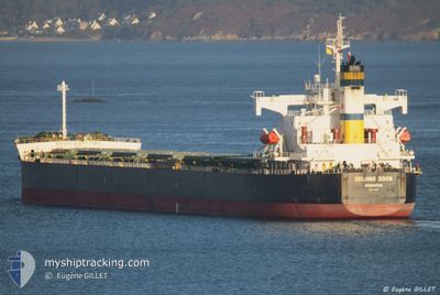
BEIJING 2008
Bulk Carrier
Current Trip
BR PNG
| Time Travelled | 1 day |
|---|---|
| Remaining Time | --- |
| Distance Travelled | 410.17 nm |
| Remaining Distance | --- |
| AVG Speed | 9.6 Noeuds |
| MAX Speed | 11.4 Noeuds |
| AVG Wind | 7.2 knots |
| MAX Wind | 12.3 knots |
| MIN Temp | 11.3°C / 52.34°F |
| MAX Temp | 21.7°C / 71.06°F |
| Tirant d eau | 6.8 m |
| Position reçue | 7 d depuis |
Current Position
| Longitude | -48.17829° |
|---|---|
| Latitude | -25.57990° |
| Etat | At anchor |
| Vitesse | 0.2 Noeuds |
| Parcours | 224° |
| Zone | South Atlantic Ocean |
| Station | T-AIS |
| Position reçue | 7 d depuis |
Info
Information
The current position of BEIJING 2008 is in South Atlantic Ocean with coordinates -25.57990° / -48.17829° as reported on 2024-05-25 02:32 by AIS to our vessel tracker app. The vessel's current speed is 0.2 Noeuds
The vessel BEIJING 2008 (IMO: 9442744, MMSI: 636013612) is a Bulk Carrier that was built in 2007 ( 17 Age ). It's sailing under the flag of [LR] Liberia.
In this page you can find informations about the vessels current position, last detected port calls, and current voyage information. If the vessels is not in coverage by AIS you will find the latest position.
The current position of BEIJING 2008 is detected by our AIS receivers and we are not responsible for the reliability of the data. The last position was recorded while the vessel was in Coverage by the Ais receivers of our vessel tracking app.
The current draught of BEIJING 2008 as reported by AIS is 6.8 meters
Weather
| Temperature | 21.1°C / 69.98°F |
|---|---|
| Wind Speed | 7 knots |
| Direction | 134° SE |
| Pressure | 1025.1 hPa |
| Humidity | 56.8 % |
| Cloud Coverage | 22 % |
Featured Company
Last Trips
| Origin | Departure | Destination | Arrival | Distance |
|---|
Events
| Heure | Evenement | Détails | Position/ Destination | Info |
|---|---|---|---|---|
| 2024-05-30 14:02 | Démarrage | 1.83 nm, East of PARANAGUA |
-25.49257 / -48.48508
BR PNG
|
Vitesse: 5.2 kn Parcours: 102° |
| 2024-05-30 10:42 | PORT DE DEPART |
|
-25.49667 / -48.50500
BR PNG
|
Vitesse: 0.1 kn Parcours: 261° |
| 2024-05-28 18:05 | Arret |
-25.50146 / -48.50573
[BR] PARANAGUA
|
Vitesse: Parcours: 259° |
|
| 2024-05-28 17:49 | Port d'arrivée |
|
-25.49969 / -48.50369
[BR] PARANAGUA
|
Vitesse: 4 kn Parcours: -1° |
| 2024-05-28 17:09 | Démarrage | 4.58 nm, East of PARANAGUA |
-25.49833 / -48.43333
BR PNG
|
Vitesse: 4 kn Parcours: -1° |
| 2024-05-25 23:01 | Arret | 5.02 nm, North West of PONTAL DO SUL |
-25.50334 / -48.41853
BR PNG
|
Vitesse: 0.3 kn Parcours: 263° |
| 2024-05-25 20:27 | Démarrage | 7.59 nm, East of ILHA DO MEL |
-25.58333 / -48.17333
BR PNG
|
Vitesse: 5 kn Parcours: 173° |
| 2024-05-25 02:36 | Etat Changé | Default At anchor |
-25.57833 / -48.17833
BR PNG
|
Vitesse: 0.2 kn Parcours: 224° |
| 2024-05-25 02:32 | Hors de la zone couverte |
-25.57990 / -48.17829
South Atlantic Ocean
|
Vitesse: 0.2 kn Parcours: 282.9° |
|
| 2024-05-25 02:29 | Etat Changé | At anchor Default |
-25.58001 / -48.17816
BR PNG
|
Vitesse: Parcours: -1° |