
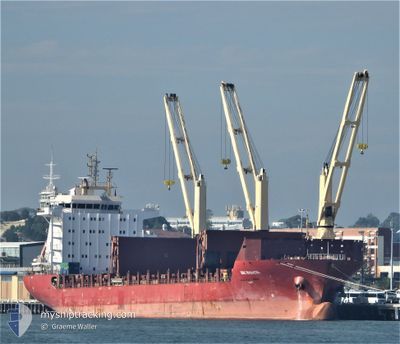
BBC RHONETAL
General Cargo
Current Trip
| Trip Time | 8 days |
|---|---|
| Trip Distance | 2944.29 nm |
| AVG Speed | 13.3 Noeuds |
| MAX Speed | 18.2 Noeuds |
| Tirant d eau | 7.5 m |
| AVG Wind | 14.4 knots |
| MAX Wind | 31.5 knots |
| MIN Temp | 3°C / 37.4°F |
| MAX Temp | 12.8°C / 55.04°F |
| Position reçue | 2 m depuis |
Current Position
| Longitude | 4.60464° |
|---|---|
| Latitude | 51.68791° |
| Etat | Moored |
| Vitesse | |
| Parcours | 283° |
| Zone | North Sea |
| Station | T-AIS |
| Position reçue | 2 m depuis |
Info
Information
The current position of BBC RHONETAL is in North Sea with coordinates 51.68791° / 4.60464° as reported on 2024-04-28 00:29 by AIS to our vessel tracker app. The vessel's current speed is 0 Noeuds and is currently inside the port of MOERDIJK.
The vessel BBC RHONETAL (IMO: 9614701, MMSI: 305030000) is a General Cargo that was built in 2013 ( 11 Age ). It's sailing under the flag of [AG] Antigua Barbuda.
In this page you can find informations about the vessels current position, last detected port calls, and current voyage information. If the vessels is not in coverage by AIS you will find the latest position.
The current position of BBC RHONETAL is detected by our AIS receivers and we are not responsible for the reliability of the data. The last position was recorded while the vessel was in Coverage by the Ais receivers of our vessel tracking app.
The current draught of BBC RHONETAL as reported by AIS is 7.5 meters
Weather
| Temperature | 12.6°C / 54.68°F |
|---|---|
| Wind Speed | 12 knots |
| Direction | 152° SSE |
| Pressure | 1002.4 hPa |
| Humidity | 81.4 % |
| Cloud Coverage | 100 % |
Featured Company
Most Visited Ports (Last year)
| Port | Arrivals | |
|---|---|---|
| 2 | ||
| 2 | ||
| 1 | ||
| 1 | ||
| 1 | ||
| 1 |
Events
| Heure | Evenement | Détails | Position/ Destination | Info |
|---|---|---|---|---|
| 2024-04-27 23:38 | Etat Changé | Moored Default |
51.68793 / 4.60463
[NL] MOERDIJK
|
Vitesse: Parcours: 284° |
| 2024-04-27 23:35 | Etat Changé | Default Moored |
51.68796 / 4.60470
[NL] MOERDIJK
|
Vitesse: Parcours: 283° |
| 2024-04-27 23:17 | Etat Changé | Moored Under way using engine |
51.68795 / 4.60463
[NL] MOERDIJK
|
Vitesse: Parcours: 283° |
| 2024-04-27 22:45 | Arret |
51.68781 / 4.60434
[NL] MOERDIJK
|
Vitesse: 0.3 kn Parcours: 284° |
|
| 2024-04-27 22:15 | Port d'arrivée |
|
51.69787 / 4.59471
[NL] MOERDIJK
|
Vitesse: 5.3 kn Parcours: 249.9° |
| 2024-04-27 12:26 | Changement de zone | Dutch part of the North Sea Belgian part of the North Sea |
51.78347 / 2.70318
North Sea
NLMOE
|
Vitesse: 12.5 kn Parcours: 63.6° |
| 2024-04-27 10:38 | Changement de zone | Belgian part of the North Sea French part of the North Sea |
51.50213 / 2.28425
North Sea
NLMOE
|
Vitesse: 12.2 kn Parcours: 39.8° |
| 2024-04-27 09:56 | Tirant d'eau modifié | 7.5 7.7 |
51.36024 / 2.19256
NLMOE
|
Vitesse: 13.6 kn Parcours: 36.4° |
| 2024-04-27 09:31 | Etat Changé | Under way using engine Default |
51.28535 / 2.10243
NLMOE
|
Vitesse: 13.3 kn Parcours: 26° |
| 2024-04-27 09:28 | Etat Changé | Default Under way using engine |
51.27763 / 2.09641
NLMOE
|
Vitesse: 13.2 kn Parcours: 25.4° |