
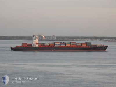
BALTIMORE STAR
Container Ship
Current Trip
GHTMA
| Time Travelled | 11 days |
|---|---|
| Remaining Time | --- |
| Distance Travelled | 3066.53 nm |
| Remaining Distance | --- |
| AVG Speed | 18.6 Noeuds |
| MAX Speed | 20.8 Noeuds |
| AVG Wind | 11.7 knots |
| MAX Wind | 23.9 knots |
| MIN Temp | 13.2°C / 55.76°F |
| MAX Temp | 29.9°C / 85.82°F |
| Tirant d eau | 12.3 m |
| Position reçue | 8 d depuis |
Current Position
| Longitude | -18.01833° |
|---|---|
| Latitude | 21.97786° |
| Etat | Under way using engine |
| Vitesse | 19.2 Noeuds |
| Parcours | 192.1° |
| Zone | North Atlantic Ocean |
| Station | T-AIS |
| Position reçue | 8 d depuis |
Info
Information
The current position of BALTIMORE STAR is in North Atlantic Ocean with coordinates 21.97786° / -18.01833° as reported on 2024-04-25 12:59 by AIS to our vessel tracker app. The vessel's current speed is 19.2 Noeuds
The vessel BALTIMORE STAR (IMO: 9440796, MMSI: 538009287) is a Container Ship that was built in 2009 ( 15 Age ). It's sailing under the flag of [MH] Marshall Is.
In this page you can find informations about the vessels current position, last detected port calls, and current voyage information. If the vessels is not in coverage by AIS you will find the latest position.
The current position of BALTIMORE STAR is detected by our AIS receivers and we are not responsible for the reliability of the data. The last position was recorded while the vessel was in Coverage by the Ais receivers of our vessel tracking app.
The current draught of BALTIMORE STAR as reported by AIS is 12.3 meters
Weather
| Temperature | 28.8°C / 83.84°F |
|---|---|
| Wind Speed | 8 knots |
| Direction | 224° SW |
| Pressure | 1010.7 hPa |
| Humidity | 78.6 % |
| Cloud Coverage | 77 % |
Featured Company
Last Port Calls
| Port | Arrival | Departure | Time In Port |
|---|---|---|---|
| 2024-04-22 11:35 | 2024-04-23 03:12 | 15 h | |
| 2024-04-16 06:17 | 2024-04-16 11:14 | 4 h | |
| 2024-04-10 17:42 | 2024-04-11 21:15 | 1 d | |
| 2024-04-08 02:05 | 2024-04-08 11:04 | 8 h | |
| 2024-03-22 22:35 | 2024-03-24 17:35 | 1 d | |
| 2024-03-15 13:02 | 2024-03-16 02:32 | 13 h | |
| 2024-03-03 19:01 |
Most Visited Ports (Last year)
| Port | Arrivals | |
|---|---|---|
| 12 | ||
| 7 | ||
| 6 | ||
| 5 | ||
| 4 | ||
| 4 |
Last Trips
| Origin | Departure | Destination | Arrival | Distance | |
|---|---|---|---|---|---|
| 2024-04-16 12:14 | 2024-04-22 13:35 | 405.82 nm | |||
| 2024-04-11 23:15 | 2024-04-16 07:17 | 999.67 nm | |||
| 2024-04-08 11:04 | 2024-04-10 19:42 | 943.15 nm | |||
| 2024-03-24 17:35 | 2024-04-08 02:05 | 3069.18 nm | |||
| 2024-03-16 02:32 | 2024-03-22 22:35 | 2761.74 nm | |||
| 2024-02-24 00:54 | 2024-03-03 19:01 | 2773.08 nm |
Events
| Heure | Evenement | Détails | Position/ Destination | Info |
|---|---|---|---|---|
| 2024-04-29 16:50 | Arret | 5.54 nm, South East of TEMA |
5.56255 / .07826
GHTMA
|
Vitesse: 0.3 kn Parcours: 239° |
| 2024-04-25 13:06 | Etat Changé | Default Under way using engine |
21.93776 / -18.01807
GHTMA
|
Vitesse: 19.2 kn Parcours: 192.1° |
| 2024-04-25 12:59 | Hors de la zone couverte |
21.97786 / -18.01833
North Atlantic Ocean
GHTMA
|
Vitesse: 19.2 kn Parcours: 192.1° |
|
| 2024-04-25 12:44 | Etat Changé | Under way using engine Default |
22.05643 / -17.99256
GHTMA
|
Vitesse: 19.8 kn Parcours: 198° |
| 2024-04-25 12:34 | Etat Changé | Default Under way using engine |
22.10764 / -17.97384
GHTMA
|
Vitesse: 19.5 kn Parcours: 196.9° |
| 2024-04-25 12:25 | Etat Changé | Under way using engine Default |
22.15544 / -17.95667
GHTMA
|
Vitesse: 19.4 kn Parcours: 200° |
| 2024-04-25 12:22 | Etat Changé | Default Under way using engine |
22.16948 / -17.95170
GHTMA
|
Vitesse: 19 kn Parcours: 197.5° |
| 2024-04-25 07:18 | Etat Changé | Under way using engine Default |
23.71048 / -17.38146
GHTMA
|
Vitesse: 19 kn Parcours: 206° |
| 2024-04-25 07:14 | Dans la zone couverte |
23.70554 / -17.38350
North Atlantic Ocean
GHTMA
|
Vitesse: 18.8 kn Parcours: 200.9° |
|
| 2024-04-25 05:04 | Hors de la zone couverte |
24.30717 / -16.91531
North Atlantic Ocean
GHTMA
|
Vitesse: 19.4 kn Parcours: 217.5° |