
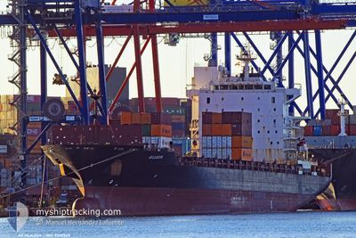
AS CLAUDIA
Container Ship
Current Trip
| Time Travelled | 2 days |
|---|---|
| Remaining Time | 7 days |
| Distance Travelled | 997.24 nm |
| Remaining Distance | 3301.24 nm |
| AVG Speed | 16.7 Noeuds |
| MAX Speed | 17.9 Noeuds |
| AVG Wind | 9.5 knots |
| MAX Wind | 23 knots |
| MIN Temp | 16.4°C / 61.52°F |
| MAX Temp | 21°C / 69.8°F |
| Tirant d eau | 11.8 m |
| Position reçue | 18 h, 4 m depuis |
Current Position
| Longitude | -9.03114° |
|---|---|
| Latitude | 35.92189° |
| Etat | Under way using engine |
| Vitesse | 17.4 Noeuds |
| Parcours | 269° |
| Zone | North Atlantic Ocean |
| Station | T-AIS |
| Position reçue | 18 h, 4 m depuis |
Info
Information
The current position of AS CLAUDIA is in North Atlantic Ocean with coordinates 35.92189° / -9.03114° as reported on 2024-05-14 01:04 by AIS to our vessel tracker app. The vessel's current speed is 17.4 Noeuds and is heading at the port of BOCA CHIKA. The estimated time of arrival as calculated by MyShipTracking vessel tracking app is 2024-05-22 08:29 LT
The vessel AS CLAUDIA (IMO: 9330549, MMSI: 636093159) is a Container Ship that was built in 2007 ( 17 Age ). It's sailing under the flag of [LR] Liberia.
In this page you can find informations about the vessels current position, last detected port calls, and current voyage information. If the vessels is not in coverage by AIS you will find the latest position.
The current position of AS CLAUDIA is detected by our AIS receivers and we are not responsible for the reliability of the data. The last position was recorded while the vessel was in Coverage by the Ais receivers of our vessel tracking app.
The current draught of AS CLAUDIA as reported by AIS is 11.8 meters
Weather
| Temperature | 16.9°C / 62.42°F |
|---|---|
| Wind Speed | 17 knots |
| Direction | 9° N |
| Pressure | 1020.1 hPa |
| Humidity | 69.6 % |
| Cloud Coverage | 6 % |
Featured Company
Last Port Calls
| Port | Arrival | Departure | Time In Port |
|---|---|---|---|
| 2024-05-10 21:59 | 2024-05-12 07:45 | 1 d | |
| 2024-05-08 19:57 | 2024-05-09 12:47 | 16 h | |
| 2024-05-07 05:39 | 2024-05-08 06:16 | 1 d | |
| 2024-05-06 03:16 | 2024-05-06 20:57 | 17 h | |
| 2024-05-03 10:25 | 2024-05-04 11:49 | 1 d | |
| 2024-05-02 02:23 | 2024-05-02 09:31 | 7 h | |
| 2024-04-28 17:22 | 2024-04-29 11:23 | 18 h | |
| 2024-04-17 21:40 | 2024-04-18 11:42 | 14 h | |
| 2024-04-14 21:42 | 2024-04-15 11:08 | 13 h | |
| 2024-04-11 02:09 | 2024-04-11 21:38 | 19 h |
Last Trips
| Origin | Departure | Destination | Arrival | Distance | |
|---|---|---|---|---|---|
| 2024-05-09 14:47 | 2024-05-10 23:59 | 478.73 nm | |||
| 2024-05-08 08:16 | 2024-05-08 21:57 | 144.77 nm | |||
| 2024-05-06 22:57 | 2024-05-07 07:39 | 85.35 nm | |||
| 2024-05-04 13:49 | 2024-05-06 05:16 | 524.35 nm | |||
| 2024-05-02 11:31 | 2024-05-03 12:25 | 367.23 nm | |||
| 2024-04-29 13:23 | 2024-05-02 04:23 | 664.52 nm | |||
| 2024-04-18 06:42 | 2024-04-28 19:22 | 4030.02 nm | |||
| 2024-04-15 06:08 | 2024-04-17 16:40 | 655.85 nm | |||
| 2024-04-11 16:38 | 2024-04-14 16:42 | 856.73 nm | |||
| 2024-04-07 23:50 | 2024-04-10 21:09 | 258.03 nm |
Events
| Heure | Evenement | Détails | Position/ Destination | Info |
|---|---|---|---|---|
| 2024-05-14 01:10 | Etat Changé | Default Under way using engine |
35.92107 / -9.07320
ESBCN > DOCAU
|
Vitesse: 17.4 kn Parcours: 269° |
| 2024-05-14 01:04 | Etat Changé | Under way using engine Default |
35.92189 / -9.03114
ESBCN > DOCAU
|
Vitesse: 17.4 kn Parcours: 268° |
| 2024-05-14 01:04 | Hors de la zone couverte |
35.92189 / -9.03114
North Atlantic Ocean
ESBCN > DOCAU
|
Vitesse: 17.4 kn Parcours: 269° |
|
| 2024-05-14 01:00 | Dans la zone couverte |
35.92189 / -9.03114
North Atlantic Ocean
ESBCN > DOCAU
|
Vitesse: 17.4 kn Parcours: 269° |
|
| 2024-05-13 23:21 | Etat Changé | Default Under way using engine |
35.94167 / -8.42666
ESBCN > DOCAU
|
Vitesse: 17.4 kn Parcours: 268.8° |
| 2024-05-13 23:15 | Etat Changé | Under way using engine Default |
35.94324 / -8.39217
ESBCN > DOCAU
|
Vitesse: 17.4 kn Parcours: 269° |
| 2024-05-13 23:15 | Hors de la zone couverte |
35.94324 / -8.39217
North Atlantic Ocean
ESBCN > DOCAU
|
Vitesse: 17.4 kn Parcours: 268.8° |
|
| 2024-05-13 23:09 | Etat Changé | Default Under way using engine |
35.94333 / -8.35500
ESBCN > DOCAU
|
Vitesse: 17.7 kn Parcours: 269° |
| 2024-05-13 22:50 | Etat Changé | Under way using engine Default |
35.94450 / -8.21498
ESBCN > DOCAU
|
Vitesse: 17 kn Parcours: 268° |
| 2024-05-13 22:42 | Etat Changé | Default Under way using engine |
35.94333 / -8.19333
ESBCN > DOCAU
|
Vitesse: 17.8 kn Parcours: 268.4° |