
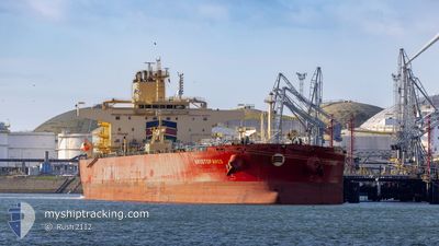
ARISTOFANIS
Tanker
Current Trip
SIDI KERIR
| Time Travelled | 14 days |
|---|---|
| Remaining Time | --- |
| Distance Travelled | 1367.01 nm |
| Remaining Distance | --- |
| AVG Speed | 9.6 Noeuds |
| MAX Speed | 9.6 Noeuds |
| AVG Wind | 11.3 knots |
| MAX Wind | 25 knots |
| MIN Temp | 17.6°C / 63.68°F |
| MAX Temp | 29.3°C / 84.74°F |
| Tirant d eau | 8.5 m |
| Position reçue | 13 m depuis |
Current Position
| Longitude | 32.33769° |
|---|---|
| Latitude | 31.53085° |
| Etat | At anchor |
| Vitesse | 0.1 Noeuds |
| Parcours | 325° |
| Zone | Mediterranean Sea - Eastern Basin |
| Station | T-AIS |
| Position reçue | 13 m depuis |
Info
Information
The current position of ARISTOFANIS is in Mediterranean Sea - Eastern Basin with coordinates 31.53085° / 32.33769° as reported on 2024-04-26 23:47 by AIS to our vessel tracker app. The vessel's current speed is 0.1 Noeuds
The vessel ARISTOFANIS (IMO: 9867621, MMSI: 538008714) is a Tanker It's sailing under the flag of [MH] Marshall Is.
In this page you can find informations about the vessels current position, last detected port calls, and current voyage information. If the vessels is not in coverage by AIS you will find the latest position.
The current position of ARISTOFANIS is detected by our AIS receivers and we are not responsible for the reliability of the data. The last position was recorded while the vessel was in Coverage by the Ais receivers of our vessel tracking app.
The current draught of ARISTOFANIS as reported by AIS is 8.5 meters
Weather
| Temperature | 19.1°C / 66.38°F |
|---|---|
| Wind Speed | 14 knots |
| Direction | 312° NW |
| Pressure | 1010.7 hPa |
| Humidity | 71.1 % |
| Cloud Coverage | 82 % |
Featured Company
Last Port Calls
| Port | Arrival | Departure | Time In Port |
|---|---|---|---|
| 2024-04-21 06:29 | 2024-04-21 15:47 | 9 h | |
| 2024-04-11 03:26 | 2024-04-12 08:01 | 1 d | |
| 2024-03-29 04:10 | 2024-03-29 13:31 | 9 h | |
| 2024-03-13 00:30 | 2024-03-16 12:24 | 3 d | |
| 2024-03-03 00:10 | 2024-03-04 03:13 | 1 d | |
| 2024-02-09 07:26 | 2024-02-10 18:02 | 1 d |
Last Trips
| Origin | Departure | Destination | Arrival | Distance | |
|---|---|---|---|---|---|
| 2024-04-12 11:01 | 2024-04-21 08:29 | 1173.53 nm | |||
| 2024-03-16 13:24 | 2024-04-11 06:26 | 4606.13 nm | |||
| 2024-03-16 13:24 | 2024-03-29 06:10 | 3383.13 nm | |||
| 2024-03-04 04:13 | 2024-03-13 01:30 | 74.53 nm | |||
| 2024-02-10 19:02 | 2024-03-03 01:10 | 3622.29 nm | |||
| 2024-01-07 03:25 | 2024-02-09 08:26 | 2909.37 nm |
Events
| Heure | Evenement | Détails | Position/ Destination | Info |
|---|---|---|---|---|
| 2024-04-26 23:51 | Etat Changé | Default At anchor |
31.53081 / 32.33760
SIDI KERIR
|
Vitesse: 0.1 kn Parcours: 325° |
| 2024-04-26 23:29 | Etat Changé | At anchor Default |
31.53096 / 32.33785
SIDI KERIR
|
Vitesse: Parcours: 323° |
| 2024-04-26 23:20 | Etat Changé | Default At anchor |
31.53088 / 32.33767
SIDI KERIR
|
Vitesse: 0.2 kn Parcours: 327° |
| 2024-04-26 22:50 | Etat Changé | At anchor Default |
31.53090 / 32.33776
SIDI KERIR
|
Vitesse: Parcours: 321° |
| 2024-04-26 22:48 | Etat Changé | Default At anchor |
31.53097 / 32.33779
SIDI KERIR
|
Vitesse: Parcours: 319° |
| 2024-04-26 22:48 | Etat Changé | At anchor Default |
31.53102 / 32.33781
SIDI KERIR
|
Vitesse: 0.1 kn Parcours: 316° |
| 2024-04-26 22:03 | Etat Changé | Default At anchor |
31.53082 / 32.33755
SIDI KERIR
|
Vitesse: 0.1 kn Parcours: 315° |
| 2024-04-26 21:59 | Etat Changé | At anchor Default |
31.53101 / 32.33788
SIDI KERIR
|
Vitesse: Parcours: 314° |
| 2024-04-26 21:56 | Etat Changé | Default At anchor |
31.53108 / 32.33792
SIDI KERIR
|
Vitesse: 0.1 kn Parcours: 318° |
| 2024-04-26 21:48 | Etat Changé | At anchor Default |
31.53099 / 32.33784
SIDI KERIR
|
Vitesse: 0.1 kn Parcours: 334° |