
ARC COMMITMENT
Vehicles Carrier
Current Trip
| Time Travelled | 2 days |
|---|---|
| Remaining Time | --- |
| Distance Travelled | 983.96 nm |
| Remaining Distance | --- |
| AVG Speed | 11.8 Noeuds |
| MAX Speed | 20 Noeuds |
| AVG Wind | 9.3 knots |
| MAX Wind | 16.3 knots |
| MIN Temp | 3°C / 37.4°F |
| MAX Temp | 21°C / 69.8°F |
| Tirant d eau | 9.2 m |
| Position reçue | 16 m depuis |
Current Position
| Longitude | --- |
|---|---|
| Latitude | --- |
| Etat | Under way using engine |
| Vitesse | 16.3 Noeuds |
| Parcours | 56.5° |
| Zone | North Atlantic Ocean |
| Station | T-AIS |
| Position reçue | 16 m depuis |
Info
Information
The current position of ARC COMMITMENT is in North Atlantic Ocean with coordinates 24.66461° / -79.75908° as reported on 2026-01-02 08:54 by AIS to our vessel tracker app. The vessel's current speed is 16.3 Noeuds and is heading at the port of BALTIMORE. The estimated time of arrival as calculated by MyShipTracking vessel tracking app is 2026-01-04 09:00 LT
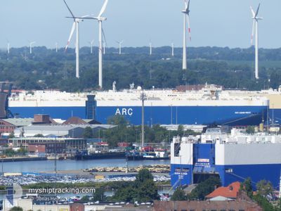
The vessel ARC COMMITMENT (IMO: 9505039, MMSI: 368444000) is a Vehicles Carrier that was built in 2011 ( 15 Age ). It's sailing under the flag of [US] USA.
In this page you can find informations about the vessels current position, last detected port calls, and current voyage information. If the vessels is not in coverage by AIS you will find the latest position.
The current position of ARC COMMITMENT is detected by our AIS receivers and we are not responsible for the reliability of the data. The last position was recorded while the vessel was in Coverage by the Ais receivers of our vessel tracking app.
The current draught of ARC COMMITMENT as reported by AIS is 9.2 meters
Weather
| Temperature | 19.2°C / 66.56°F |
|---|---|
| Wind Speed | 6 knots |
| Direction | 335° NNW |
| Pressure | 1017.2 hPa |
| Humidity | 50.4 % |
| Cloud Coverage | 11 % |
Featured Company
Most Visited Ports (Last year)
| Port | Arrivals | |
|---|---|---|
| 5 | ||
| 5 | ||
| 4 | ||
| 3 | ||
| 2 | ||
| 2 |
Events
| Heure | Evenement | Détails | Position/ Destination | Info |
|---|---|---|---|---|
| 2026-01-02 08:57 | Etat Changé | Default Under way using engine |
24.67167 / -79.74667
US BAL
|
Vitesse: 16.3 kn Parcours: 56.5° |
| 2026-01-02 08:54 | Etat Changé | Under way using engine Default |
24.66461 / -79.75908
US BAL
|
Vitesse: 16.5 kn Parcours: 56° |
| 2026-01-02 08:44 | Etat Changé | Default Under way using engine |
24.63888 / -79.80151
US BAL
|
Vitesse: 16.5 kn Parcours: 56.2° |
| 2026-01-02 08:36 | Changement de zone | Bahamas part of the North Atlantic Ocean United States part of the Gulf of Mexico |
24.61891 / -79.83423
North Atlantic Ocean
US BAL
|
Vitesse: 16.5 kn Parcours: 56.4° |
| 2026-01-02 08:36 | Etat Changé | Under way using engine Default |
24.61891 / -79.83423
US BAL
|
Vitesse: 16 kn Parcours: 55° |
| 2026-01-02 08:36 | Dans la zone couverte |
24.61891 / -79.83423
North Atlantic Ocean
US BAL
|
Vitesse: 16.5 kn Parcours: 56.4° |
|
| 2025-12-30 20:44 | Etat Changé | Default Under way using engine |
29.25979 / -93.66940
US BAL
|
Vitesse: 15.2 kn Parcours: 176° |
| 2025-12-30 20:38 | Hors de la zone couverte |
29.28459 / -93.67141
Gulf of Mexico
US BAL
|
Vitesse: 15.2 kn Parcours: 176° |
|
| 2025-12-30 13:39 | PORT DE DEPART |
|
30.05844 / -94.03176
US BAL
|
Vitesse: 7.1 kn Parcours: 138° |
| 2025-12-30 13:03 | Démarrage |
30.07708 / -94.08349
[US] BEAUMONT
|
Vitesse: 3.1 kn Parcours: 89° |