
AQUAGRACE
Cargo
Current Trip
| Time Travelled | 7 days |
|---|---|
| Remaining Time | --- |
| Distance Travelled | 2422.83 nm |
| Remaining Distance | --- |
| AVG Speed | 13.4 Noeuds |
| MAX Speed | 15.2 Noeuds |
| AVG Wind | 13.1 knots |
| MAX Wind | 30 knots |
| MIN Temp | 12°C / 53.6°F |
| MAX Temp | 25.8°C / 78.44°F |
| Tirant d eau | 8.5 m |
| Position reçue | 7 d depuis |
Current Position
| Longitude | -9.28754° |
|---|---|
| Latitude | 43.84995° |
| Etat | Under way using engine |
| Vitesse | 11.6 Noeuds |
| Parcours | 260.4° |
| Zone | North Atlantic Ocean |
| Station | T-AIS |
| Position reçue | 7 d depuis |
Info
Information
The current position of AQUAGRACE is in North Atlantic Ocean with coordinates 43.84995° / -9.28754° as reported on 2024-05-02 19:22 by AIS to our vessel tracker app. The vessel's current speed is 11.6 Noeuds and is heading at the port of ITAQUI. The estimated time of arrival as calculated by MyShipTracking vessel tracking app is 2024-05-14 17:00 LT
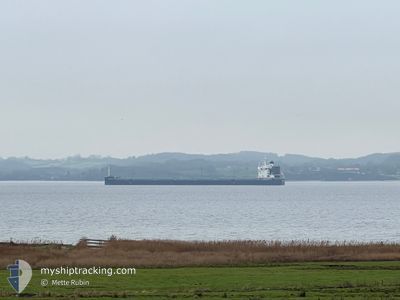
The vessel AQUAGRACE (IMO: 9764087, MMSI: 371355000) is a Cargo It's sailing under the flag of [PA] Panama.
In this page you can find informations about the vessels current position, last detected port calls, and current voyage information. If the vessels is not in coverage by AIS you will find the latest position.
The current position of AQUAGRACE is detected by our AIS receivers and we are not responsible for the reliability of the data. The last position was recorded while the vessel was in Coverage by the Ais receivers of our vessel tracking app.
The current draught of AQUAGRACE as reported by AIS is 8.5 meters
Weather
| Temperature | 24.4°C / 75.92°F |
|---|---|
| Wind Speed | 15 knots |
| Direction | 60° ENE |
| Pressure | 1013.9 hPa |
| Humidity | 79.6 % |
| Cloud Coverage | 55 % |
Featured Company
Last Port Calls
| Port | Arrival | Departure | Time In Port |
|---|---|---|---|
| 2024-04-25 21:23 | 2024-05-02 11:36 | 6 d | |
| 2024-04-10 17:51 | 2024-04-11 20:58 | 1 d |
Most Visited Ports (Last year)
| Port | Arrivals | |
|---|---|---|
| 2 | ||
| 1 | ||
| 1 | ||
| 1 | ||
| 1 | ||
| 1 |
Last Trips
| Origin | Departure | Destination | Arrival | Distance | |
|---|---|---|---|---|---|
| 2024-04-11 20:58 | 2024-04-25 23:23 | 2573.05 nm |
Events
| Heure | Evenement | Détails | Position/ Destination | Info |
|---|---|---|---|---|
| 2024-05-02 19:23 | Etat Changé | Default Under way using engine |
43.84932 / -9.29263
ITAQUI BRAZIL
|
Vitesse: 11.6 kn Parcours: 260.4° |
| 2024-05-02 19:22 | Hors de la zone couverte |
43.84995 / -9.28754
North Atlantic Ocean
ITAQUI BRAZIL
|
Vitesse: 11.6 kn Parcours: 260.4° |
|
| 2024-05-02 17:07 | Etat Changé | Under way using engine Default |
43.90135 / -8.68814
ITAQUI BRAZIL
|
Vitesse: 11.7 kn Parcours: 265° |
| 2024-05-02 16:29 | Etat Changé | Default Under way using engine |
43.91163 / -8.51351
ITAQUI BRAZIL
|
Vitesse: 11.3 kn Parcours: 261.6° |
| 2024-05-02 15:23 | Etat Changé | Under way using engine Default |
43.94159 / -8.23087
ITAQUI BRAZIL
|
Vitesse: 11.2 kn Parcours: 258° |
| 2024-05-02 15:10 | Etat Changé | Default Under way using engine |
43.94982 / -8.17217
ITAQUI BRAZIL
|
Vitesse: 11.2 kn Parcours: 260.9° |
| 2024-05-02 15:05 | Etat Changé | Under way using engine Default |
43.95251 / -8.15170
ITAQUI BRAZIL
|
Vitesse: 11 kn Parcours: 260° |
| 2024-05-02 14:22 | Etat Changé | Default Under way using engine |
43.96161 / -7.97354
ITAQUI BRAZIL
|
Vitesse: 11.1 kn Parcours: 267.7° |
| 2024-05-02 13:16 | Changement de zone | Spanish part of the North Atlantic Ocean Spanish part of the Bay of Biscay |
43.94587 / -7.70366
North Atlantic Ocean
ITAQUI BRAZIL
|
Vitesse: 11.4 kn Parcours: 304.6° |
| 2024-05-02 12:28 | Tirant d'eau modifié | 8.5 12.5 |
43.84683 / -7.55165
ITAQUI BRAZIL
|
Vitesse: 11.2 kn Parcours: 316.2° |