
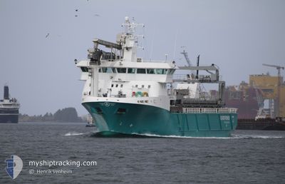
AQUA FJELL
General Cargo
Current Trip
| Time Travelled | 1 day |
|---|---|
| Remaining Time | --- |
| Distance Travelled | 137.52 nm |
| Remaining Distance | --- |
| AVG Speed | 11.7 Noeuds |
| MAX Speed | 12.4 Noeuds |
| AVG Wind | 10 knots |
| MAX Wind | 14.7 knots |
| MIN Temp | 17.4°C / 63.32°F |
| MAX Temp | 21.3°C / 70.34°F |
| Tirant d eau | 6.2 m |
| Position reçue | 5 m depuis |
Current Position
| Longitude | 13.49961° |
|---|---|
| Latitude | 66.74496° |
| Etat | Moored |
| Vitesse | |
| Parcours | --- |
| Zone | Norwegian Sea |
| Station | T-AIS |
| Position reçue | 5 m depuis |
Info
Information
The current position of AQUA FJELL is in Norwegian Sea with coordinates 66.74496° / 13.49961° as reported on 2024-07-27 09:41 by AIS to our vessel tracker app. The vessel's current speed is 0 Noeuds and is heading at the port of HALSA. The estimated time of arrival as calculated by MyShipTracking vessel tracking app is 2024-07-26 23:00 LT
The vessel AQUA FJELL (IMO: 9688960, MMSI: 257659800) is a General Cargo that was built in 2014 ( 10 Age ). It's sailing under the flag of [NO] Norway.
In this page you can find informations about the vessels current position, last detected port calls, and current voyage information. If the vessels is not in coverage by AIS you will find the latest position.
The current position of AQUA FJELL is detected by our AIS receivers and we are not responsible for the reliability of the data. The last position was recorded while the vessel was in Coverage by the Ais receivers of our vessel tracking app.
The current draught of AQUA FJELL as reported by AIS is 6.2 meters
Weather
| Temperature | 12.8°C / 55.04°F |
|---|---|
| Wind Speed | 3 knots |
| Direction | 258° WSW |
| Pressure | 1009 hPa |
| Humidity | 97.7 % |
| Cloud Coverage | 100 % |
Featured Company
Last Port Calls
| Port | Arrival | Departure | Time In Port |
|---|---|---|---|
| 2024-07-26 09:00 | 2024-07-26 09:20 | 20 m | |
| 2024-07-25 04:27 | 2024-07-25 05:21 | 54 m | |
| 2024-07-18 07:09 | 2024-07-18 07:49 | 40 m | |
| 2024-07-16 08:21 | 2024-07-16 20:19 | 11 h | |
| 2024-07-12 00:38 | 2024-07-12 00:46 | 7 m | |
| 2024-07-10 20:37 | 2024-07-10 21:26 | 49 m | |
| 2024-07-08 01:00 | 2024-07-08 01:08 | 8 m | |
| 2024-07-02 14:45 | 2024-07-02 14:53 | 8 m | |
| 2024-07-01 07:38 | 2024-07-01 08:20 | 41 m | |
| 2024-06-28 15:44 | 2024-06-28 15:50 | 6 m |
Most Visited Ports (Last year)
| Port | Arrivals | |
|---|---|---|
| 15 | ||
| 8 | ||
| 7 | ||
| 6 | ||
| 6 | ||
| 5 |
Last Trips
| Origin | Departure | Destination | Arrival | Distance | |
|---|---|---|---|---|---|
| 2024-07-25 07:21 | 2024-07-26 11:00 | 194.74 nm | |||
| 2024-07-18 09:49 | 2024-07-25 06:27 | 1016.37 nm | |||
| 2024-07-16 22:19 | 2024-07-18 09:09 | 171.39 nm | |||
| 2024-07-12 02:46 | 2024-07-16 10:21 | 724.27 nm | |||
| 2024-07-10 23:26 | 2024-07-12 02:38 | 159.62 nm | |||
| 2024-07-08 03:08 | 2024-07-10 22:37 | 462.28 nm | |||
| 2024-07-02 16:53 | 2024-07-08 03:00 | 819.06 nm | |||
| 2024-07-01 10:20 | 2024-07-02 16:45 | 274.10 nm | |||
| 2024-06-28 17:50 | 2024-07-01 09:38 | 344.51 nm | |||
| 2024-06-22 11:51 | 2024-06-28 17:44 | 1058.61 nm |
Events
| Heure | Evenement | Détails | Position/ Destination | Info |
|---|---|---|---|---|
| 2024-07-27 06:26 | Etat Changé | Moored Under way using engine |
66.74503 / 13.49960
HALSA
|
Vitesse: Parcours: 0° |
| 2024-07-26 21:09 | Arret | 8.77 nm, South West of ORNES |
66.74503 / 13.49958
HALSA
|
Vitesse: Parcours: 0° |
| 2024-07-26 09:20 | Démarrage | 0.37 nm, East of ROERVIK |
64.85923 / 11.24892
HALSA
|
Vitesse: 9.3 kn Parcours: 93° |
| 2024-07-26 09:20 | PORT DE DEPART |
|
64.85923 / 11.24892
HALSA
|
Vitesse: 2.6 kn Parcours: 100° |
| 2024-07-26 09:00 | Arret |
64.85981 / 11.23826
[NO] ROERVIK
|
Vitesse: 0.3 kn Parcours: 39° |
|
| 2024-07-26 09:00 | Port d'arrivée |
|
64.85980 / 11.23824
[NO] ROERVIK
|
Vitesse: 2.1 kn Parcours: 44° |
| 2024-07-26 07:50 | Changement de destination | HALSA FLOROE/FISHFARMS |
64.70725 / 10.88963
HALSA
|
Vitesse: 11.7 kn Parcours: 47.8° |
| 2024-07-26 07:50 | Changement d'ETA | 2024/07/26 23:00 2024/07/23 04:00 |
64.70725 / 10.88963
HALSA
|
Vitesse: 11.7 kn Parcours: 47.8° |
| 2024-07-26 00:46 | Démarrage | 4.11 nm, North of NORDSKAGET |
63.77744 / 8.52866
FLOROE/FISHFARMS
|
Vitesse: 5.9 kn Parcours: 85.4° |
| 2024-07-25 23:08 | Arret | 4.26 nm, North of NORDSKAGET |
63.77946 / 8.52327
FLOROE/FISHFARMS
|
Vitesse: Parcours: 156° |