
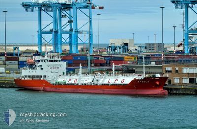
ANGELA
Lpg Tanker
Current Trip
Current Position
| Longitude | -8.27130° |
|---|---|
| Latitude | 51.84173° |
| Etat | At anchor |
| Vitesse | |
| Parcours | 95° |
| Zone | Celtic Sea |
| Station | T-AIS |
| Position reçue | 3 m depuis |
Info
Information
The current position of ANGELA is in Celtic Sea with coordinates 51.84173° / -8.27130° as reported on 2024-05-14 17:22 by AIS to our vessel tracker app. The vessel's current speed is 0 Noeuds and is currently inside the port of CORK.
The vessel ANGELA (IMO: 9474541, MMSI: 205772000) is a Lpg Tanker that was built in 2009 ( 15 Age ). It's sailing under the flag of [BE] Belgium.
In this page you can find informations about the vessels current position, last detected port calls, and current voyage information. If the vessels is not in coverage by AIS you will find the latest position.
The current position of ANGELA is detected by our AIS receivers and we are not responsible for the reliability of the data. The last position was recorded while the vessel was in Coverage by the Ais receivers of our vessel tracking app.
The current draught of ANGELA as reported by AIS is 5.4 meters
Weather
| Temperature | 12.9°C / 55.22°F |
|---|---|
| Wind Speed | 16 knots |
| Direction | 54° NE |
| Pressure | 993.2 hPa |
| Humidity | 88.5 % |
| Cloud Coverage | 57 % |
Featured Company
Last Port Calls
| Port | Arrival | Departure | Time In Port |
|---|---|---|---|
| 2024-05-13 09:47 | |||
| 2024-05-10 07:27 | 2024-05-11 02:19 | 18 h | |
| 2024-05-08 06:16 | 2024-05-09 18:51 | 1 d | |
| 2024-05-06 06:49 | 2024-05-07 11:28 | 1 d | |
| 2024-05-02 00:54 | 2024-05-02 23:57 | 23 h | |
| 2024-04-27 18:18 | 2024-04-29 15:56 | 1 d | |
| 2024-04-20 11:22 | 2024-04-21 20:10 | 1 d | |
| 2024-04-15 11:17 | 2024-04-16 17:28 | 1 d | |
| 2024-04-11 11:18 | 2024-04-12 13:21 | 1 d | |
| 2024-04-07 13:13 | 2024-04-08 12:55 | 23 h |
Most Visited Ports (Last year)
| Port | Arrivals | |
|---|---|---|
| 33 | ||
| 33 | ||
| 13 | ||
| 11 | ||
| 6 | ||
| 3 |
Last Trips
| Origin | Departure | Destination | Arrival | Distance | |
|---|---|---|---|---|---|
| 2024-05-11 03:19 | 2024-05-13 10:47 | 736.63 nm | |||
| 2024-05-09 19:51 | 2024-05-10 08:27 | 115.28 nm | |||
| 2024-05-07 13:28 | 2024-05-08 07:16 | 191.94 nm | |||
| 2024-05-03 00:57 | 2024-05-06 08:49 | 598.29 nm | |||
| 2024-04-29 16:56 | 2024-05-02 01:54 | 736.74 nm | |||
| 2024-04-21 21:10 | 2024-04-27 19:18 | 1491.50 nm | |||
| 2024-04-16 18:28 | 2024-04-20 12:22 | 134.84 nm | |||
| 2024-04-12 14:21 | 2024-04-15 12:17 | 798.20 nm | |||
| 2024-04-08 13:55 | 2024-04-11 12:18 | 120.64 nm | |||
| 2024-04-06 15:28 | 2024-04-07 14:13 | 196.53 nm |
Events
| Heure | Evenement | Détails | Position/ Destination | Info |
|---|---|---|---|---|
| 2024-05-13 10:19 | Etat Changé | At anchor Under way using engine |
51.84217 / -8.27026
[IE] CORK
|
Vitesse: 0.2 kn Parcours: 98° |
| 2024-05-13 10:12 | Arret |
51.84179 / -8.26978
[IE] CORK
|
Vitesse: 0.3 kn Parcours: 116° |
|
| 2024-05-13 09:47 | Port d'arrivée |
|
51.81360 / -8.27118
[IE] CORK
|
Vitesse: 8.3 kn Parcours: 330.2° |
| 2024-05-13 05:49 | Detecté en mer | Irish part of the Celtic Sea |
51.23974 / -7.30422
Celtic Sea
IEORK
|
Vitesse: 13.6 kn Parcours: 310.9° |
| 2024-05-13 05:49 | Dans la zone couverte |
51.23974 / -7.30422
Celtic Sea
IEORK
|
Vitesse: 13.6 kn Parcours: 310.9° |
|
| 2024-05-13 00:39 | Etat Changé | Default Under way using engine |
50.46648 / -5.93120
IEORK
|
Vitesse: 12.7 kn Parcours: 334.5° |
| 2024-05-13 00:31 | Hors de la zone couverte |
50.44675 / -5.89819
Celtic Sea
IEORK
|
Vitesse: 12.7 kn Parcours: 334.5° |
|
| 2024-05-12 22:45 | Etat Changé | Under way using engine Default |
50.07684 / -5.90649
IEORK
|
Vitesse: 12.5 kn Parcours: 0° |
| 2024-05-12 22:42 | Etat Changé | Default Under way using engine |
50.06638 / -5.90656
IEORK
|
Vitesse: 12.6 kn Parcours: 357.5° |
| 2024-05-12 22:08 | Etat Changé | Under way using engine Default |
49.94860 / -5.87903
IEORK
|
Vitesse: 12.5 kn Parcours: 341° |