
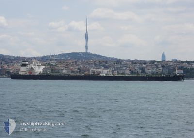
AMAZON
Crude Oil Tanker
Current Trip
IQBSR
| Time Travelled | 41 days |
|---|---|
| Remaining Time | --- |
| Distance Travelled | 7624.24 nm |
| Remaining Distance | --- |
| AVG Speed | 10.8 Noeuds |
| MAX Speed | 15.1 Noeuds |
| AVG Wind | 12.4 knots |
| MAX Wind | 37.3 knots |
| MIN Temp | 10.1°C / 50.18°F |
| MAX Temp | 26.5°C / 79.7°F |
| Tirant d eau | 9.5 m |
| Position reçue | 1 d depuis |
Current Position
| Longitude | --- |
|---|---|
| Latitude | --- |
| Etat | Under way using engine |
| Vitesse | 11.5 Noeuds |
| Parcours | 302.6° |
| Zone | Persian Gulf |
| Station | T-AIS |
| Position reçue | 1 d depuis |
Info
Information
The current position of AMAZON is in Persian Gulf with coordinates 29.63672° / 48.88031° as reported on 2026-01-03 10:23 by AIS to our vessel tracker app. The vessel's current speed is 11.5 Noeuds
The vessel AMAZON (IMO: 9476654, MMSI: 636014503) is a Crude Oil Tanker that was built in 2011 ( 15 Age ). It's sailing under the flag of [LR] Liberia.
In this page you can find informations about the vessels current position, last detected port calls, and current voyage information. If the vessels is not in coverage by AIS you will find the latest position.
The current position of AMAZON is detected by our AIS receivers and we are not responsible for the reliability of the data. The last position was recorded while the vessel was in Coverage by the Ais receivers of our vessel tracking app.
The current draught of AMAZON as reported by AIS is 9.5 meters
Weather
| Temperature | 15.4°C / 59.72°F |
|---|---|
| Wind Speed | 19 knots |
| Direction | 323° NW |
| Pressure | 1025.5 hPa |
| Humidity | 36.6 % |
| Cloud Coverage | --- |
Featured Company
Last Port Calls
| Port | Arrival | Departure | Time In Port |
|---|---|---|---|
| 2025-12-13 13:40 | 2025-12-13 23:09 | 9 h | |
| 2025-11-24 07:42 | |||
| 2025-11-01 15:50 | 2025-11-03 10:39 | 1 d |
Most Visited Ports (Last year)
| Port | Arrivals | |
|---|---|---|
| 3 | ||
| 2 | ||
| 1 | ||
| 1 | ||
| 1 | ||
| 1 |
Last Trips
| Origin | Departure | Destination | Arrival | Distance | |
|---|---|---|---|---|---|
| 2025-11-24 07:42 | 2025-12-13 13:40 | 4784.39 nm | |||
| 2025-09-21 13:54 | 2025-11-01 15:50 | 5093.47 nm |
Events
| Heure | Evenement | Détails | Position/ Destination | Info |
|---|---|---|---|---|
| 2026-01-03 11:51 | Arret |
29.70329 / 48.80203
IQBSR
|
Vitesse: 0.1 kn Parcours: 293° |
|
| 2026-01-03 10:24 | Etat Changé | Default Under way using engine |
29.63731 / 48.87928
IQBSR
|
Vitesse: 11.5 kn Parcours: 302.6° |
| 2026-01-03 10:23 | Hors de la zone couverte |
29.63672 / 48.88031
Persian Gulf
|
Vitesse: 11.5 kn Parcours: 302.6° |
|
| 2026-01-03 10:16 | Etat Changé | Under way using engine Default |
29.62624 / 48.90046
IQBSR
|
Vitesse: 4.2 kn Parcours: 305° |
| 2026-01-03 10:16 | Démarrage |
29.62624 / 48.90046
IQBSR
|
Vitesse: 6.7 kn Parcours: 305.3° |
|
| 2026-01-03 10:05 | Dans la zone couverte |
29.62662 / 48.89981
Persian Gulf
|
Vitesse: 7.1 kn Parcours: 303.3° |
|
| 2026-01-03 09:11 | Etat Changé | Default At anchor |
29.61817 / 48.91147
IQBSR
|
Vitesse: 0.1 kn Parcours: 338° |
| 2026-01-03 09:08 | Etat Changé | At anchor Default |
29.61816 / 48.91146
IQBSR
|
Vitesse: 0.1 kn Parcours: 341° |
| 2026-01-03 09:08 | Hors de la zone couverte |
29.61816 / 48.91146
Persian Gulf
|
Vitesse: 0.1 kn Parcours: 183.2° |
|
| 2026-01-03 08:53 | Etat Changé | Default At anchor |
29.61810 / 48.91120
IQBSR
|
Vitesse: 0.1 kn Parcours: 347° |