
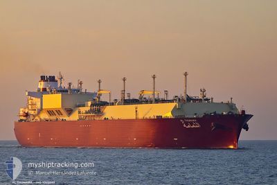
AL THUMAMA
Lng Tanker
Current Trip
| Time Travelled | 33 days |
|---|---|
| Remaining Time | --- |
| Distance Travelled | 12553.61 nm |
| Remaining Distance | 66.36 nm |
| AVG Speed | 15.5 Noeuds |
| MAX Speed | 20 Noeuds |
| AVG Wind | 12.7 knots |
| MAX Wind | 38.5 knots |
| MIN Temp | 4.7°C / 40.46°F |
| MAX Temp | 29.5°C / 85.1°F |
| Tirant d eau | 12.4 m |
| Position reçue | 5 h, 57 m depuis |
Current Position
| Longitude | --- |
|---|---|
| Latitude | --- |
| Etat | Constrained by her draught |
| Vitesse | 8.6 Noeuds |
| Parcours | 45.3° |
| Zone | Baltic Sea |
| Station | T-AIS |
| Position reçue | 5 h, 57 m depuis |
Info
Information
The current position of AL THUMAMA is in Baltic Sea with coordinates 54.62536° / 12.35530° as reported on 2025-12-05 14:47 by AIS to our vessel tracker app. The vessel's current speed is 8.6 Noeuds and is heading at the port of SWINOUJSCIE. The estimated time of arrival as calculated by MyShipTracking vessel tracking app is 2025-12-06 06:05 LT
The vessel AL THUMAMA (IMO: 9360843, MMSI: 538003018) is a Lng Tanker that was built in 2008 ( 17 Age ). It's sailing under the flag of [MH] Marshall Is.
In this page you can find informations about the vessels current position, last detected port calls, and current voyage information. If the vessels is not in coverage by AIS you will find the latest position.
The current position of AL THUMAMA is detected by our AIS receivers and we are not responsible for the reliability of the data. The last position was recorded while the vessel was in Coverage by the Ais receivers of our vessel tracking app.
The current draught of AL THUMAMA as reported by AIS is 12.4 meters
Weather
| Temperature | 6°C / 42.8°F |
|---|---|
| Wind Speed | 9 knots |
| Direction | 223° SW |
| Pressure | 1011.5 hPa |
| Humidity | 92.2 % |
| Cloud Coverage | 100 % |
Featured Company
Last Port Calls
| Port | Arrival | Departure | Time In Port |
|---|---|---|---|
| 2025-11-01 07:00 | 2025-11-02 10:40 | 1 d | |
| 2025-10-10 08:01 | 2025-10-11 19:34 | 1 d |
Most Visited Ports (Last year)
| Port | Arrivals | |
|---|---|---|
| 8 | ||
| 1 | ||
| 1 |
Last Trips
| Origin | Departure | Destination | Arrival | Distance | |
|---|---|---|---|---|---|
| 2025-10-11 19:34 | 2025-11-01 07:00 | 6664.71 nm | |||
| 2025-09-18 17:15 | 2025-10-10 08:01 | 6995.68 nm |
Events
| Heure | Evenement | Détails | Position/ Destination | Info |
|---|---|---|---|---|
| 2025-12-05 20:17 | Arret | 11.66 nm, North of KLOSTER |
54.77037 / 13.20639
QA RLF>PLSWI
|
Vitesse: 0.3 kn Parcours: 118° |
| 2025-12-05 14:53 | Etat Changé | Default Constrained by her draught |
54.63527 / 12.37284
QA RLF>PLSWI
|
Vitesse: 8.6 kn Parcours: 45.3° |
| 2025-12-05 14:47 | Hors de la zone couverte |
54.62536 / 12.35530
Baltic Sea
QA RLF>PLSWI
|
Vitesse: 8.6 kn Parcours: 45.3° |
|
| 2025-12-05 14:31 | Etat Changé | Constrained by her draught Default |
54.60095 / 12.31045
QA RLF>PLSWI
|
Vitesse: 8.7 kn Parcours: 18° |
| 2025-12-05 14:25 | Etat Changé | Default Constrained by her draught |
54.58635 / 12.30091
QA RLF>PLSWI
|
Vitesse: 8.7 kn Parcours: 18.4° |
| 2025-12-05 14:12 | Changement de zone | Danish part of the Baltic Sea German part of the Baltic Sea |
54.55669 / 12.28405
Baltic Sea
QA RLF>PLSWI
|
Vitesse: 8.8 kn Parcours: 18.2° |
| 2025-12-05 13:59 | Etat Changé | Constrained by her draught Default |
54.52463 / 12.26536
QA RLF>PLSWI
|
Vitesse: 10.3 kn Parcours: 20° |
| 2025-12-05 13:57 | Etat Changé | Default Constrained by her draught |
54.51950 / 12.26214
QA RLF>PLSWI
|
Vitesse: 11.8 kn Parcours: 26.1° |
| 2025-12-05 13:17 | Changement de zone | German part of the Baltic Sea Danish part of the Baltic Sea |
54.41270 / 12.13081
Baltic Sea
QA RLF>PLSWI
|
Vitesse: 13 kn Parcours: 84.8° |
| 2025-12-05 11:28 | Changement de zone | Danish part of the Baltic Sea German part of the Baltic Sea |
54.50621 / 11.43617
Baltic Sea
QA RLF>PLSWI
|
Vitesse: 14 kn Parcours: 119° |