
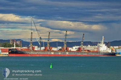
AFRICAN NIGHTHAWK
Cargo
Current Trip
| Time Travelled | 31 days |
|---|---|
| Remaining Time | 2 days |
| Distance Travelled | 6589.82 nm |
| Remaining Distance | 643.13 nm |
| AVG Speed | 10.9 Noeuds |
| MAX Speed | 14.7 Noeuds |
| AVG Wind | 11.3 knots |
| MAX Wind | 32 knots |
| MIN Temp | --- |
| MAX Temp | 27.8°C / 82.04°F |
| Tirant d eau | 10.2 m |
| Position reçue | 5 d depuis |
Current Position
| Longitude | --- |
|---|---|
| Latitude | --- |
| Etat | Under way using engine |
| Vitesse | 11.3 Noeuds |
| Parcours | 179.3° |
| Zone | North Atlantic Ocean |
| Station | T-AIS |
| Position reçue | 5 d depuis |
Info
Information
The current position of AFRICAN NIGHTHAWK is in North Atlantic Ocean with coordinates 12.86114° / -17.54874° as reported on 2025-12-01 11:31 by AIS to our vessel tracker app. The vessel's current speed is 11.3 Noeuds and is heading at the port of POINTE NOIRE. The estimated time of arrival as calculated by MyShipTracking vessel tracking app is 2025-12-09 16:33 LT
The vessel AFRICAN NIGHTHAWK (IMO: 9646895, MMSI: 311001204) is a Cargo It's sailing under the flag of [BS] Bahamas.
In this page you can find informations about the vessels current position, last detected port calls, and current voyage information. If the vessels is not in coverage by AIS you will find the latest position.
The current position of AFRICAN NIGHTHAWK is detected by our AIS receivers and we are not responsible for the reliability of the data. The last position was recorded while the vessel was in Coverage by the Ais receivers of our vessel tracking app.
The current draught of AFRICAN NIGHTHAWK as reported by AIS is 10.2 meters
Weather
| Temperature | 25.5°C / 77.9°F |
|---|---|
| Wind Speed | 9 knots |
| Direction | 195° SSW |
| Pressure | 1011.4 hPa |
| Humidity | 87.4 % |
| Cloud Coverage | 93 % |
Featured Company
Events
| Heure | Evenement | Détails | Position/ Destination | Info |
|---|---|---|---|---|
| 2025-12-01 11:35 | Etat Changé | Default Under way using engine |
12.84895 / -17.54860
CG PNR
|
Vitesse: 11.3 kn Parcours: 179.3° |
| 2025-12-01 11:31 | Hors de la zone couverte |
12.86114 / -17.54874
North Atlantic Ocean
CG PNR
|
Vitesse: 11.3 kn Parcours: 179.3° |
|
| 2025-12-01 11:31 | Etat Changé | Under way using engine Default |
12.86114 / -17.54874
CG PNR
|
Vitesse: 11.3 kn Parcours: 174° |
| 2025-12-01 11:14 | Dans la zone couverte |
12.86114 / -17.54874
North Atlantic Ocean
CG PNR
|
Vitesse: 11.3 kn Parcours: 179.3° |
|
| 2025-12-01 10:35 | Etat Changé | Default Under way using engine |
13.03667 / -17.57167
CG PNR
|
Vitesse: 11.2 kn Parcours: 171.8° |
| 2025-12-01 10:30 | Detecté en mer | Senegalese part of the North Atlantic Ocean |
13.05243 / -17.57461
North Atlantic Ocean
CG PNR
|
Vitesse: 11.2 kn Parcours: 171.8° |
| 2025-12-01 10:30 | Hors de la zone couverte |
13.05243 / -17.57461
North Atlantic Ocean
CG PNR
|
Vitesse: 11.2 kn Parcours: 171.8° |
|
| 2025-12-01 07:42 | Detecté en mer | Gambian part of the North Atlantic Ocean |
13.58790 / -17.65154
North Atlantic Ocean
CG PNR
|
Vitesse: 11.5 kn Parcours: 171.8° |
| 2025-11-30 20:41 | Etat Changé | Under way using engine Default |
15.70957 / -17.72023
CG PNR
|
Vitesse: 11.4 kn Parcours: 179° |
| 2025-11-30 20:31 | Etat Changé | Default Under way using engine |
15.74276 / -17.72055
CG PNR
|
Vitesse: 11.4 kn Parcours: 178.5° |