
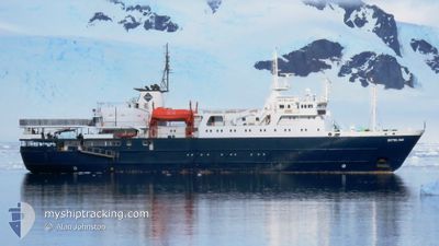
ORTELIUS
Passengers Ship
Current Trip
| Time Travelled | 4 days |
|---|---|
| Remaining Time | 1 day |
| Distance Travelled | 1294.46 nm |
| Remaining Distance | 440.28 nm |
| AVG Speed | 12.1 Knoten |
| MAX Speed | 13.8 Knoten |
| AVG Wind | 18.4 knots |
| MAX Wind | 31 knots |
| MIN Temp | 12.4°C / 54.32°F |
| MAX Temp | 21°C / 69.8°F |
| Tiefgang | 5.2 m |
| Position erhalten | Jetzt |
Current Position
| Länge | -6.04610° |
|---|---|
| Breite | 48.31593° |
| Zustand | Under way using engine |
| Geschwindigkeit | 13.4 Knoten |
| Kurs | 34.3° |
| Gebiet | Celtic Sea |
| Station | T-AIS |
| Position erhalten | Jetzt |
Info
Information
Die aktuelle Position von ORTELIUS befindet sich in Celtic Sea mit den Koordinaten 48.31593° / -6.04610°, wie von AIS am 2024-05-14 05:58 an unsere Schiffsverfolgungs-App. Die aktuelle Geschwindigkeit des Schiffes betragt 13.4 Knoten und fahrt in den Hafen von VLISSINGEN. Die geschatzte Ankunftszeit, berechnet von der MyShipTracking-App zur Schiffsverfolgung, ist 2024-05-15 17:52 LT
Das Schiff ORTELIUS (IMO: 8509181, MMSI: 244180151) ist Passengers Ship das wurde im Jahr 1989 ( 35 Jahre alt ) gebaut. Es segelt unter der Flagge [NL] Netherlands.
Auf dieser Seite finden Sie Informationen zur aktuellen Position des Schiffes, zu den zuletzt erkannten Hafenanlaufen und zu aktuellen Reiseinformationen. Wenn die Schiffe nicht von AIS abgedeckt werden, finden Sie die neueste Position.
Die aktuelle Position von ORTELIUS wird von unseren AIS-Empfangern erkannt und wir sind nicht fur die Zuverlassigkeit der Daten verantwortlich. Die letzte Position wurde von den Ais-Empfangern unserer Schiffsverfolgungs-App aufgezeichnet, wahrend sich das Schiff in Deckung befand.
Der aktuelle Entwurf von ORTELIUS, wie von AIS gemeldet, betragt 5.2 meter
Weather
| Temperature | 12.7°C / 54.86°F |
|---|---|
| Wind Speed | 22 knots |
| Direction | 239° WSW |
| Pressure | 992.7 hPa |
| Humidity | 87.1 % |
| Cloud Coverage | 35 % |
Featured Company
Last Port Calls
| Port | Arrival | Departure | Time In Port |
|---|---|---|---|
| 2024-04-22 09:33 | 2024-05-09 18:55 | 17 d | |
| 2024-04-05 08:21 | 2024-04-05 16:09 | 7 h | |
| 2024-03-29 00:25 | 2024-03-29 19:36 | 19 h | |
| 2024-03-15 22:18 | 2024-03-16 17:51 | 19 h | |
| 2024-03-03 22:41 | 2024-03-04 18:08 | 19 h |
Most Visited Ports (Last year)
| Port | Arrivals | |
|---|---|---|
| 12 | ||
| 2 | ||
| 2 | ||
| 2 | ||
| 1 |
Last Trips
| Origin | Departure | Destination | Arrival | Distance | |
|---|---|---|---|---|---|
| 2024-04-05 16:09 | 2024-04-22 09:33 | 4583.70 nm | |||
| 2024-03-29 19:36 | 2024-04-05 08:21 | 1424.78 nm | |||
| 2024-03-16 17:51 | 2024-03-29 00:25 | 2261.84 nm | |||
| 2024-03-04 18:08 | 2024-03-15 22:18 | 1787.16 nm | |||
| 2024-02-21 18:19 | 2024-03-03 22:41 | 1936.46 nm |
Events
| Zeit | Ereignis | Details | Position / Ziel | Information |
|---|---|---|---|---|
| 2024-05-13 23:28 | Ändere Seegebiet | French part of the Celtic Sea French part of the North Atlantic Ocean |
47.18042 / -7.16609
Celtic Sea
NL VLI
|
Geschwindigkeit: 13.1 kn Kurs: 32° |
| 2024-05-13 15:45 | Ändere Seegebiet | French part of the North Atlantic Ocean High seas of the North Atlantic Ocean |
45.81294 / -8.53657
North Atlantic Ocean
NL VLI
|
Geschwindigkeit: 12.7 kn Kurs: 34° |
| 2024-05-13 15:44 | Ändere Seegebiet | High seas of the North Atlantic Ocean Spanish part of the North Atlantic Ocean |
45.80762 / -8.54187
North Atlantic Ocean
NL VLI
|
Geschwindigkeit: 12.8 kn Kurs: 34.9° |
| 2024-05-12 18:29 | Auf See entdeckt | Spanish part of the North Atlantic Ocean |
41.66991 / -11.16347
North Atlantic Ocean
NL VLI
|
Geschwindigkeit: 13.2 kn Kurs: 12.9° |
| 2024-05-12 13:11 | geänderter Tiefgang | 5.2 5.4 |
40.64820 / -11.50220
NL VLI
|
Geschwindigkeit: 12 kn Kurs: 12.8° |
| 2024-05-12 13:07 | geändertes Ziel | NL VLI VLISSINGEN |
40.63611 / -11.50596
NL VLI
|
Geschwindigkeit: 12.1 kn Kurs: 13.1° |
| 2024-05-11 13:19 | Ändere Seegebiet | Portuguese part of the North Atlantic Ocean High seas of the North Atlantic Ocean |
36.13597 / -12.97555
North Atlantic Ocean
VLISSINGEN
|
Geschwindigkeit: 11.4 kn Kurs: 16.9° |
| 2024-05-11 08:52 | Ändere Seegebiet | High seas of the North Atlantic Ocean Portuguese (Madeira) part of the North Atlantic Ocean |
35.29388 / -13.23546
North Atlantic Ocean
VLISSINGEN
|
Geschwindigkeit: 11.8 kn Kurs: 14.1° |
| 2024-05-10 00:38 | Ändere Seegebiet | Portuguese (Madeira) part of the North Atlantic Ocean Spanish (Canary Islands) part of the North Atlantic Ocean |
29.35394 / -15.02978
North Atlantic Ocean
VLISSINGEN
|
Geschwindigkeit: 11.5 kn Kurs: 14° |
| 2024-05-09 17:55 | ABFAHRTSHAFEN |
|
28.11549 / -15.40639
VLISSINGEN
|
Geschwindigkeit: 8.8 kn Kurs: 111° |