
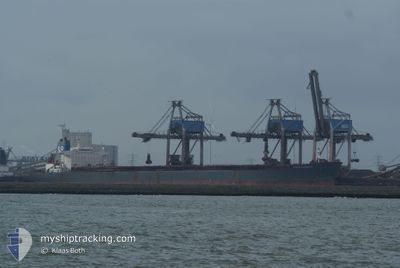
HONG YUN HENG TONG
Bulk Carrier
Current Trip
TIAN JIN
| Time Travelled | 5 days |
|---|---|
| Remaining Time | --- |
| Distance Travelled | 996.15 nm |
| Remaining Distance | --- |
| AVG Speed | 9.3 Knots |
| MAX Speed | 11.3 Knots |
| AVG Wind | 9.9 knots |
| MAX Wind | 19 knots |
| MIN Temp | 11.7°C / 53.06°F |
| MAX Temp | 23°C / 73.4°F |
| Dybgang | 7 m |
| Position Modtaget | 4 d siden |
Current Position
| Longitude | 118.79447° |
|---|---|
| Latitude | 38.78423° |
| Status | Under way using engine |
| Fart | 9.8 Knots |
| Kurs | 95° |
| Område | Yellow Sea |
| Station | T-AIS |
| Position Modtaget | 4 d siden |
Info
Information
The current position of HONG YUN HENG TONG is in Yellow Sea with coordinates 38.78423° / 118.79447° as reported on 2024-05-01 23:59 by AIS to our vessel tracker app. The vessel's current speed is 9.8 Knots
The vessel HONG YUN HENG TONG (IMO: 9235878, MMSI: 414351000) is a Bulk Carrier that was built in 2001 ( 23 år gamle ). It's sailing under the flag of [CN] China.
In this page you can find informations about the vessels current position, last detected port calls, and current voyage information. If the vessels is not in coverage by AIS you will find the latest position.
The current position of HONG YUN HENG TONG is detected by our AIS receivers and we are not responsible for the reliability of the data. The last position was recorded while the vessel was in Coverage by the Ais receivers of our vessel tracking app.
The current draught of HONG YUN HENG TONG as reported by AIS is 7 meters
Weather
| Temperature | 21.7°C / 71.06°F |
|---|---|
| Wind Speed | 10 knots |
| Direction | 32° NNE |
| Pressure | 1012.5 hPa |
| Humidity | 91.5 % |
| Cloud Coverage | 100 % |
Featured Company
Last Port Calls
| Port | Arrival | Departure | Time In Port |
|---|---|---|---|
| 2024-04-29 12:44 | 2024-05-01 01:39 | 1 d | |
| 2024-04-07 14:41 | 2024-04-09 01:53 | 1 d | |
| 2024-04-02 02:17 | 2024-04-04 03:41 | 2 d | |
| 2024-03-28 02:03 | 2024-03-29 11:24 | 1 d | |
| 2024-03-13 10:41 | 2024-03-15 04:26 | 1 d |
Last Trips
| Origin | Departure | Destination | Arrival | Distance | |
|---|---|---|---|---|---|
| 2024-04-09 09:53 | 2024-04-29 20:44 | 2795.96 nm | |||
| 2024-04-04 11:41 | 2024-04-07 22:41 | 142.89 nm | |||
| 2024-03-29 19:24 | 2024-04-02 10:17 | 146.17 nm | |||
| 2024-03-15 12:26 | 2024-03-28 10:03 | 1556.39 nm | |||
| 2024-02-23 08:26 | 2024-03-13 18:41 | 2260.52 nm |
Events
| Tid | Hændelsen | Detaljer | Position / Dest | Info |
|---|---|---|---|---|
| 2024-05-02 00:04 | Status er ændret | Default Under way using engine |
38.78277 / 118.81847
TIAN JIN
|
Fart: 9.8 kn Kurs: 95° |
| 2024-05-01 23:59 | Udenfor Dækning |
38.78423 / 118.79447
Yellow Sea
|
Fart: 9.8 kn Kurs: 95° |
|
| 2024-05-01 23:31 | Status er ændret | Under way using engine At anchor |
38.79362 / 118.70103
TIAN JIN
|
Fart: 9.5 kn Kurs: 98° |
| 2024-05-01 23:17 | Ændre havområde | Chinese part of the Yellow Sea Chinese part of the South China Sea |
38.79957 / 118.65628
Yellow Sea
|
Fart: 9.4 kn Kurs: 100° |
| 2024-05-01 23:17 | Status er ændret | At anchor Default |
38.79957 / 118.65628
TIAN JIN
|
Fart: 9.3 kn Kurs: 99° |
| 2024-05-01 22:59 | Indenfor Dækning |
38.79957 / 118.65628
Yellow Sea
|
Fart: 9.4 kn Kurs: 100° |
|
| 2024-05-01 21:51 | START Sejllads | 7.91 nm, South of CAOFEIDIAN |
38.88195 / 118.59243
TIAN JIN
|
Fart: 3.7 kn Kurs: 298° |
| 2024-05-01 02:48 | STOP Sejllads | 8.1 nm, South of CAOFEIDIAN |
38.87917 / 118.59885
TIAN JIN
|
Fart: 0.3 kn Kurs: 270° |
| 2024-05-01 01:39 | Afsejlet fra sidste havn |
|
38.91700 / 118.46315
TIAN JIN
|
Fart: 7.8 kn Kurs: 199° |
| 2024-05-01 01:12 | START Sejllads |
38.95750 / 118.46122
[CN] CAOFEIDIAN
|
Fart: 4 kn Kurs: 100° |