
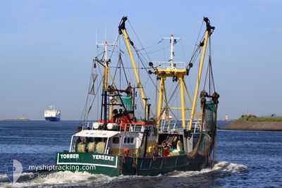
YE76 TOBBER
Fishing Vessel
Current Trip
FISHINGGROUNDS
| Time Travelled | 3 days |
|---|---|
| Remaining Time | --- |
| Distance Travelled | 358.71 nm |
| Remaining Distance | --- |
| AVG Speed | 5 Knots |
| MAX Speed | 10.7 Knots |
| AVG Wind | 18.9 knots |
| MAX Wind | 32 knots |
| MIN Temp | 9°C / 48.2°F |
| MAX Temp | 11°C / 51.8°F |
| Dybgang | 0 m |
| Position Modtaget | 2 m siden |
Current Position
| Longitude | --- |
|---|---|
| Latitude | --- |
| Status | Engaged in Fishing |
| Fart | 9.4 Knots |
| Kurs | 224.3° |
| Område | North Sea |
| Station | T-AIS |
| Position Modtaget | 2 m siden |
Info
Information
The current position of YE76 TOBBER is in North Sea with coordinates 52.13034° / 4.16965° as reported on 2025-12-11 15:29 by AIS to our vessel tracker app. The vessel's current speed is 9.4 Knots
The vessel YE76 TOBBER (IMO: 8431621, MMSI: 245731000) is a Fishing Vessel that was built in 1980 ( 45 år gamle ). It's sailing under the flag of [NL] Netherlands.
In this page you can find informations about the vessels current position, last detected port calls, and current voyage information. If the vessels is not in coverage by AIS you will find the latest position.
The current position of YE76 TOBBER is detected by our AIS receivers and we are not responsible for the reliability of the data. The last position was recorded while the vessel was in Coverage by the Ais receivers of our vessel tracking app.
Weather
| Temperature | 9.4°C / 48.92°F |
|---|---|
| Wind Speed | 13 knots |
| Direction | 191° S |
| Pressure | 1019.8 hPa |
| Humidity | 81.2 % |
| Cloud Coverage | 45 % |
Featured Company
Last Port Calls
| Port | Arrival | Departure | Time In Port |
|---|---|---|---|
| 2025-12-05 06:30 | 2025-12-08 00:59 | 2 d | |
| 2025-11-28 03:18 | 2025-12-01 08:45 | 3 d | |
| 2025-11-11 22:08 | 2025-11-11 22:26 | 18 m | |
| 2025-11-11 20:24 | |||
| 2025-11-07 05:32 | 2025-11-07 07:31 | 1 h | |
| 2025-11-06 13:52 | 2025-11-06 15:01 | 1 h | |
| 2025-11-03 00:32 | 2025-11-03 00:49 | 16 m | |
| 2025-10-31 06:25 | 2025-10-31 07:17 | 51 m | |
| 2025-10-31 05:29 | 2025-10-31 05:46 | 16 m | |
| 2025-10-28 07:08 | 2025-10-28 08:45 | 1 h |
Most Visited Ports (Last year)
| Port | Arrivals | |
|---|---|---|
| 48 | ||
| 22 | ||
| 20 | ||
| 15 | ||
| 13 | ||
| 10 |
Last Trips
| Origin | Departure | Destination | Arrival | Distance | |
|---|---|---|---|---|---|
| 2025-12-01 08:45 | 2025-12-05 06:30 | 334.24 nm | |||
| 2025-11-11 22:26 | 2025-11-28 03:18 | 345.15 nm | |||
| 2025-11-11 20:24 | 2025-11-11 22:08 | 16.39 nm | |||
| 2025-11-06 15:01 | 2025-11-07 05:32 | 62.27 nm | |||
| 2025-11-03 00:49 | 2025-11-06 13:52 | 338.02 nm | |||
| 2025-10-31 07:17 | 2025-11-03 00:32 | 27.45 nm | |||
| 2025-10-31 05:46 | 2025-10-31 06:25 | 6.24 nm | |||
| 2025-10-28 08:45 | 2025-10-31 05:29 | 256.90 nm | |||
| 2025-10-27 21:06 | 2025-10-28 07:08 | 49.08 nm | |||
| 2025-10-27 19:44 | 2025-10-27 20:51 | 6.08 nm |
Events
| Tid | Hændelsen | Detaljer | Position / Dest | Info |
|---|---|---|---|---|
| 2025-12-10 22:58 | START Sejllads | 6.09 nm, North East of AMELAND |
53.48023 / 5.90009
FISHINGGROUNDS
|
Fart: 6.3 kn Kurs: 351.7° |
| 2025-12-10 22:56 | STOP Sejllads | 6.19 nm, North East of AMELAND |
53.48001 / 5.90333
FISHINGGROUNDS
|
Fart: 0.2 kn Kurs: 511° |
| 2025-12-09 16:12 | START Sejllads | 3.97 nm, North East of SCHIERMONNIKOOG |
53.52573 / 6.23503
FISHINGGROUNDS
|
Fart: 3.5 kn Kurs: 76.8° |
| 2025-12-09 16:09 | STOP Sejllads | 3.9 nm, North East of SCHIERMONNIKOOG |
53.52530 / 6.23203
FISHINGGROUNDS
|
Fart: 0.3 kn Kurs: 511° |
| 2025-12-09 12:12 | START Sejllads | 3.68 nm, North East of SCHIERMONNIKOOG |
53.52418 / 6.22231
FISHINGGROUNDS
|
Fart: 3.5 kn Kurs: 264.7° |
| 2025-12-09 12:09 | STOP Sejllads | 3.73 nm, North East of SCHIERMONNIKOOG |
53.52409 / 6.22556
FISHINGGROUNDS
|
Fart: 0.3 kn Kurs: 511° |
| 2025-12-09 10:07 | START Sejllads | 3.51 nm, North of SCHIERMONNIKOOG |
53.52388 / 6.15053
FISHINGGROUNDS
|
Fart: 3.8 kn Kurs: 267.8° |
| 2025-12-09 10:04 | STOP Sejllads | 3.49 nm, North of SCHIERMONNIKOOG |
53.52411 / 6.15377
FISHINGGROUNDS
|
Fart: 0.2 kn Kurs: 511° |
| 2025-12-09 06:08 | START Sejllads | 4.47 nm, North East of SCHIERMONNIKOOG |
53.53293 / 6.24195
FISHINGGROUNDS
|
Fart: 5 kn Kurs: 65.1° |
| 2025-12-09 06:06 | STOP Sejllads | 4.38 nm, North East of SCHIERMONNIKOOG |
53.53200 / 6.23915
FISHINGGROUNDS
|
Fart: 0.3 kn Kurs: 511° |