
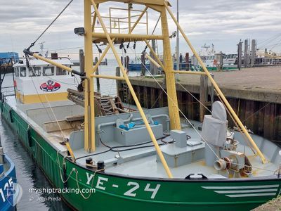
YE-24 SARAH.MAURITS
Fishing
Current Trip
FISHING GROUNDS
| Time Travelled | 3 h, 14 mins |
|---|---|
| Remaining Time | --- |
| Distance Travelled | 8.14 nm |
| Remaining Distance | --- |
| AVG Speed | 5.5 Knots |
| MAX Speed | 9.2 Knots |
| AVG Wind | 9.9 knots |
| MAX Wind | 10.7 knots |
| MIN Temp | 7°C / 44.6°F |
| MAX Temp | 7.7°C / 45.86°F |
| Dybgang | 1 m |
| Position Modtaget | 16 m siden |
Current Position
| Longitude | --- |
|---|---|
| Latitude | --- |
| Status | Engaged in Fishing |
| Fart | |
| Kurs | 170° |
| Område | North Sea |
| Station | T-AIS |
| Position Modtaget | 16 m siden |
Info
Information
The current position of YE-24 SARAH.MAURITS is in North Sea with coordinates 51.48798° / 4.05830° as reported on 2025-12-11 09:31 by AIS to our vessel tracker app. The vessel's current speed is 0 Knots
The vessel YE-24 SARAH.MAURITS (MMSI: 244750739) is a Fishing It's sailing under the flag of [NL] Netherlands.
In this page you can find informations about the vessels current position, last detected port calls, and current voyage information. If the vessels is not in coverage by AIS you will find the latest position.
The current position of YE-24 SARAH.MAURITS is detected by our AIS receivers and we are not responsible for the reliability of the data. The last position was recorded while the vessel was in Coverage by the Ais receivers of our vessel tracking app.
The current draught of YE-24 SARAH.MAURITS as reported by AIS is 1 meters
Weather
| Temperature | 7.4°C / 45.32°F |
|---|---|
| Wind Speed | 9 knots |
| Direction | 213° SSW |
| Pressure | 1023 hPa |
| Humidity | 90.4 % |
| Cloud Coverage | 16 % |
Featured Company
Last Port Calls
| Port | Arrival | Departure | Time In Port |
|---|---|---|---|
| 2025-12-10 16:52 | 2025-12-11 07:34 | 14 h | |
| 2025-12-10 11:36 | 2025-12-10 14:58 | 3 h | |
| 2025-12-09 16:09 | 2025-12-10 06:56 | 14 h | |
| 2025-12-08 15:25 | 2025-12-09 06:35 | 15 h | |
| 2025-12-08 10:53 | 2025-12-08 14:07 | 3 h | |
| 2025-12-05 14:39 | 2025-12-08 07:58 | 2 d | |
| 2025-12-05 11:18 | 2025-12-05 13:45 | 2 h | |
| 2025-12-04 12:23 | 2025-12-05 07:22 | 18 h | |
| 2025-12-03 14:35 | 2025-12-04 07:15 | 16 h | |
| 2025-12-02 14:44 | 2025-12-03 07:19 | 16 h |
Last Trips
| Origin | Departure | Destination | Arrival | Distance | |
|---|---|---|---|---|---|
| 2025-12-10 14:58 | 2025-12-10 16:52 | 2.13 nm | |||
| 2025-12-10 06:56 | 2025-12-10 11:36 | 12.45 nm | |||
| 2025-12-09 06:35 | 2025-12-09 16:09 | 14.81 nm | |||
| 2025-12-08 14:07 | 2025-12-08 15:25 | 1.46 nm | |||
| 2025-12-08 07:58 | 2025-12-08 10:53 | 8.46 nm | |||
| 2025-12-05 13:45 | 2025-12-05 14:39 | 3.81 nm | |||
| 2025-12-05 07:22 | 2025-12-05 11:18 | 8.23 nm | |||
| 2025-12-04 07:15 | 2025-12-04 12:23 | 6.39 nm | |||
| 2025-12-03 07:19 | 2025-12-03 14:35 | 39.33 nm | |||
| 2025-12-02 07:12 | 2025-12-02 14:44 | 14.08 nm |
Events
| Tid | Hændelsen | Detaljer | Position / Dest | Info |
|---|---|---|---|---|
| 2025-12-11 09:28 | Indenfor Dækning |
51.48798 / 4.05829
North Sea
|
Fart: Kurs: 283.6° |
|
| 2025-12-11 08:15 | Udenfor Dækning |
51.48886 / 4.08181
North Sea
|
Fart: 8.6 kn Kurs: 264° |
|
| 2025-12-11 06:46 | START Sejllads | 0.43 nm, East of YERSEKE |
51.49848 / 4.06753
FISHING GROUNDS
|
Fart: 3.7 kn Kurs: 322° |
| 2025-12-11 06:34 | Afsejlet fra sidste havn |
|
51.49854 / 4.06907
FISHING GROUNDS
|
Fart: 4.8 kn Kurs: 127° |
| 2025-12-11 05:41 | Indenfor Dækning |
51.49968 / 4.05398
North Sea
[NL] YERSEKE
|
Fart: Kurs: 291.9° |
|
| 2025-12-11 04:33 | Udenfor Dækning |
51.49968 / 4.05403
North Sea
[NL] YERSEKE
|
Fart: Kurs: 216.2° |
|
| 2025-12-11 04:33 | Indenfor Dækning |
51.49968 / 4.05403
North Sea
[NL] YERSEKE
|
Fart: Kurs: 216.2° |
|
| 2025-12-11 01:52 | Udenfor Dækning |
51.49973 / 4.05402
North Sea
[NL] YERSEKE
|
Fart: Kurs: 183.3° |
|
| 2025-12-11 01:52 | Indenfor Dækning |
51.49973 / 4.05402
North Sea
[NL] YERSEKE
|
Fart: Kurs: 183.3° |
|
| 2025-12-11 00:06 | Udenfor Dækning |
51.49971 / 4.05401
North Sea
[NL] YERSEKE
|
Fart: Kurs: 298.3° |