
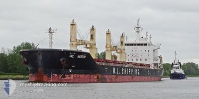
WL MUROM
Cargo
Current Trip
| Time Travelled | 17 days |
|---|---|
| Remaining Time | --- |
| Distance Travelled | 4515.66 nm |
| Remaining Distance | --- |
| AVG Speed | 10.2 Knots |
| MAX Speed | 12.9 Knots |
| AVG Wind | 11.1 knots |
| MAX Wind | 28 knots |
| MIN Temp | 16.7°C / 62.06°F |
| MAX Temp | 28.8°C / 83.84°F |
| Dybgang | 10.6 m |
| Position Modtaget | 1 d siden |
Current Position
| Longitude | -23.93125° |
|---|---|
| Latitude | 38.08407° |
| Status | Under way using engine |
| Fart | 10.7 Knots |
| Kurs | 94.1° |
| Område | North Atlantic Ocean |
| Station | T-AIS |
| Position Modtaget | 1 d siden |
Info
Information
The current position of WL MUROM is in North Atlantic Ocean with coordinates 38.08407° / -23.93125° as reported on 2024-06-01 08:27 by AIS to our vessel tracker app. The vessel's current speed is 10.7 Knots and is heading at the port of HUELVA. The estimated time of arrival as calculated by MyShipTracking vessel tracking app is 2024-06-03 16:00 LT
The vessel WL MUROM (IMO: 9674385, MMSI: 477885500) is a Cargo It's sailing under the flag of [HK] Hong Kong.
In this page you can find informations about the vessels current position, last detected port calls, and current voyage information. If the vessels is not in coverage by AIS you will find the latest position.
The current position of WL MUROM is detected by our AIS receivers and we are not responsible for the reliability of the data. The last position was recorded while the vessel was in Coverage by the Ais receivers of our vessel tracking app.
The current draught of WL MUROM as reported by AIS is 10.6 meters
Weather
| Temperature | 17.5°C / 63.5°F |
|---|---|
| Wind Speed | 10 knots |
| Direction | 336° NNW |
| Pressure | 1015 hPa |
| Humidity | 83.1 % |
| Cloud Coverage | 100 % |
Featured Company
Most Visited Ports (Last year)
| Port | Arrivals | |
|---|---|---|
| 2 | ||
| 2 | ||
| 1 | ||
| 1 | ||
| 1 | ||
| 1 |
Events
| Tid | Hændelsen | Detaljer | Position / Dest | Info |
|---|---|---|---|---|
| 2024-06-01 08:31 | Status er ændret | Default Under way using engine |
38.08295 / -23.91280
USHOU>ESHUV
|
Fart: 10.7 kn Kurs: 94.1° |
| 2024-06-01 08:27 | Udenfor Dækning |
38.08407 / -23.93125
North Atlantic Ocean
USHOU>ESHUV
|
Fart: 10.7 kn Kurs: 94.1° |
|
| 2024-06-01 07:17 | Status er ændret | Under way using engine Default |
38.09909 / -24.19375
USHOU>ESHUV
|
Fart: 10 kn Kurs: 95° |
| 2024-06-01 07:02 | Status er ændret | Default Under way using engine |
38.10166 / -24.24333
USHOU>ESHUV
|
Fart: 10.3 kn Kurs: 94.3° |
| 2024-05-31 22:32 | Status er ændret | Under way using engine Default |
38.16574 / -26.22606
USHOU>ESHUV
|
Fart: 11.4 kn Kurs: 88° |
| 2024-05-31 22:17 | Status er ændret | Default Under way using engine |
38.16333 / -26.28167
USHOU>ESHUV
|
Fart: 11.1 kn Kurs: 86.9° |
| 2024-05-31 22:13 | Status er ændret | Under way using engine Default |
38.16335 / -26.30391
USHOU>ESHUV
|
Fart: 11 kn Kurs: 88° |
| 2024-05-31 22:02 | Indenfor Dækning |
38.16338 / -26.30261
North Atlantic Ocean
USHOU>ESHUV
|
Fart: 11.1 kn Kurs: 88.1° |
|
| 2024-05-31 18:38 | Status er ændret | Default Under way using engine |
38.15226 / -27.12324
USHOU>ESHUV
|
Fart: 10.5 kn Kurs: 87.1° |
| 2024-05-31 18:33 | Udenfor Dækning |
38.15169 / -27.14202
North Atlantic Ocean
USHOU>ESHUV
|
Fart: 10.5 kn Kurs: 87.1° |