
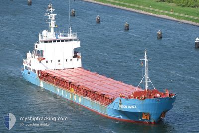
WILSON DVINA
General Cargo
Current Trip
| Time Travelled | 5 days |
|---|---|
| Remaining Time | 2 days |
| Distance Travelled | 589.60 nm |
| Remaining Distance | 387.52 nm |
| AVG Speed | 7.5 Knots |
| MAX Speed | 10.9 Knots |
| AVG Wind | 13.5 knots |
| MAX Wind | 31 knots |
| MIN Temp | -3.6°C / 25.52°F |
| MAX Temp | 8.6°C / 47.48°F |
| Dybgang | 3.6 m |
| Position Modtaget | 1 m siden |
Current Position
| Longitude | 10.31246° |
|---|---|
| Latitude | 56.70542° |
| Status | Under way using engine |
| Fart | 5.6 Knots |
| Kurs | 103° |
| Område | Kattegat |
| Station | T-AIS |
| Position Modtaget | 1 m siden |
Info
Information
The current position of WILSON DVINA is in Kattegat with coordinates 56.70542° / 10.31246° as reported on 2024-04-27 23:24 by AIS to our vessel tracker app. The vessel's current speed is 5.6 Knots and is heading at the port of GDANSK. The estimated time of arrival as calculated by MyShipTracking vessel tracking app is 2024-04-30 22:06 LT
The vessel WILSON DVINA (IMO: 9005742, MMSI: 314220000) is a General Cargo that was built in 1992 ( 32 år gamle ). It's sailing under the flag of [BB] Barbados.
In this page you can find informations about the vessels current position, last detected port calls, and current voyage information. If the vessels is not in coverage by AIS you will find the latest position.
The current position of WILSON DVINA is detected by our AIS receivers and we are not responsible for the reliability of the data. The last position was recorded while the vessel was in Coverage by the Ais receivers of our vessel tracking app.
The current draught of WILSON DVINA as reported by AIS is 3.6 meters
Weather
| Temperature | 8.4°C / 47.12°F |
|---|---|
| Wind Speed | 12 knots |
| Direction | 107° ESE |
| Pressure | 1012.2 hPa |
| Humidity | 89 % |
| Cloud Coverage | 100 % |
Featured Company
Last Port Calls
| Port | Arrival | Departure | Time In Port |
|---|---|---|---|
| 2024-04-22 02:46 | 2024-04-22 18:07 | 15 h | |
| 2024-04-19 04:15 | 2024-04-21 13:59 | 2 d | |
| 2024-04-13 17:35 | 2024-04-14 12:48 | 19 h | |
| 2024-04-10 21:43 | 2024-04-12 14:24 | 1 d | |
| 2024-04-01 09:08 | 2024-04-01 10:12 | 1 h | |
| 2024-03-31 09:58 | 2024-03-31 16:50 | 6 h | |
| 2024-03-25 04:08 | 2024-03-26 18:55 | 1 d | |
| 2024-03-13 02:01 | 2024-03-13 08:42 | 6 h | |
| 2024-03-03 03:58 | 2024-03-03 07:40 | 3 h | |
| 2024-02-18 15:16 | 2024-02-20 22:08 | 2 d |
Last Trips
| Origin | Departure | Destination | Arrival | Distance | |
|---|---|---|---|---|---|
| 2024-04-21 15:59 | 2024-04-22 04:46 | 127.81 nm | |||
| 2024-04-14 14:48 | 2024-04-19 06:15 | 746.04 nm | |||
| 2024-04-12 16:24 | 2024-04-13 19:35 | 282.55 nm | |||
| 2024-04-01 12:12 | 2024-04-10 23:43 | 1720.74 nm | |||
| 2024-03-31 18:50 | 2024-04-01 11:08 | 131.43 nm | |||
| 2024-03-26 19:55 | 2024-03-31 11:58 | 859.18 nm | |||
| 2024-03-13 11:42 | 2024-03-25 05:08 | 1538.52 nm | |||
| 2024-03-03 08:40 | 2024-03-13 05:01 | 1998.90 nm | |||
| 2024-02-20 23:08 | 2024-03-03 04:58 | 2025.96 nm | |||
| 2024-02-16 17:06 | 2024-02-18 16:16 | 476.83 nm |
Events
| Tid | Hændelsen | Detaljer | Position / Dest | Info |
|---|---|---|---|---|
| 2024-04-27 20:10 | START Sejllads | 13.55 nm, North West of RANDERS |
56.63928 / 9.80440
GDANSK
|
Fart: 3.1 kn Kurs: 73° |
| 2024-04-27 20:08 | ETA er ændret | 2024/04/29 17:00 2024/04/29 09:00 |
56.63888 / 9.80221
GDANSK
|
Fart: 2.1 kn Kurs: 74° |
| 2024-04-27 19:56 | Status er ændret | Under way using engine Moored |
56.63875 / 9.79994
GDANSK
|
Fart: Kurs: 58° |
| 2024-04-27 11:28 | Dybgangen er ændret | 3.6 5.1 |
56.63873 / 9.79994
GDANSK
|
Fart: Kurs: 58° |
| 2024-04-27 11:28 | Destination er ændret | GDANSK DKHBO |
56.63873 / 9.79994
GDANSK
|
Fart: Kurs: 58° |
| 2024-04-27 11:28 | ETA er ændret | 2024/04/29 09:00 2024/04/25 06:30 |
56.63873 / 9.79994
GDANSK
|
Fart: Kurs: 58° |
| 2024-04-26 04:30 | Indenfor Dækning |
56.63874 / 9.79993
Kattegat
|
Fart: Kurs: 84.8° |
|
| 2024-04-25 12:06 | Udenfor Dækning |
56.63874 / 9.79994
Kattegat
|
Fart: Kurs: 34.7° |
|
| 2024-04-25 11:37 | STOP Sejllads | 13.55 nm, North West of RANDERS |
56.63889 / 9.80328
DKHBO
|
Fart: 0.2 kn Kurs: 273° |
| 2024-04-24 22:35 | Ændre havområde | Danish part of the Kattegat Danish part of the Skaggerak |
57.78296 / 10.87529
Kattegat
DKHBO
|
Fart: 9.5 kn Kurs: 134.4° |