
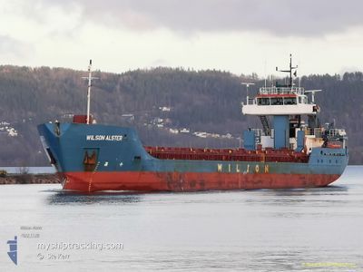
WILSON ALSTER
General Cargo
Current Trip
| Time Travelled | 2 days |
|---|---|
| Remaining Time | 20 h, 50 mins |
| Distance Travelled | 605.82 nm |
| Remaining Distance | 170.47 nm |
| AVG Speed | 9.5 Knots |
| MAX Speed | 13.7 Knots |
| AVG Wind | 9.2 knots |
| MAX Wind | 17 knots |
| MIN Temp | 9.2°C / 48.56°F |
| MAX Temp | 15.1°C / 59.18°F |
| Dybgang | 4.9 m |
| Position Modtaget | 1 d siden |
Current Position
| Longitude | -3.17040° |
|---|---|
| Latitude | 49.86601° |
| Status | Under way using engine |
| Fart | 10.2 Knots |
| Kurs | 238.9° |
| Område | English Channel |
| Station | T-AIS |
| Position Modtaget | 1 d siden |
Info
Information
The current position of WILSON ALSTER is in English Channel with coordinates 49.86601° / -3.17040° as reported on 2024-05-05 22:19 by AIS to our vessel tracker app. The vessel's current speed is 10.2 Knots and is heading at the port of SANTANDER. The estimated time of arrival as calculated by MyShipTracking vessel tracking app is 2024-05-08 05:14 LT
The vessel WILSON ALSTER (IMO: 9222429, MMSI: 314019000) is a General Cargo that was built in 2005 ( 19 år gamle ). It's sailing under the flag of [BB] Barbados.
In this page you can find informations about the vessels current position, last detected port calls, and current voyage information. If the vessels is not in coverage by AIS you will find the latest position.
The current position of WILSON ALSTER is detected by our AIS receivers and we are not responsible for the reliability of the data. The last position was recorded while the vessel was in Coverage by the Ais receivers of our vessel tracking app.
The current draught of WILSON ALSTER as reported by AIS is 4.9 meters
Weather
| Temperature | 13.3°C / 55.94°F |
|---|---|
| Wind Speed | 15 knots |
| Direction | 323° NW |
| Pressure | 1021.8 hPa |
| Humidity | 87.1 % |
| Cloud Coverage | 3 % |
Featured Company
Last Port Calls
| Port | Arrival | Departure | Time In Port |
|---|---|---|---|
| 2024-05-01 09:44 | 2024-05-04 10:55 | 3 d | |
| 2024-04-20 13:18 | 2024-04-23 06:18 | 2 d | |
| 2024-04-14 23:51 | 2024-04-15 18:26 | 18 h | |
| 2024-04-11 03:58 | 2024-04-13 08:01 | 2 d | |
| 2024-04-07 15:49 | 2024-04-09 08:44 | 1 d | |
| 2024-04-02 18:58 | 2024-04-03 13:08 | 18 h | |
| 2024-04-01 08:08 | 2024-04-02 14:31 | 1 d | |
| 2024-03-29 10:06 | 2024-03-29 19:18 | 9 h | |
| 2024-03-27 13:11 | 2024-03-28 22:59 | 1 d | |
| 2024-03-26 23:27 | 2024-03-26 23:51 | 24 m |
Last Trips
| Origin | Departure | Destination | Arrival | Distance | |
|---|---|---|---|---|---|
| 2024-04-23 07:18 | 2024-05-01 11:44 | 751.34 nm | |||
| 2024-04-15 20:26 | 2024-04-20 14:18 | 986.02 nm | |||
| 2024-04-13 10:01 | 2024-04-15 01:51 | 313.80 nm | |||
| 2024-04-09 10:44 | 2024-04-11 05:58 | 398.48 nm | |||
| 2024-04-03 15:08 | 2024-04-07 17:49 | 61.55 nm | |||
| 2024-04-02 16:31 | 2024-04-02 20:58 | 40.29 nm | |||
| 2024-03-29 20:18 | 2024-04-01 10:08 | 525.00 nm | |||
| 2024-03-28 23:59 | 2024-03-29 11:06 | 107.40 nm | |||
| 2024-03-27 00:51 | 2024-03-27 14:11 | 95.18 nm | |||
| 2024-03-26 15:16 | 2024-03-27 00:27 | 60.98 nm |
Events
| Tid | Hændelsen | Detaljer | Position / Dest | Info |
|---|---|---|---|---|
| 2024-05-05 22:23 | Status er ændret | Default Under way using engine |
49.86091 / -3.18352
SANTANDER
|
Fart: 10.2 kn Kurs: 238.9° |
| 2024-05-05 22:19 | Udenfor Dækning |
49.86601 / -3.17040
English Channel
SANTANDER
|
Fart: 10.2 kn Kurs: 238.9° |
|
| 2024-05-05 21:56 | Ændre havområde | United Kingdom part of the English Channel Guernsey part of the English Channel |
49.89998 / -3.08229
English Channel
SANTANDER
|
Fart: 10 kn Kurs: 239° |
| 2024-05-05 21:11 | Status er ændret | Under way using engine Default |
49.96003 / -2.92159
SANTANDER
|
Fart: 9 kn Kurs: 254° |
| 2024-05-05 20:42 | Status er ændret | Default Under way using engine |
49.97995 / -2.81515
SANTANDER
|
Fart: 8.7 kn Kurs: 254.8° |
| 2024-05-05 19:58 | Status er ændret | Under way using engine Default |
50.00827 / -2.66232
SANTANDER
|
Fart: 7.6 kn Kurs: 254° |
| 2024-05-05 19:50 | Status er ændret | Default Under way using engine |
50.01316 / -2.63641
SANTANDER
|
Fart: 7.5 kn Kurs: 253.8° |
| 2024-05-05 19:41 | Status er ændret | Under way using engine Default |
50.01860 / -2.60722
SANTANDER
|
Fart: 7.6 kn Kurs: 254° |
| 2024-05-05 19:38 | Status er ændret | Default Under way using engine |
50.02039 / -2.59775
SANTANDER
|
Fart: 7.3 kn Kurs: 254.3° |
| 2024-05-05 19:06 | Fundet i havområde | Guernsey part of the English Channel |
50.03755 / -2.50495
English Channel
SANTANDER
|
Fart: 6.7 kn Kurs: 253.5° |