
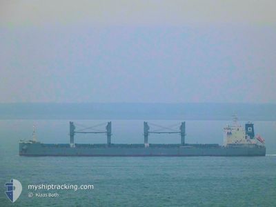
WESTERN DONCASTER
Cargo
Current Trip
| Time Travelled | 8 days |
|---|---|
| Remaining Time | --- |
| Distance Travelled | 2068.47 nm |
| Remaining Distance | --- |
| AVG Speed | 9.9 Knots |
| MAX Speed | 13.2 Knots |
| AVG Wind | 14.1 knots |
| MAX Wind | 29.4 knots |
| MIN Temp | 17.7°C / 63.86°F |
| MAX Temp | 24.7°C / 76.46°F |
| Dybgang | 9.7 m |
| Position Modtaget | 4 d siden |
Current Position
| Longitude | -13.84749° |
|---|---|
| Latitude | 27.56827° |
| Status | Under way using engine |
| Fart | 11.5 Knots |
| Kurs | 218.6° |
| Område | North Atlantic Ocean |
| Station | T-AIS |
| Position Modtaget | 4 d siden |
Info
Information
The current position of WESTERN DONCASTER is in North Atlantic Ocean with coordinates 27.56827° / -13.84749° as reported on 2024-06-04 09:55 by AIS to our vessel tracker app. The vessel's current speed is 11.5 Knots and is heading at the port of PUERTO MONTT. The estimated time of arrival as calculated by MyShipTracking vessel tracking app is 2024-06-30 04:00 LT
The vessel WESTERN DONCASTER (IMO: 9831505, MMSI: 548977000) is a Cargo It's sailing under the flag of [PH] Philippines.
In this page you can find informations about the vessels current position, last detected port calls, and current voyage information. If the vessels is not in coverage by AIS you will find the latest position.
The current position of WESTERN DONCASTER is detected by our AIS receivers and we are not responsible for the reliability of the data. The last position was recorded while the vessel was in Coverage by the Ais receivers of our vessel tracking app.
The current draught of WESTERN DONCASTER as reported by AIS is 9.7 meters
Weather
| Temperature | 24.7°C / 76.46°F |
|---|---|
| Wind Speed | 11 knots |
| Direction | 42° NE |
| Pressure | 1016.3 hPa |
| Humidity | 78.4 % |
| Cloud Coverage | 91 % |
Featured Company
Most Visited Ports (Last year)
| Port | Arrivals | |
|---|---|---|
| 4 | ||
| 2 | ||
| 2 | ||
| 1 | ||
| 1 | ||
| 1 |
Events
| Tid | Hændelsen | Detaljer | Position / Dest | Info |
|---|---|---|---|---|
| 2024-06-04 09:57 | Status er ændret | Default Under way using engine |
27.56167 / -13.85167
CL PMC
|
Fart: 11.5 kn Kurs: 218.6° |
| 2024-06-04 09:55 | Status er ændret | Under way using engine Default |
27.56827 / -13.84749
CL PMC
|
Fart: 11.4 kn Kurs: 219° |
| 2024-06-04 09:55 | Udenfor Dækning |
27.56827 / -13.84749
North Atlantic Ocean
CL PMC
|
Fart: 11.5 kn Kurs: 218.6° |
|
| 2024-06-04 09:40 | Status er ændret | Default Under way using engine |
27.60593 / -13.81398
CL PMC
|
Fart: 11.3 kn Kurs: 218.4° |
| 2024-06-04 09:26 | Ændre havområde | Western Saharan part of the North Atlantic Ocean Moroccan part of the North Atlantic Ocean |
27.64131 / -13.78332
North Atlantic Ocean
CL PMC
|
Fart: 11.4 kn Kurs: 215.8° |
| 2024-06-04 09:25 | Status er ændret | Under way using engine Default |
27.64309 / -13.78186
CL PMC
|
Fart: 11.4 kn Kurs: 215° |
| 2024-06-04 09:09 | Status er ændret | Default Under way using engine |
27.68333 / -13.74833
CL PMC
|
Fart: 11.4 kn Kurs: 214.4° |
| 2024-06-04 08:26 | Status er ændret | Under way using engine Default |
27.79549 / -13.66078
CL PMC
|
Fart: 11.1 kn Kurs: 213° |
| 2024-06-04 08:21 | Status er ændret | Default Under way using engine |
27.80868 / -13.65067
CL PMC
|
Fart: 11.1 kn Kurs: 214.7° |
| 2024-06-04 07:48 | Status er ændret | Under way using engine Default |
27.89208 / -13.58429
CL PMC
|
Fart: 11 kn Kurs: 217° |