
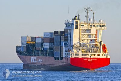
WEC MONDRIAAN
Container Ship
Current Trip
| Time Travelled | 2 days |
|---|---|
| Remaining Time | 16 h, 57 mins |
| Distance Travelled | 627.12 nm |
| Remaining Distance | 254.53 nm |
| AVG Speed | 13.2 Knots |
| MAX Speed | 15.8 Knots |
| AVG Wind | 16.5 knots |
| MAX Wind | 26.2 knots |
| MIN Temp | 14.3°C / 57.74°F |
| MAX Temp | 19.5°C / 67.1°F |
| Dybgang | 7 m |
| Position Modtaget | 1 d siden |
Current Position
| Longitude | --- |
|---|---|
| Latitude | --- |
| Status | Under way using engine |
| Fart | 14.1 Knots |
| Kurs | 60.5° |
| Område | North Atlantic Ocean |
| Station | T-AIS |
| Position Modtaget | 1 d siden |
Info
Information
The current position of WEC MONDRIAAN is in North Atlantic Ocean with coordinates 28.80223° / -13.49908° as reported on 2026-01-04 22:48 by AIS to our vessel tracker app. The vessel's current speed is 14.1 Knots and is heading at the port of SINES. The estimated time of arrival as calculated by MyShipTracking vessel tracking app is 2026-01-07 07:00 LT
The vessel WEC MONDRIAAN (IMO: 9354363, MMSI: 255805775) is a Container Ship that was built in 2006 ( 20 år gamle ). It's sailing under the flag of [PT] Portugal.
In this page you can find informations about the vessels current position, last detected port calls, and current voyage information. If the vessels is not in coverage by AIS you will find the latest position.
The current position of WEC MONDRIAAN is detected by our AIS receivers and we are not responsible for the reliability of the data. The last position was recorded while the vessel was in Coverage by the Ais receivers of our vessel tracking app.
The current draught of WEC MONDRIAAN as reported by AIS is 7 meters
Weather
| Temperature | 14.5°C / 58.1°F |
|---|---|
| Wind Speed | 22 knots |
| Direction | 13° NNE |
| Pressure | 1023.2 hPa |
| Humidity | 54.9 % |
| Cloud Coverage | 100 % |
Featured Company
Last Port Calls
| Port | Arrival | Departure | Time In Port |
|---|---|---|---|
| 2026-01-03 03:21 | 2026-01-04 12:20 | 1 d | |
| 2025-12-31 20:04 | 2026-01-02 19:44 | 1 d | |
| 2025-12-31 06:05 | 2025-12-31 14:49 | 8 h | |
| 2025-12-28 06:07 | 2025-12-28 18:38 | 12 h | |
| 2025-12-25 09:36 | 2025-12-26 19:14 | 1 d | |
| 2025-12-21 09:11 | 2025-12-22 03:27 | 18 h | |
| 2025-12-20 10:28 | 2025-12-20 18:24 | 7 h | |
| 2025-12-17 22:10 | 2025-12-19 00:02 | 1 d | |
| 2025-12-15 03:16 | 2025-12-16 02:01 | 22 h | |
| 2025-12-07 21:36 | 2025-12-10 23:51 | 3 d |
Last Trips
| Origin | Departure | Destination | Arrival | Distance | |
|---|---|---|---|---|---|
| 2026-01-02 19:44 | 2026-01-03 03:21 | 55.98 nm | |||
| 2025-12-31 14:49 | 2025-12-31 20:04 | 55.97 nm | |||
| 2025-12-28 18:38 | 2025-12-31 06:05 | 852.42 nm | |||
| 2025-12-26 19:14 | 2025-12-28 06:07 | 478.08 nm | |||
| 2025-12-22 03:27 | 2025-12-25 09:36 | 829.38 nm | |||
| 2025-12-20 18:24 | 2025-12-21 09:11 | 170.84 nm | |||
| 2025-12-19 00:02 | 2025-12-20 10:28 | 431.17 nm | |||
| 2025-12-16 02:01 | 2025-12-17 22:10 | 354.54 nm | |||
| 2025-12-10 23:51 | 2025-12-15 03:16 | 1279.81 nm | |||
| 2025-12-05 16:55 | 2025-12-07 21:36 | 225.82 nm |
Events
| Tid | Hændelsen | Detaljer | Position / Dest | Info |
|---|---|---|---|---|
| 2026-01-04 22:55 | Status er ændret | Default Under way using engine |
28.81538 / -13.47346
PTSIE
|
Fart: 14.1 kn Kurs: 60.5° |
| 2026-01-04 22:48 | Udenfor Dækning |
28.80223 / -13.49908
North Atlantic Ocean
PTSIE
|
Fart: 14.1 kn Kurs: 60.5° |
|
| 2026-01-04 20:03 | Status er ændret | Under way using engine Default |
28.81907 / -14.20284
PTSIE
|
Fart: 13.8 kn Kurs: 83° |
| 2026-01-04 20:03 | Status er ændret | Default Under way using engine |
28.81878 / -14.20624
PTSIE
|
Fart: 14 kn Kurs: 85.7° |
| 2026-01-04 20:02 | Status er ændret | Under way using engine Default |
28.81846 / -14.20966
PTSIE
|
Fart: 13.9 kn Kurs: 85° |
| 2026-01-04 19:59 | Status er ændret | Default Under way using engine |
28.81713 / -14.22326
PTSIE
|
Fart: 14 kn Kurs: 86° |
| 2026-01-04 19:58 | Status er ændret | Under way using engine Default |
28.81681 / -14.22677
PTSIE
|
Fart: 13.8 kn Kurs: 82° |
| 2026-01-04 19:39 | Indenfor Dækning |
28.81681 / -14.22677
North Atlantic Ocean
PTSIE
|
Fart: 14 kn Kurs: 86° |
|
| 2026-01-04 15:55 | Status er ændret | Default Under way using engine |
28.71031 / -15.28512
PTSIE
|
Fart: 14.4 kn Kurs: 84.7° |
| 2026-01-04 15:49 | Udenfor Dækning |
28.70850 / -15.31033
North Atlantic Ocean
PTSIE
|
Fart: 14.4 kn Kurs: 84.7° |