
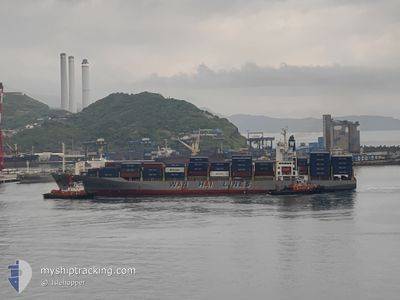
WAN HAI 303
Container Ship
Current Trip
CNNSS>MYPKG
| Time Travelled | 1 day |
|---|---|
| Remaining Time | --- |
| Distance Travelled | 199.48 nm |
| Remaining Distance | --- |
| AVG Speed | 13 Knots |
| MAX Speed | 15.6 Knots |
| AVG Wind | 11.5 knots |
| MAX Wind | 17.8 knots |
| MIN Temp | 23.1°C / 73.58°F |
| MAX Temp | 31.4°C / 88.52°F |
| Dybgang | 11.4 m |
| Position Modtaget | 15 d siden |
Current Position
| Longitude | 103.44976° |
|---|---|
| Latitude | 1.22345° |
| Status | Under way using engine |
| Fart | 14.1 Knots |
| Kurs | 286.2° |
| Område | Malacca Strait |
| Station | T-AIS |
| Position Modtaget | 15 d siden |
Info
Information
The current position of WAN HAI 303 is in Malacca Strait with coordinates 1.22345° / 103.44976° as reported on 2024-04-28 00:12 by AIS to our vessel tracker app. The vessel's current speed is 14.1 Knots
The vessel WAN HAI 303 (IMO: 9238179, MMSI: 564524000) is a Container Ship that was built in 2002 ( 22 år gamle ). It's sailing under the flag of [SG] Singapore.
In this page you can find informations about the vessels current position, last detected port calls, and current voyage information. If the vessels is not in coverage by AIS you will find the latest position.
The current position of WAN HAI 303 is detected by our AIS receivers and we are not responsible for the reliability of the data. The last position was recorded while the vessel was in Coverage by the Ais receivers of our vessel tracking app.
The current draught of WAN HAI 303 as reported by AIS is 11.4 meters
Weather
| Temperature | 27.2°C / 80.96°F |
|---|---|
| Wind Speed | 8 knots |
| Direction | 157° SSE |
| Pressure | 1011.6 hPa |
| Humidity | 72.9 % |
| Cloud Coverage | 81 % |
Featured Company
Last Port Calls
| Port | Arrival | Departure | Time In Port |
|---|---|---|---|
| 2024-05-11 08:19 | 2024-05-12 09:23 | 1 d | |
| 2024-04-28 20:52 | 2024-04-29 13:48 | 16 h | |
| 2024-04-23 14:33 | 2024-04-24 01:28 | 10 h | |
| 2024-04-16 02:51 | 2024-04-16 15:43 | 12 h | |
| 2024-04-06 13:29 | 2024-04-07 02:00 | 12 h | |
| 2024-03-24 10:55 | 2024-03-27 05:19 | 2 d | |
| 2024-03-03 07:29 |
Most Visited Ports (Last year)
| Port | Arrivals | |
|---|---|---|
| 20 | ||
| 13 | ||
| 10 | ||
| 7 | ||
| 7 | ||
| 7 |
Last Trips
| Origin | Departure | Destination | Arrival | Distance | |
|---|---|---|---|---|---|
| 2024-04-29 13:48 | 2024-05-11 08:19 | 3993.33 nm | |||
| 2024-04-24 01:28 | 2024-04-28 20:52 | 1652.21 nm | |||
| 2024-04-16 15:43 | 2024-04-23 14:33 | 1409.95 nm | |||
| 2024-04-07 02:00 | 2024-04-16 02:51 | 2751.91 nm | |||
| 2024-03-27 05:19 | 2024-04-06 13:29 | 3948.02 nm |
Events
| Tid | Hændelsen | Detaljer | Position / Dest | Info |
|---|---|---|---|---|
| 2024-05-12 21:27 | STOP Sejllads | 8.73 nm, North of DAR ES SALAAM |
-6.68000 / 39.32859
CNNSS>MYPKG
|
Fart: 0.2 kn Kurs: 218° |
| 2024-05-12 06:23 | START Sejllads | 0.45 nm, West of MOMBASA |
-4.04722 / 39.63280
CNNSS>MYPKG
|
Fart: 7.5 kn Kurs: 87° |
| 2024-05-12 06:23 | Afsejlet fra sidste havn |
|
-4.04722 / 39.63280
CNNSS>MYPKG
|
Fart: 2.1 kn Kurs: 114° |
| 2024-05-11 05:19 | STOP Sejllads |
-4.04563 / 39.62776
[KE] MOMBASA
|
Fart: 0.3 kn Kurs: 242° |
|
| 2024-05-11 05:19 | Skibe i havn |
|
-4.04563 / 39.62776
[KE] MOMBASA
|
Fart: 0.9 kn Kurs: 240° |