
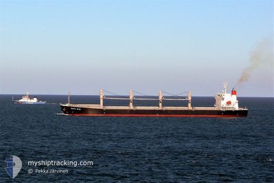
VMAS SUZHOU
Bulk Carrier
Current Trip
BLW(ALL CREW CHINESD
| Time Travelled | 18 h, 23 mins |
|---|---|
| Remaining Time | --- |
| Distance Travelled | 223.32 nm |
| Remaining Distance | --- |
| AVG Speed | 12.7 Knots |
| MAX Speed | 14.6 Knots |
| AVG Wind | 6 knots |
| MAX Wind | 10 knots |
| MIN Temp | 26.2°C / 79.16°F |
| MAX Temp | 30.8°C / 87.44°F |
| Dybgang | 9.6 m |
| Position Modtaget | 18 d siden |
Current Position
| Longitude | 39.03583° |
|---|---|
| Latitude | 18.88515° |
| Status | Under way using engine |
| Fart | 12.4 Knots |
| Kurs | 157° |
| Område | Red Sea |
| Station | T-AIS |
| Position Modtaget | 18 d siden |
Info
Information
The current position of VMAS SUZHOU is in Red Sea with coordinates 18.88515° / 39.03583° as reported on 2024-04-11 03:39 by AIS to our vessel tracker app. The vessel's current speed is 12.4 Knots
The vessel VMAS SUZHOU (IMO: 9322774, MMSI: 636018932) is a Bulk Carrier that was built in 2005 ( 19 år gamle ). It's sailing under the flag of [LR] Liberia.
In this page you can find informations about the vessels current position, last detected port calls, and current voyage information. If the vessels is not in coverage by AIS you will find the latest position.
The current position of VMAS SUZHOU is detected by our AIS receivers and we are not responsible for the reliability of the data. The last position was recorded while the vessel was in Coverage by the Ais receivers of our vessel tracking app.
The current draught of VMAS SUZHOU as reported by AIS is 9.6 meters
Weather
| Temperature | 30.2°C / 86.36°F |
|---|---|
| Wind Speed | 10 knots |
| Direction | 119° ESE |
| Pressure | 1008.6 hPa |
| Humidity | 78.6 % |
| Cloud Coverage | 95 % |
Featured Company
Last Port Calls
| Port | Arrival | Departure | Time In Port |
|---|---|---|---|
| 2024-04-25 06:48 | 2024-04-28 21:48 | 3 d | |
| 2024-04-08 03:44 | 2024-04-08 13:20 | 9 h | |
| 2024-03-20 11:40 | |||
| 2024-02-24 06:12 | 2024-03-04 09:59 | 9 d | |
| 2024-02-17 01:14 | 2024-02-21 23:07 | 4 d | |
| 2024-02-15 06:05 | 2024-02-15 15:27 | 9 h |
Most Visited Ports (Last year)
| Port | Arrivals | |
|---|---|---|
| 2 | ||
| 2 | ||
| 1 | ||
| 1 | ||
| 1 | ||
| 1 |
Last Trips
| Origin | Departure | Destination | Arrival | Distance | |
|---|---|---|---|---|---|
| 2024-03-04 12:59 | 2024-03-20 14:40 | 964.46 nm | |||
| 2024-02-22 02:07 | 2024-02-24 09:12 | 682.59 nm | |||
| 2024-01-29 00:10 | 2024-02-17 04:14 | 5304.85 nm | |||
| 2024-01-29 00:10 | 2024-02-15 08:05 | 4837.81 nm |
Events
| Tid | Hændelsen | Detaljer | Position / Dest | Info |
|---|---|---|---|---|
| 2024-04-28 21:48 | Afsejlet fra sidste havn |
|
3.80918 / 98.72545
BLW(ALL CREW CHINESD
|
Fart: 6.5 kn Kurs: 40° |
| 2024-04-28 21:32 | START Sejllads |
3.79078 / 98.70607
[ID] BELAWAN
|
Fart: 5 kn Kurs: 77° |
|
| 2024-04-25 06:56 | STOP Sejllads |
3.78830 / 98.70049
[ID] BELAWAN
|
Fart: 0.2 kn Kurs: 83° |
|
| 2024-04-25 06:48 | Skibe i havn |
|
3.78890 / 98.70010
[ID] BELAWAN
|
Fart: 1.4 kn Kurs: 76° |
| 2024-04-25 05:13 | START Sejllads | 8.53 nm, North East of BELAWAN |
3.92170 / 98.77296
BLW(ALL CREW CHINESD
|
Fart: 4.6 kn Kurs: 260° |
| 2024-04-24 19:25 | STOP Sejllads | 8.7 nm, North East of BELAWAN |
3.92107 / 98.78015
BLW(ALL CREW CHINESD
|
Fart: 0.1 kn Kurs: 302° |