
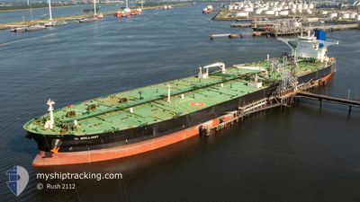
VL BRILLIANT
Tanker
Current Trip
| Time Travelled | --- |
|---|---|
| Remaining Time | 14 h, 36 mins |
| Distance Travelled | 7506.37 nm |
| Remaining Distance | 428.96 nm |
| AVG Speed | 10.3 Knots |
| MAX Speed | 13.9 Knots |
| AVG Wind | 9.8 knots |
| MAX Wind | 25 knots |
| MIN Temp | 24.8°C / 76.64°F |
| MAX Temp | 32.8°C / 91.04°F |
| Dybgang | 20.5 m |
| Position Modtaget | 9 d siden |
Current Position
| Longitude | --- |
|---|---|
| Latitude | --- |
| Status | Constrained by her draught |
| Fart | 10.7 Knots |
| Kurs | 44.6° |
| Område | South China Sea |
| Station | T-AIS |
| Position Modtaget | 9 d siden |
Info
Information
The current position of VL BRILLIANT is in South China Sea with coordinates 1.31277° / 104.35450° as reported on 2025-12-25 17:38 by AIS to our vessel tracker app. The vessel's current speed is 10.7 Knots and is heading at the port of QINGDAO. The estimated time of arrival as calculated by MyShipTracking vessel tracking app is 2026-01-04 23:33 LT
The vessel VL BRILLIANT (IMO: 9683673, MMSI: 636023888) is a Tanker It's sailing under the flag of [LR] Liberia.
In this page you can find informations about the vessels current position, last detected port calls, and current voyage information. If the vessels is not in coverage by AIS you will find the latest position.
The current position of VL BRILLIANT is detected by our AIS receivers and we are not responsible for the reliability of the data. The last position was recorded while the vessel was in Coverage by the Ais receivers of our vessel tracking app.
The current draught of VL BRILLIANT as reported by AIS is 20.5 meters
Weather
| Temperature | 7.8°C / 46.04°F |
|---|---|
| Wind Speed | 8 knots |
| Direction | 174° S |
| Pressure | 1027.3 hPa |
| Humidity | 76.1 % |
| Cloud Coverage | 10 % |
Featured Company
Last Port Calls
Most Visited Ports (Last year)
| Port | Arrivals | |
|---|---|---|
| 1 | ||
| 1 | ||
| 1 |
Last Trips
| Origin | Departure | Destination | Arrival | Distance |
|---|
Events
| Tid | Hændelsen | Detaljer | Position / Dest | Info |
|---|---|---|---|---|
| 2026-01-03 04:45 | STOP Sejllads | 7.98 nm, East of NINGBO |
29.92328 / 121.99781
QINGDAO
|
Fart: 0.3 kn Kurs: 304° |
| 2026-01-02 19:29 | START Sejllads |
29.27368 / 123.25594
QINGDAO
|
Fart: 4.4 kn Kurs: 330° |
|
| 2026-01-02 08:44 | STOP Sejllads |
29.41360 / 123.06712
QINGDAO
|
Fart: 0.3 kn Kurs: 12° |
|
| 2025-12-25 17:44 | Status er ændret | Default Constrained by her draught |
1.32623 / 104.36902
QINGDAO
|
Fart: 10.7 kn Kurs: 44.6° |
| 2025-12-25 17:38 | Ændre havområde | Malaysian part of the South China Sea Malaysian part of the Singapore Strait |
1.31277 / 104.35450
South China Sea
QINGDAO
|
Fart: 10.7 kn Kurs: 44.6° |
| 2025-12-25 17:38 | Udenfor Dækning |
1.31277 / 104.35450
South China Sea
QINGDAO
|
Fart: 10.7 kn Kurs: 44.6° |
|
| 2025-12-25 16:29 | Ændre havområde | Malaysian part of the Singapore Strait Indonesian part of the Singapore Strait |
1.26109 / 104.15063
Singapore Strait
QINGDAO
|
Fart: 11.3 kn Kurs: 84.6° |
| 2025-12-25 15:19 | Ændre havområde | Indonesian part of the Singapore Strait Singaporean part of the Singapore Strait |
1.24578 / 103.97781
Singapore Strait
QINGDAO
|
Fart: 9 kn Kurs: 86.7° |
| 2025-12-25 14:59 | START Sejllads | 4.94 nm, South West of TANAH MERAH |
1.26568 / 103.94979
QINGDAO
|
Fart: 3.2 kn Kurs: 148° |
| 2025-12-25 14:50 | Status er ændret | Constrained by her draught At anchor |
1.26958 / 103.95213
QINGDAO
|
Fart: 0.4 kn Kurs: 261° |