
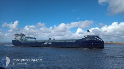
VERTOM JOYCE
Cargo
Current Trip
| Time Travelled | 2 days |
|---|---|
| Remaining Time | 4 days |
| Distance Travelled | 468.92 nm |
| Remaining Distance | 993.05 nm |
| AVG Speed | 7.9 Knots |
| MAX Speed | 13.6 Knots |
| AVG Wind | 13.6 knots |
| MAX Wind | 23.3 knots |
| MIN Temp | 6.5°C / 43.7°F |
| MAX Temp | 10.5°C / 50.9°F |
| Dybgang | 6.4 m |
| Position Modtaget | 1 m siden |
Current Position
| Longitude | --- |
|---|---|
| Latitude | --- |
| Status | Under way using engine |
| Fart | 10.5 Knots |
| Kurs | 231.8° |
| Område | North Sea |
| Station | T-AIS |
| Position Modtaget | 1 m siden |
Info
Information
The current position of VERTOM JOYCE is in North Sea with coordinates 53.01684° / 4.12558° as reported on 2025-12-12 16:04 by AIS to our vessel tracker app. The vessel's current speed is 10.5 Knots and is heading at the port of LEIXOES. The estimated time of arrival as calculated by MyShipTracking vessel tracking app is 2025-12-16 17:57 LT
The vessel VERTOM JOYCE (IMO: 9993365, MMSI: 244549000) is a Cargo It's sailing under the flag of [NL] Netherlands.
In this page you can find informations about the vessels current position, last detected port calls, and current voyage information. If the vessels is not in coverage by AIS you will find the latest position.
The current position of VERTOM JOYCE is detected by our AIS receivers and we are not responsible for the reliability of the data. The last position was recorded while the vessel was in Coverage by the Ais receivers of our vessel tracking app.
The current draught of VERTOM JOYCE as reported by AIS is 6.4 meters
Weather
| Temperature | 10.1°C / 50.18°F |
|---|---|
| Wind Speed | 12 knots |
| Direction | 203° SSW |
| Pressure | 1019.3 hPa |
| Humidity | 94.6 % |
| Cloud Coverage | 100 % |
Featured Company
Last Trips
Events
| Tid | Hændelsen | Detaljer | Position / Dest | Info |
|---|---|---|---|---|
| 2025-12-12 06:34 | Fundet i havområde | Dutch part of the North Sea |
53.80432 / 6.20851
North Sea
PTLEI VIA NOK
|
Fart: 10.6 kn Kurs: 251° |
| 2025-12-12 00:38 | Indenfor Dækning |
54.02502 / 7.71551
North Sea
PTLEI VIA NOK
|
Fart: 7.9 kn Kurs: 257.3° |
|
| 2025-12-11 23:23 | Udenfor Dækning |
54.01200 / 8.02034
North Sea
PTLEI VIA NOK
|
Fart: 8.7 kn Kurs: 271.9° |
|
| 2025-12-11 19:17 | Fundet i havområde | German part of the North Sea |
53.89213 / 9.14144
North Sea
PTLEI VIA NOK
|
Fart: 3.8 kn Kurs: 227° |
| 2025-12-11 19:16 | START Sejllads | 0.89 nm, South West of BRUNSBUETTEL |
53.89247 / 9.14207
PTLEI VIA NOK
|
Fart: 3.3 kn Kurs: 225° |
| 2025-12-11 18:31 | STOP Sejllads | 0.78 nm, South West of BRUNSBUETTEL |
53.89374 / 9.14452
PTLEI VIA NOK
|
Fart: 0.3 kn Kurs: 225° |
| 2025-12-11 14:35 | START Sejllads | 6.74 nm, North East of FISCHERHUTTE |
54.19806 / 9.54913
PTLEI VIA NOK
|
Fart: 4.1 kn Kurs: 232° |
| 2025-12-11 14:14 | STOP Sejllads | 6.85 nm, North East of FISCHERHUTTE |
54.19911 / 9.55194
PTLEI VIA NOK
|
Fart: 0.3 kn Kurs: 235° |
| 2025-12-11 10:13 | START Sejllads | 2.29 nm, West of STICKENHΟRN SPORT |
54.37139 / 10.10555
PTLEI VIA NOK
|
Fart: 3.1 kn Kurs: 278° |
| 2025-12-11 09:32 | Status er ændret | Under way using engine Moored |
54.36687 / 10.12822
PTLEI VIA NOK
|
Fart: Kurs: 283° |