
VECCO
Cargo
Current Trip
| Time Travelled | 4 days |
|---|---|
| Remaining Time | --- |
| Distance Travelled | 1028.54 nm |
| Remaining Distance | --- |
| AVG Speed | 10.1 Knots |
| MAX Speed | 13.6 Knots |
| AVG Wind | 14.5 knots |
| MAX Wind | 29 knots |
| MIN Temp | 22°C / 71.6°F |
| MAX Temp | 34.4°C / 93.92°F |
| Dybgang | 9.4 m |
| Position Modtaget | 19 h, 43 m siden |
Current Position
| Longitude | --- |
|---|---|
| Latitude | --- |
| Status | Under way using engine |
| Fart | 10.7 Knots |
| Kurs | 211.2° |
| Område | South Atlantic Ocean |
| Station | T-AIS |
| Position Modtaget | 19 h, 43 m siden |
Info
Information
The current position of VECCO is in South Atlantic Ocean with coordinates -29.40119° / -48.41192° as reported on 2025-12-12 05:23 by AIS to our vessel tracker app. The vessel's current speed is 10.7 Knots and is heading at the port of LIRQUEN. The estimated time of arrival as calculated by MyShipTracking vessel tracking app is 2025-12-22 09:00 LT
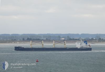
The vessel VECCO (IMO: 9696852, MMSI: 311001022) is a Cargo It's sailing under the flag of [BS] Bahamas.
In this page you can find informations about the vessels current position, last detected port calls, and current voyage information. If the vessels is not in coverage by AIS you will find the latest position.
The current position of VECCO is detected by our AIS receivers and we are not responsible for the reliability of the data. The last position was recorded while the vessel was in Coverage by the Ais receivers of our vessel tracking app.
The current draught of VECCO as reported by AIS is 9.4 meters
Weather
| Temperature | 22.6°C / 72.68°F |
|---|---|
| Wind Speed | 10 knots |
| Direction | 4° N |
| Pressure | 1002.9 hPa |
| Humidity | 82.4 % |
| Cloud Coverage | 39 % |
Featured Company
Last Port Calls
| Port | Arrival | Departure | Time In Port |
|---|---|---|---|
| 2025-12-05 02:14 | 2025-12-08 08:28 | 3 d | |
| 2025-10-31 07:42 | 2025-11-09 06:41 | 8 d | |
| 2025-10-08 16:26 | 2025-10-14 13:37 | 5 d |
Most Visited Ports (Last year)
| Port | Arrivals | |
|---|---|---|
| 2 | ||
| 2 | ||
| 1 | ||
| 1 | ||
| 1 | ||
| 1 |
Last Trips
| Origin | Departure | Destination | Arrival | Distance | |
|---|---|---|---|---|---|
| 2025-11-09 06:41 | 2025-12-05 02:14 | 463.32 nm | |||
| 2025-10-14 13:37 | 2025-10-31 07:42 | 1417.27 nm | |||
| 2025-09-21 18:58 | 2025-10-08 16:26 | 4831.21 nm |
Events
| Tid | Hændelsen | Detaljer | Position / Dest | Info |
|---|---|---|---|---|
| 2025-12-12 05:27 | Status er ændret | Default Under way using engine |
-29.41167 / -48.41833
CL LQN
|
Fart: 10.7 kn Kurs: 211.2° |
| 2025-12-12 05:23 | Udenfor Dækning |
-29.40119 / -48.41192
South Atlantic Ocean
CL LQN
|
Fart: 10.7 kn Kurs: 211.2° |
|
| 2025-12-12 05:18 | Status er ændret | Under way using engine Default |
-29.38988 / -48.40399
CL LQN
|
Fart: 10.8 kn Kurs: 212° |
| 2025-12-12 05:09 | Status er ændret | Default Under way using engine |
-29.36500 / -48.38667
CL LQN
|
Fart: 10.8 kn Kurs: 213.4° |
| 2025-12-12 04:58 | Status er ændret | Under way using engine Default |
-29.33808 / -48.36631
CL LQN
|
Fart: 10.6 kn Kurs: 214° |
| 2025-12-12 04:58 | Indenfor Dækning |
-29.35420 / -48.37828
South Atlantic Ocean
CL LQN
|
Fart: 10.8 kn Kurs: 213.4° |
|
| 2025-12-12 01:49 | Status er ændret | Default Under way using engine |
-28.91601 / -47.98989
CL LQN
|
Fart: 9.1 kn Kurs: 219° |
| 2025-12-12 01:44 | Udenfor Dækning |
-28.90568 / -47.97926
South Atlantic Ocean
CL LQN
|
Fart: 9.1 kn Kurs: 219° |
|
| 2025-12-12 01:36 | Status er ændret | Under way using engine Default |
-28.89207 / -47.96585
CL LQN
|
Fart: 9 kn Kurs: 220° |
| 2025-12-12 01:07 | Status er ændret | Default Under way using engine |
-28.83920 / -47.91416
CL LQN
|
Fart: 8.6 kn Kurs: 217.5° |