
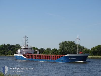
VAERMLAND
General Cargo
Current Trip
| Time Travelled | 10 h, 28 mins |
|---|---|
| Remaining Time | 59 mins |
| Distance Travelled | 59.31 nm |
| Remaining Distance | 8.81 nm |
| AVG Speed | 6.6 Knots |
| MAX Speed | 9.4 Knots |
| AVG Wind | 7.2 knots |
| MAX Wind | 12 knots |
| MIN Temp | 11.2°C / 52.16°F |
| MAX Temp | 13.3°C / 55.94°F |
| Dybgang | 3.6 m |
| Position Modtaget | 1 m siden |
Current Position
| Longitude | 8.34883° |
|---|---|
| Latitude | 53.68731° |
| Status | Under way using engine |
| Fart | 7.1 Knots |
| Kurs | 141.6° |
| Område | North Sea |
| Station | T-AIS |
| Position Modtaget | 1 m siden |
Info
Information
The current position of VAERMLAND is in North Sea with coordinates 53.68731° / 8.34883° as reported on 2024-05-07 21:31 by AIS to our vessel tracker app. The vessel's current speed is 7.1 Knots and is heading at the port of BREMERHAVEN. The estimated time of arrival as calculated by MyShipTracking vessel tracking app is 2024-05-07 22:31 LT
The vessel VAERMLAND (IMO: 9196254, MMSI: 218797000) is a General Cargo that was built in 1999 ( 25 år gamle ). It's sailing under the flag of [DE] Germany.
In this page you can find informations about the vessels current position, last detected port calls, and current voyage information. If the vessels is not in coverage by AIS you will find the latest position.
The current position of VAERMLAND is detected by our AIS receivers and we are not responsible for the reliability of the data. The last position was recorded while the vessel was in Coverage by the Ais receivers of our vessel tracking app.
The current draught of VAERMLAND as reported by AIS is 3.6 meters
Weather
| Temperature | 11.3°C / 52.34°F |
|---|---|
| Wind Speed | 12 knots |
| Direction | 95° E |
| Pressure | 1023.4 hPa |
| Humidity | 84.4 % |
| Cloud Coverage | 92 % |
Featured Company
Last Port Calls
| Port | Arrival | Departure | Time In Port |
|---|---|---|---|
| 2024-05-06 09:28 | 2024-05-07 11:04 | 1 d | |
| 2024-05-02 11:16 | 2024-05-03 11:36 | 1 d | |
| 2024-04-28 05:59 | 2024-04-30 18:29 | 2 d | |
| 2024-04-24 02:43 | 2024-04-27 17:20 | 3 d | |
| 2024-04-21 10:36 | 2024-04-22 23:12 | 1 d | |
| 2024-04-19 03:24 | 2024-04-19 15:53 | 12 h | |
| 2024-04-16 16:47 | 2024-04-17 18:13 | 1 d | |
| 2024-04-14 22:08 | 2024-04-14 23:09 | 1 h | |
| 2024-04-09 21:50 | 2024-04-11 21:26 | 1 d | |
| 2024-04-08 16:57 | 2024-04-09 06:25 | 13 h |
Last Trips
| Origin | Departure | Destination | Arrival | Distance | |
|---|---|---|---|---|---|
| 2024-05-03 14:36 | 2024-05-06 11:28 | 533.84 nm | |||
| 2024-04-30 20:29 | 2024-05-02 14:16 | 338.14 nm | |||
| 2024-04-27 19:20 | 2024-04-28 07:59 | 108.70 nm | |||
| 2024-04-23 01:12 | 2024-04-24 04:43 | 186.67 nm | |||
| 2024-04-19 17:53 | 2024-04-21 12:36 | 265.21 nm | |||
| 2024-04-17 20:13 | 2024-04-19 05:24 | 275.72 nm | |||
| 2024-04-15 01:09 | 2024-04-16 18:47 | 121.36 nm | |||
| 2024-04-12 00:26 | 2024-04-15 00:08 | 557.58 nm | |||
| 2024-04-09 09:25 | 2024-04-10 00:50 | 7.77 nm | |||
| 2024-04-05 13:48 | 2024-04-08 19:57 | 648.72 nm |
Events
| Tid | Hændelsen | Detaljer | Position / Dest | Info |
|---|---|---|---|---|
| 2024-05-07 19:23 | Dybgangen er ændret | 3.6 4.6 |
53.87910 / 8.10259
DEBRV
|
Fart: 7.6 kn Kurs: 116° |
| 2024-05-07 19:23 | Destination er ændret | DEBRV DEBUM |
53.87910 / 8.10259
DEBRV
|
Fart: 7.6 kn Kurs: 116° |
| 2024-05-07 19:23 | ETA er ændret | 2024/05/08 01:00 2024/05/06 05:00 |
53.87910 / 8.10259
DEBRV
|
Fart: 7.6 kn Kurs: 116° |
| 2024-05-07 18:53 | Status er ændret | Under way using engine Default |
53.90650 / 8.01015
DEBUM
|
Fart: 6.7 kn Kurs: 124° |
| 2024-05-07 18:52 | Status er ændret | Default Under way using engine |
53.90814 / 8.00618
DEBUM
|
Fart: 6.1 kn Kurs: 139.1° |
| 2024-05-07 18:39 | Status er ændret | Under way using engine Default |
53.92410 / 7.99393
DEBUM
|
Fart: 4.7 kn Kurs: 222° |
| 2024-05-07 18:32 | Indenfor Dækning |
53.92231 / 7.99261
North Sea
|
Fart: 5 kn Kurs: 202.8° |
|
| 2024-05-07 18:12 | START Sejllads | 12.02 nm, North East of WANGEROOGE |
53.95155 / 8.02264
DEBUM
|
Fart: 3.3 kn Kurs: 259° |
| 2024-05-07 17:24 | Status er ændret | Default Under way using engine |
53.94749 / 8.00502
DEBUM
|
Fart: 0.5 kn Kurs: 130° |
| 2024-05-07 17:15 | Udenfor Dækning |
53.94634 / 8.00334
North Sea
|
Fart: 0.5 kn Kurs: 36.2° |