
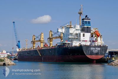
UNION TRADER
Bulk Carrier
Current Trip
| Time Travelled | 52 days |
|---|---|
| Remaining Time | 18 h, 5 mins |
| Distance Travelled | 4417.87 nm |
| Remaining Distance | 206.18 nm |
| AVG Speed | 11.2 Knots |
| MAX Speed | 12.9 Knots |
| AVG Wind | 13.6 knots |
| MAX Wind | 26 knots |
| MIN Temp | 17.1°C / 62.78°F |
| MAX Temp | 30.9°C / 87.62°F |
| Dybgang | 11.8 m |
| Position Modtaget | 4 d siden |
Current Position
| Longitude | -74.19875° |
|---|---|
| Latitude | 21.83827° |
| Status | Under way using engine |
| Fart | 11.1 Knots |
| Kurs | 259.2° |
| Område | North Atlantic Ocean |
| Station | T-AIS |
| Position Modtaget | 4 d siden |
Info
Information
The current position of UNION TRADER is in North Atlantic Ocean with coordinates 21.83827° / -74.19875° as reported on 2024-04-27 10:12 by AIS to our vessel tracker app. The vessel's current speed is 11.1 Knots and is heading at the port of COATZACOALCOS. The estimated time of arrival as calculated by MyShipTracking vessel tracking app is 2024-05-02 05:38 LT
The vessel UNION TRADER (IMO: 9445710, MMSI: 538007144) is a Bulk Carrier that was built in 2010 ( 14 år gamle ). It's sailing under the flag of [MH] Marshall Is.
In this page you can find informations about the vessels current position, last detected port calls, and current voyage information. If the vessels is not in coverage by AIS you will find the latest position.
The current position of UNION TRADER is detected by our AIS receivers and we are not responsible for the reliability of the data. The last position was recorded while the vessel was in Coverage by the Ais receivers of our vessel tracking app.
The current draught of UNION TRADER as reported by AIS is 11.8 meters
Weather
| Temperature | 26.5°C / 79.7°F |
|---|---|
| Wind Speed | 15 knots |
| Direction | 95° E |
| Pressure | 1008.9 hPa |
| Humidity | 89.7 % |
| Cloud Coverage | 54 % |
Featured Company
Most Visited Ports (Last year)
| Port | Arrivals | |
|---|---|---|
| 3 | ||
| 2 | ||
| 2 | ||
| 1 | ||
| 1 | ||
| 1 |
Events
| Tid | Hændelsen | Detaljer | Position / Dest | Info |
|---|---|---|---|---|
| 2024-04-27 10:22 | Status er ændret | Default Under way using engine |
21.83263 / -74.23175
COATZACOALCOS
|
Fart: 11.1 kn Kurs: 259.2° |
| 2024-04-27 10:12 | Status er ændret | Under way using engine Default |
21.83827 / -74.19875
COATZACOALCOS
|
Fart: 11.3 kn Kurs: 259° |
| 2024-04-27 10:12 | Udenfor Dækning |
21.83827 / -74.19875
North Atlantic Ocean
COATZACOALCOS
|
Fart: 11.1 kn Kurs: 259.2° |
|
| 2024-04-27 09:55 | Indenfor Dækning |
21.83827 / -74.19875
North Atlantic Ocean
COATZACOALCOS
|
Fart: 11.1 kn Kurs: 259.2° |
|
| 2024-04-27 02:49 | Status er ændret | Default Under way using engine |
22.09218 / -72.73933
COATZACOALCOS
|
Fart: 11.2 kn Kurs: 261.7° |
| 2024-04-27 02:43 | Udenfor Dækning |
22.09478 / -72.72231
North Atlantic Ocean
COATZACOALCOS
|
Fart: 11.2 kn Kurs: 261.7° |
|
| 2024-04-27 01:24 | Fundet i havområde | Bahamas part of the North Atlantic Ocean |
22.15295 / -72.45674
North Atlantic Ocean
COATZACOALCOS
|
Fart: 11.4 kn Kurs: 254.4° |
| 2024-04-27 01:24 | Status er ændret | Under way using engine Default |
22.15295 / -72.45674
COATZACOALCOS
|
Fart: 11.4 kn Kurs: 254° |
| 2024-04-27 01:20 | Status er ændret | Default Under way using engine |
22.15593 / -72.44393
COATZACOALCOS
|
Fart: 11.4 kn Kurs: 256.4° |
| 2024-04-27 00:33 | ETA er ændret | 2024/05/02 00:01 2024/04/29 22:00 |
22.18970 / -72.28571
COATZACOALCOS
|
Fart: 11.4 kn Kurs: 257.3° |