
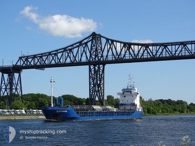
ULTRAMAR
General Cargo
Current Trip
| Time Travelled | 1 day |
|---|---|
| Remaining Time | --- |
| Distance Travelled | 260.02 nm |
| Remaining Distance | --- |
| AVG Speed | 10.3 Knots |
| MAX Speed | 11.3 Knots |
| AVG Wind | 7.7 knots |
| MAX Wind | 11.1 knots |
| MIN Temp | 4.7°C / 40.46°F |
| MAX Temp | 8.8°C / 47.84°F |
| Dybgang | 5.4 m |
| Position Modtaget | Nu |
Current Position
| Longitude | 16.57131° |
|---|---|
| Latitude | 56.00533° |
| Status | Under way using engine |
| Fart | 11 Knots |
| Kurs | 59.8° |
| Område | Baltic Sea |
| Station | T-AIS |
| Position Modtaget | Nu |
Info
Information
The current position of ULTRAMAR is in Baltic Sea with coordinates 56.00533° / 16.57131° as reported on 2024-04-27 19:51 by AIS to our vessel tracker app. The vessel's current speed is 11 Knots and is heading at the port of VASTERAS. The estimated time of arrival as calculated by MyShipTracking vessel tracking app is 2024-04-28 15:00 LT
The vessel ULTRAMAR (IMO: 9167320, MMSI: 209662000) is a General Cargo that was built in 1997 ( 27 år gamle ). It's sailing under the flag of [CY] Cyprus.
In this page you can find informations about the vessels current position, last detected port calls, and current voyage information. If the vessels is not in coverage by AIS you will find the latest position.
The current position of ULTRAMAR is detected by our AIS receivers and we are not responsible for the reliability of the data. The last position was recorded while the vessel was in Coverage by the Ais receivers of our vessel tracking app.
The current draught of ULTRAMAR as reported by AIS is 5.4 meters
Weather
| Temperature | 6.8°C / 44.24°F |
|---|---|
| Wind Speed | 8 knots |
| Direction | 95° E |
| Pressure | 1016.4 hPa |
| Humidity | 80.4 % |
| Cloud Coverage | 62 % |
Featured Company
Last Port Calls
| Port | Arrival | Departure | Time In Port |
|---|---|---|---|
| 2024-04-26 19:12 | 2024-04-26 19:17 | 5 m | |
| 2024-04-20 15:42 | 2024-04-24 19:00 | 4 d | |
| 2024-04-17 23:20 | 2024-04-19 14:51 | 1 d | |
| 2024-04-10 08:31 | 2024-04-13 00:17 | 2 d | |
| 2024-04-09 07:39 | 2024-04-10 08:15 | 1 d | |
| 2024-04-07 03:30 | 2024-04-07 18:15 | 14 h | |
| 2024-04-04 11:55 | 2024-04-05 15:37 | 1 d | |
| 2024-03-29 19:38 | 2024-03-30 21:13 | 1 d | |
| 2024-03-27 01:39 | 2024-03-28 19:10 | 1 d | |
| 2024-03-21 10:37 | 2024-03-23 13:16 | 2 d |
Last Trips
| Origin | Departure | Destination | Arrival | Distance | |
|---|---|---|---|---|---|
| 2024-04-24 20:00 | 2024-04-26 21:12 | 407.00 nm | |||
| 2024-04-19 15:51 | 2024-04-20 16:42 | 156.66 nm | |||
| 2024-04-13 03:17 | 2024-04-18 00:20 | 1081.72 nm | |||
| 2024-04-10 11:15 | 2024-04-10 11:31 | 1.46 nm | |||
| 2024-04-07 21:15 | 2024-04-09 10:39 | 350.45 nm | |||
| 2024-04-05 17:37 | 2024-04-07 06:30 | 318.01 nm | |||
| 2024-03-30 21:13 | 2024-04-04 13:55 | 869.06 nm | |||
| 2024-03-28 20:10 | 2024-03-29 19:38 | 242.74 nm | |||
| 2024-03-23 14:16 | 2024-03-27 02:39 | 830.62 nm | |||
| 2024-03-20 23:35 | 2024-03-21 11:37 | 56.18 nm |
Events
| Tid | Hændelsen | Detaljer | Position / Dest | Info |
|---|---|---|---|---|
| 2024-04-27 15:38 | Ændre havområde | Swedish part of the Baltic Sea Danish part of the Kattegat |
55.61741 / 15.37442
Baltic Sea
SEVST
|
Fart: 10.8 kn Kurs: 58.8° |
| 2024-04-27 09:53 | Fundet i havområde | Danish part of the Kattegat |
54.97621 / 14.01964
Kattegat
SEVST
|
Fart: 10.6 kn Kurs: 67.2° |
| 2024-04-27 09:47 | Fundet i havområde | Swedish part of the Baltic Sea |
54.96932 / 13.99180
Baltic Sea
SEVST
|
Fart: 10.4 kn Kurs: 66.3° |
| 2024-04-27 04:39 | ETA er ændret | 2024/04/28 15:00 2024/04/28 22:00 |
54.62022 / 12.61548
SEVST
|
Fart: 10.9 kn Kurs: 51.4° |
| 2024-04-27 02:23 | Fundet i havområde | German part of the Baltic Sea |
54.40220 / 12.08979
Baltic Sea
SEVST
|
Fart: 10.2 kn Kurs: 90.1° |
| 2024-04-27 00:08 | Ændre havområde | Danish part of the Baltic Sea German part of the Baltic Sea |
54.49564 / 11.45022
Baltic Sea
SEVST
|
Fart: 10.3 kn Kurs: 112.6° |
| 2024-04-26 21:41 | Ændre havområde | German part of the Baltic Sea Danish part of the Baltic Sea |
54.55731 / 10.76685
Baltic Sea
SEVST
|
Fart: 10.7 kn Kurs: 83.9° |
| 2024-04-26 21:17 | Ændre havområde | Danish part of the Baltic Sea German part of the Baltic Sea |
54.54925 / 10.64292
Baltic Sea
SEVST
|
Fart: 10.8 kn Kurs: 84.3° |
| 2024-04-26 19:56 | Ændre havområde | German part of the Baltic Sea German part of the North Sea |
54.46010 / 10.27264
Baltic Sea
SEVST
|
Fart: 10.7 kn Kurs: 38.8° |
| 2024-04-26 19:17 | Afsejlet fra sidste havn |
|
54.36398 / 10.17286
SEVST
|
Fart: 9.5 kn Kurs: 45° |