
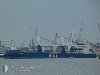
UAL AFRICA
General Cargo
Current Trip
| Time Travelled | 7 h, 4 mins |
|---|---|
| Remaining Time | 2 days |
| Distance Travelled | 3.50 nm |
| Remaining Distance | 626.17 nm |
| AVG Speed | 3.8 Knots |
| MAX Speed | 4.3 Knots |
| AVG Wind | 5 knots |
| MAX Wind | 8 knots |
| MIN Temp | 27.8°C / 82.04°F |
| MAX Temp | 28.6°C / 83.48°F |
| Dybgang | 6.8 m |
| Position Modtaget | 15 d siden |
Current Position
| Longitude | -16.58361° |
|---|---|
| Latitude | 24.64513° |
| Status | Under way using engine |
| Fart | 11.6 Knots |
| Kurs | 196.7° |
| Område | North Atlantic Ocean |
| Station | T-AIS |
| Position Modtaget | 15 d siden |
Info
Information
The current position of UAL AFRICA is in North Atlantic Ocean with coordinates 24.64513° / -16.58361° as reported on 2024-04-12 14:07 by AIS to our vessel tracker app. The vessel's current speed is 11.6 Knots and is heading at the port of TAKORADI. The estimated time of arrival as calculated by MyShipTracking vessel tracking app is 2024-04-29 14:58 LT
The vessel UAL AFRICA (IMO: 9529243, MMSI: 245890000) is a General Cargo that was built in 2011 ( 13 år gamle ). It's sailing under the flag of [NL] Netherlands.
In this page you can find informations about the vessels current position, last detected port calls, and current voyage information. If the vessels is not in coverage by AIS you will find the latest position.
The current position of UAL AFRICA is detected by our AIS receivers and we are not responsible for the reliability of the data. The last position was recorded while the vessel was in Coverage by the Ais receivers of our vessel tracking app.
The current draught of UAL AFRICA as reported by AIS is 6.8 meters
Weather
| Temperature | 27.8°C / 82.04°F |
|---|---|
| Wind Speed | 8 knots |
| Direction | 248° WSW |
| Pressure | 1005.8 hPa |
| Humidity | 82.1 % |
| Cloud Coverage | 69 % |
Featured Company
Last Port Calls
| Port | Arrival | Departure | Time In Port |
|---|---|---|---|
| 2024-04-26 13:56 | 2024-04-27 07:48 | 17 h | |
| 2024-04-23 14:29 | 2024-04-24 12:27 | 21 h | |
| 2024-04-20 07:44 | 2024-04-20 14:54 | 7 h | |
| 2024-04-11 08:30 | 2024-04-11 19:39 | 11 h | |
| 2024-03-30 11:58 | 2024-04-03 00:45 | 3 d | |
| 2024-03-26 20:25 | 2024-03-28 22:53 | 2 d | |
| 2024-03-03 11:32 | |||
| 2024-02-29 06:33 | 2024-03-01 16:16 | 1 d | |
| 2024-02-25 10:50 | 2024-02-26 09:30 | 22 h | |
| 2024-02-17 21:02 | 2024-02-24 00:06 | 6 d |
Last Trips
| Origin | Departure | Destination | Arrival | Distance | |
|---|---|---|---|---|---|
| 2024-04-24 13:27 | 2024-04-26 14:56 | 331.34 nm | |||
| 2024-04-20 14:54 | 2024-04-23 15:29 | 804.16 nm | |||
| 2024-04-11 20:39 | 2024-04-20 07:44 | 2187.71 nm | |||
| 2024-04-03 02:45 | 2024-04-11 09:30 | 1882.10 nm | |||
| 2024-03-28 22:53 | 2024-03-30 12:58 | 439.56 nm | |||
| 2024-03-01 17:16 | 2024-03-03 12:32 | 516.15 nm | |||
| 2024-02-26 10:30 | 2024-02-29 07:33 | 164.71 nm | |||
| 2024-02-24 01:06 | 2024-02-25 11:50 | 198.96 nm | |||
| 2024-02-14 16:39 | 2024-02-17 22:02 | 889.61 nm | |||
| 2024-02-01 13:57 | 2024-02-14 08:46 | 3076.77 nm |
Events
| Tid | Hændelsen | Detaljer | Position / Dest | Info |
|---|---|---|---|---|
| 2024-04-27 08:23 | STOP Sejllads | 2.05 nm, North of LUBA |
3.49938 / 8.56118
TAKORADI
|
Fart: 0.1 kn Kurs: 13° |
| 2024-04-27 07:52 | START Sejllads | 0.28 nm, North East of LUBA |
3.47104 / 8.55202
TAKORADI
|
Fart: 4.8 kn Kurs: 23° |
| 2024-04-27 07:48 | Afsejlet fra sidste havn |
|
3.47104 / 8.55202
TAKORADI
|
Fart: Kurs: -1° |
| 2024-04-26 13:56 | STOP Sejllads |
3.46500 / 8.54833
[GQ] LUBA
|
Fart: Kurs: -1° |
|
| 2024-04-26 13:56 | Skibe i havn |
|
3.46500 / 8.54833
[GQ] LUBA
|
Fart: 0.6 kn Kurs: 279° |
| 2024-04-26 13:24 | START Sejllads | 0.83 nm, North East of LUBA |
3.47738 / 8.55894
TAKORADI
|
Fart: 4.2 kn Kurs: 192° |
| 2024-04-26 13:04 | STOP Sejllads | 1.11 nm, North East of LUBA |
3.48325 / 8.55873
TAKORADI
|
Fart: 0.1 kn Kurs: 190° |
| 2024-04-26 10:12 | START Sejllads | 1.68 nm, South East of PUNTA EUROPA TERMINA |
3.77476 / 8.74624
TAKORADI
|
Fart: 6.9 kn Kurs: 6° |
| 2024-04-25 12:32 | STOP Sejllads | 1.94 nm, South East of PUNTA EUROPA TERMINA |
3.76427 / 8.74421
TAKORADI
|
Fart: 0.1 kn Kurs: 253° |
| 2024-04-24 12:27 | Afsejlet fra sidste havn |
|
-.67986 / 8.78621
TAKORADI
|
Fart: 4 kn Kurs: 56° |