
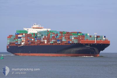
TIANJIN
Cargo A
Current Trip
| Time Travelled | 8 days |
|---|---|
| Remaining Time | --- |
| Distance Travelled | 3240.42 nm |
| Remaining Distance | --- |
| AVG Speed | 16 Knots |
| MAX Speed | 19.2 Knots |
| AVG Wind | 10.5 knots |
| MAX Wind | 21.9 knots |
| MIN Temp | 25.4°C / 77.72°F |
| MAX Temp | 31.3°C / 88.34°F |
| Dybgang | 14.1 m |
| Position Modtaget | 6 d siden |
Current Position
| Longitude | 107.01185° |
|---|---|
| Latitude | 10.51348° |
| Status | Moored |
| Fart | |
| Kurs | 28° |
| Område | South China Sea |
| Station | T-AIS |
| Position Modtaget | 6 d siden |
Info
Information
The current position of TIANJIN is in South China Sea with coordinates 10.51348° / 107.01185° as reported on 2024-05-27 15:00 by AIS to our vessel tracker app. The vessel's current speed is 0 Knots and is heading at the port of CAI MEP. The estimated time of arrival as calculated by MyShipTracking vessel tracking app is 2024-05-27 13:35 LT
The vessel TIANJIN (IMO: 9398462, MMSI: 636014224) is a Cargo A It's sailing under the flag of [LR] Liberia.
In this page you can find informations about the vessels current position, last detected port calls, and current voyage information. If the vessels is not in coverage by AIS you will find the latest position.
The current position of TIANJIN is detected by our AIS receivers and we are not responsible for the reliability of the data. The last position was recorded while the vessel was in Coverage by the Ais receivers of our vessel tracking app.
The current draught of TIANJIN as reported by AIS is 14.1 meters
Weather
| Temperature | 26.3°C / 79.34°F |
|---|---|
| Wind Speed | 20 knots |
| Direction | 113° ESE |
| Pressure | 1013.4 hPa |
| Humidity | 82.1 % |
| Cloud Coverage | 100 % |
Featured Company
Last Port Calls
| Port | Arrival | Departure | Time In Port |
|---|---|---|---|
| 2024-05-24 20:40 | 2024-05-25 08:08 | 11 h | |
| 2024-05-19 09:16 | 2024-05-19 22:40 | 13 h | |
| 2024-05-16 14:56 | 2024-05-17 13:00 | 22 h | |
| 2024-05-13 19:48 | 2024-05-14 14:00 | 18 h | |
| 2024-05-08 13:35 | 2024-05-09 09:20 | 19 h |
Most Visited Ports (Last year)
| Port | Arrivals | |
|---|---|---|
| 6 | ||
| 4 | ||
| 3 | ||
| 3 | ||
| 3 | ||
| 2 |
Last Trips
| Origin | Departure | Destination | Arrival | Distance | |
|---|---|---|---|---|---|
| 2024-05-19 22:40 | 2024-05-24 20:40 | 990.23 nm | |||
| 2024-05-17 13:00 | 2024-05-19 09:16 | 445.88 nm | |||
| 2024-05-14 14:00 | 2024-05-16 14:56 | 529.16 nm | |||
| 2024-05-09 09:20 | 2024-05-13 19:48 | 1223.25 nm | |||
| 2024-03-31 01:33 | 2024-05-08 13:35 | 13587.63 nm |
Events
| Tid | Hændelsen | Detaljer | Position / Dest | Info |
|---|---|---|---|---|
| 2024-05-28 00:50 | START Sejllads | 2.42 nm, South West of CAI MEP |
10.50848 / 107.00295
CAI MEP
|
Fart: 3.4 kn Kurs: 223° |
| 2024-05-27 15:01 | Status er ændret | Default Moored |
10.51347 / 107.01185
CAI MEP
|
Fart: Kurs: 28° |
| 2024-05-27 15:00 | Udenfor Dækning |
10.51348 / 107.01185
South China Sea
|
Fart: Kurs: 159° |
|
| 2024-05-27 14:47 | Status er ændret | Moored Default |
10.51342 / 107.01185
CAI MEP
|
Fart: Kurs: 28° |
| 2024-05-27 14:34 | Status er ændret | Default Moored |
10.51347 / 107.01188
CAI MEP
|
Fart: Kurs: 28° |
| 2024-05-27 14:33 | Status er ændret | Moored Default |
10.51347 / 107.01188
CAI MEP
|
Fart: Kurs: 28° |
| 2024-05-27 14:20 | Indenfor Dækning |
10.51347 / 107.01188
South China Sea
|
Fart: Kurs: 164° |
|
| 2024-05-27 11:37 | Status er ændret | Default Moored |
10.51347 / 107.01186
CAI MEP
|
Fart: Kurs: 28° |
| 2024-05-27 11:31 | Udenfor Dækning |
10.51345 / 107.01187
South China Sea
|
Fart: Kurs: 210° |
|
| 2024-05-27 11:20 | Status er ændret | Moored Default |
10.51345 / 107.01187
CAI MEP
|
Fart: Kurs: 28° |