
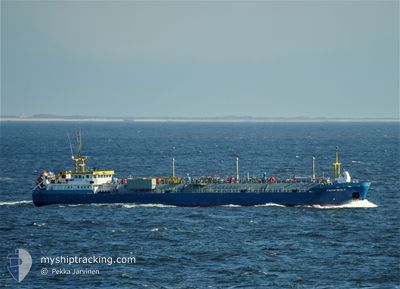
TEMPEST
Lpg Tanker
Current Trip
| Trip Time | 1 day |
|---|---|
| Trip Distance | 261.53 nm |
| AVG Speed | 6.5 Knots |
| MAX Speed | 12.2 Knots |
| Dybgang | 3.2 m |
| AVG Wind | 20 knots |
| MAX Wind | 34 knots |
| MIN Temp | 3.2°C / 37.76°F |
| MAX Temp | 10.2°C / 50.36°F |
| Position Modtaget | 1 m siden |
Current Position
| Longitude | --- |
|---|---|
| Latitude | --- |
| Status | Moored |
| Fart | |
| Kurs | 139° |
| Område | English Channel |
| Station | T-AIS |
| Position Modtaget | 1 m siden |
Info
Information
The current position of TEMPEST is in English Channel with coordinates 50.83679° / -1.32733° as reported on 2026-01-08 21:20 by AIS to our vessel tracker app. The vessel's current speed is 0 Knots and is currently inside the port of FAWLEY.
The vessel TEMPEST (IMO: 9424754, MMSI: 244285000) is a Lpg Tanker that was built in 2008 ( 18 år gamle ). It's sailing under the flag of [NL] Netherlands.
In this page you can find informations about the vessels current position, last detected port calls, and current voyage information. If the vessels is not in coverage by AIS you will find the latest position.
The current position of TEMPEST is detected by our AIS receivers and we are not responsible for the reliability of the data. The last position was recorded while the vessel was in Coverage by the Ais receivers of our vessel tracking app.
The current draught of TEMPEST as reported by AIS is 3.2 meters
Weather
| Temperature | 6.8°C / 44.24°F |
|---|---|
| Wind Speed | 38 knots |
| Direction | 183° S |
| Pressure | 973.1 hPa |
| Humidity | 87.9 % |
| Cloud Coverage | 98 % |
Featured Company
Last Port Calls
| Port | Arrival | Departure | Time In Port |
|---|---|---|---|
| 2026-01-08 20:33 | |||
| 2026-01-03 09:26 | 2026-01-07 15:21 | 4 d | |
| 2026-01-01 02:05 | 2026-01-02 03:49 | 1 d | |
| 2025-12-28 15:17 | 2025-12-30 07:38 | 1 d | |
| 2025-12-23 21:21 | 2025-12-27 07:28 | 3 d | |
| 2025-12-20 16:43 | 2025-12-22 18:34 | 2 d | |
| 2025-12-17 19:56 | 2025-12-19 14:36 | 1 d | |
| 2025-12-07 20:32 | 2025-12-09 17:08 | 1 d | |
| 2025-12-04 19:03 | 2025-12-05 12:41 | 17 h | |
| 2025-11-25 22:33 | 2025-11-26 10:45 | 12 h |
Last Trips
| Origin | Departure | Destination | Arrival | Distance | |
|---|---|---|---|---|---|
| 2026-01-07 15:21 | 2026-01-08 20:33 | 261.53 nm | |||
| 2026-01-02 03:49 | 2026-01-03 09:26 | 264.15 nm | |||
| 2025-12-30 07:38 | 2026-01-01 02:05 | 257.09 nm | |||
| 2025-12-27 07:28 | 2025-12-28 15:17 | 265.54 nm | |||
| 2025-12-22 18:34 | 2025-12-23 21:21 | 258.29 nm | |||
| 2025-12-19 14:36 | 2025-12-20 16:43 | 265.50 nm | |||
| 2025-12-09 17:08 | 2025-12-17 19:56 | 268.64 nm | |||
| 2025-12-05 12:41 | 2025-12-07 20:32 | 268.50 nm | |||
| 2025-11-26 10:45 | 2025-12-04 19:03 | 257.63 nm | |||
| 2025-11-24 16:03 | 2025-11-25 22:33 | 253.03 nm |
Events
| Tid | Hændelsen | Detaljer | Position / Dest | Info |
|---|---|---|---|---|
| 2026-01-08 21:17 | Status er ændret | Moored Default |
50.83679 / -1.32733
[GB] FAWLEY
|
Fart: Kurs: 139° |
| 2026-01-08 21:14 | Status er ændret | Default Moored |
50.83679 / -1.32733
[GB] FAWLEY
|
Fart: Kurs: 139° |
| 2026-01-08 20:47 | Status er ændret | Moored Under way using engine |
50.83679 / -1.32733
[GB] FAWLEY
|
Fart: 0.1 kn Kurs: 139° |
| 2026-01-08 20:39 | STOP Sejllads |
50.83666 / -1.32719
[GB] FAWLEY
|
Fart: 0.3 kn Kurs: 135° |
|
| 2026-01-08 20:33 | Skibe i havn |
|
50.83347 / -1.32461
[GB] FAWLEY
|
Fart: 3 kn Kurs: 145° |
| 2026-01-08 18:43 | START Sejllads | 3.42 nm, East of ST HELENS |
50.69290 / -1.02181
GBFAW
|
Fart: 3.1 kn Kurs: 125° |
| 2026-01-08 18:26 | STOP Sejllads | 3.4 nm, East of ST HELENS |
50.69924 / -1.02213
GBFAW
|
Fart: 0.1 kn Kurs: 190° |
| 2026-01-08 14:39 | Status er ændret | Under way using engine Default |
50.57616 / -.45283
GBFAW
|
Fart: 10.1 kn Kurs: 280° |
| 2026-01-08 14:15 | Status er ændret | Default Under way using engine |
50.56330 / -.35112
GBFAW
|
Fart: 9.4 kn Kurs: 283.8° |
| 2026-01-08 14:07 | Status er ændret | Under way using engine Default |
50.55954 / -.32179
GBFAW
|
Fart: 9.3 kn Kurs: 282° |