
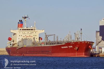
TARANAKI SUN
Tanker B
Current Trip
| Time Travelled | 21 days |
|---|---|
| Remaining Time | 5 days |
| Distance Travelled | 5171.85 nm |
| Remaining Distance | 1524.67 nm |
| AVG Speed | 13.4 Knots |
| MAX Speed | 18.5 Knots |
| AVG Wind | 13.1 knots |
| MAX Wind | 32.8 knots |
| MIN Temp | 3°C / 37.4°F |
| MAX Temp | 30.9°C / 87.62°F |
| Dybgang | 10.7 m |
| Position Modtaget | 16 d siden |
Current Position
| Longitude | -27.33803° |
|---|---|
| Latitude | 41.63165° |
| Status | Under way using engine |
| Fart | 14.2 Knots |
| Kurs | 251.4° |
| Område | North Atlantic Ocean |
| Station | T-AIS |
| Position Modtaget | 16 d siden |
Info
Information
The current position of TARANAKI SUN is in North Atlantic Ocean with coordinates 41.63165° / -27.33803° as reported on 2024-04-26 06:13 by AIS to our vessel tracker app. The vessel's current speed is 14.2 Knots and is heading at the port of NEW YORK. The estimated time of arrival as calculated by MyShipTracking vessel tracking app is 2024-05-18 00:50 LT
The vessel TARANAKI SUN (IMO: 9751406, MMSI: 319091800) is a Tanker B It's sailing under the flag of [KY] Cayman Is.
In this page you can find informations about the vessels current position, last detected port calls, and current voyage information. If the vessels is not in coverage by AIS you will find the latest position.
The current position of TARANAKI SUN is detected by our AIS receivers and we are not responsible for the reliability of the data. The last position was recorded while the vessel was in Coverage by the Ais receivers of our vessel tracking app.
The current draught of TARANAKI SUN as reported by AIS is 10.7 meters
Weather
| Temperature | 28.3°C / 82.94°F |
|---|---|
| Wind Speed | 16 knots |
| Direction | 86° E |
| Pressure | 1012.6 hPa |
| Humidity | 81.4 % |
| Cloud Coverage | 100 % |
Featured Company
Last Port Calls
| Port | Arrival | Departure | Time In Port |
|---|---|---|---|
| 2024-04-17 06:55 | 2024-04-21 05:01 | 3 d | |
| 2024-04-08 13:41 | 2024-04-12 15:39 | 4 d | |
| 2024-03-24 12:45 | 2024-03-25 16:24 | 1 d | |
| 2024-03-22 11:35 | 2024-03-23 06:40 | 19 h | |
| 2024-03-10 22:24 | 2024-03-12 00:21 | 1 d |
Last Trips
| Origin | Departure | Destination | Arrival | Distance | |
|---|---|---|---|---|---|
| 2024-04-12 15:39 | 2024-04-17 06:55 | 364.87 nm | |||
| 2024-03-25 16:24 | 2024-04-08 13:41 | 4178.59 nm | |||
| 2024-03-23 06:40 | 2024-03-24 12:45 | 11.96 nm | |||
| 2024-03-12 00:21 | 2024-03-22 11:35 | 2206.36 nm | |||
| 2024-02-26 14:20 | 2024-03-10 22:24 | 3180.02 nm |
Events
| Tid | Hændelsen | Detaljer | Position / Dest | Info |
|---|---|---|---|---|
| 2024-05-08 11:22 | START Sejllads | 3.87 nm, East of SAN PEDRO DE MACORIS |
18.43338 / -69.24893
USNYC
|
Fart: 3.6 kn Kurs: 180° |
| 2024-05-06 12:34 | STOP Sejllads | 3.61 nm, East of SAN PEDRO DE MACORIS |
18.43914 / -69.25301
USNYC
|
Fart: Kurs: 130° |
| 2024-05-06 11:27 | START Sejllads | 1.58 nm, South East of SAN PEDRO DE MACORIS |
18.41808 / -69.30356
USNYC
|
Fart: 5.4 kn Kurs: 91° |
| 2024-05-04 14:13 | STOP Sejllads | 1.37 nm, South of SAN PEDRO DE MACORIS |
18.41867 / -69.31467
USNYC
|
Fart: 0.2 kn Kurs: 94° |